Travelogue August 23 thru August 29
This week began with us finishing up the Cassiar Hwy. and then working southward through British Columbia on our way back to Washington. It also marks the end of our great adventure to the far north. This is the last travelogue post for the trip.
Sunday, August 23 - Meziadin Lake CG to Smithers (day 78)
Meziadin Lake Provincial CG
Hey, sunshine this morning. Nice to see. Perused campsite when I got out of camper and saw no additional evidence of the bear that the campground host said had wandered around our campsite before we got here yesterday. We kept looking for him/her as we prepared to leave, but nothing. Probably found a better berry patch further up the hill.
Just a short drive south to Kitwanga at the southern terminus of the Cassiar where we spent a little time checking out the historic church and totem poles referred to in the Milepost guide. A local native walked over and gave us a more detailed history and a little of the story depicted on the poles.
Hwy 16 runs from Prince Rupert on the coast to Prince George and then eastward from there. It’s a modern highway with painted lines, useable shoulders, and a good pavement… things we haven’t had an abundance of lately. But apparently good roads bring more traffic and we were beginning to feel the end of our trip to the far north. Much more traffic and crazy hustle-bustle… something else we haven’t had much of in the past couple months.
We got as far as Smithers where we decided to stop for a beer and some local flavor at the Alpenhorn Bistro, Bar and Grill. We found a couple seats at the bar and fell in with a lively bartender and a few friendly locals. Needless to say we had a blast. One of them, a fellow named Stanley, offered to sponsor us if we decided to move to Smithers and become Canadians. If by some unexplained cosmic flash of stupidity makes Trump the next President, we will most assuredly take him up on his offer.
Our new friends at the Alpenhorn all decided that we needed to camp tonight at the Smithers City Park and Campground… which we did. Right on the banks of the Bulkley River, it was a convenient solution to our immediate housing need.

Monday, August 24 - Smithers to Fraser Lake (day 79)
Smithers City Park CG
Had a good night at Smithers City Park CG. I mean, how can you go wrong? Right along the banks of the Bulkley River, full-hookup site for $24 Canadian, free WIFI that actually worked, and free hot (hot!!) showers to boot. Slept like an old man… a clean old man.
After our normal morning routine, the wheels were turning and the truck was heading southeast. Oh... but wait, we had to stop for a few items at the local Safeway. Then we were back on busy Hwy 16. Dar had scoped out another provincial park near Fraser Lake and that was our goal.
We’re on the Interior Plateau up here and a sign of that is a lot more agricultural activity. It looked and felt like Wisconsin most of the time. Found a good roadside park on the eastern end of Burns Lake for a picnic lunch.
 Before long, after just 150 miles, we pulled into Beaumont Provincial Park and found a site for the night. The park is on the grounds once occupied by historic Fort Fraser, built about 1806. It was an outpost of the old Northwest Company until absorbed by the Hudson Bay Company about 1824. There is a substantial old log barn on the site which post dated the old Fort by quite a few years.
It’s really starting to get dark at night. The calendar is inching toward equinox and we’re further south every day. Dar commented that she’s having a little trouble sleeping now that it actually gets dark at night. I don’t seem to suffer from that particular affliction.
Tuesday, August 25 - Fraser Lake to Lac le Hache (day 80)
Beaumont Provincial Park CG
Another mostly sunny morning. Back on the road about 9:30am. Easterly, mostly, to Prince George where we bend mostly southward on Hwy 97. Stopped at visitor center in Quesnel (french pronunciation… no “s” sound) to make a phone call and check email. Continued through the “lake district” to Lac le Hache (french for lake of the hatchet) where we made camp at the eponymous provincial campground.
It’s not uncommon to run into people you’ve seen in previous days or weeks as one travels through the far north. And tonight we ran into a solo traveler and fellow truck-camper we knew from our stay in Smithers. David lives on Vancouver Island and is slowly meandering back home. We shared happy hour and a campfire before retiring for the evening.
Wednesday, August 26 - Lac le Hache to Emory Creek CG (Yale, BC) (day 81)
Lac le Hache CG
Mostly sunny drive today with an increasing amount of smoky haze from wildfires east of here. We’re dropping almost due south through an area with a concentration of large log home and building manufacturers. Identified by the big cranes needed to lift the logs into place, each home is completely put together here, then disassembled and transported to it’s ultimate location where it’s all put back together once again… hopefully for the final time. It’s an expensive proposition, but these log buildings look marvelous.

The highlight of the drive today was a side-trip over a historic route used by early settlers and gold-rushers coming north. They’d follow the Fraser River canyon to Lillooet via riverboat and then transition to an overland route further north to towns still named 70 Mile House, 100 Mile House, and 150 Mile House. Those town names refer to the distance from Lillooet.
We, of course, were taking the route southbound. We left Hwy 97 at Clinton and headed southwestward. For a few miles the road is paved but in poor condition. Near Downing Provincial Park, the road becomes dirt and quickly changes into a very steep one lane road that was more challenging than I thought it might be. With confidence that we were on the right path provided by an occasional sign, we continued through what can best be described as an “E” ticket ride of thrills and chills on a road that often was, at times, nothing more than a narrow trail dozed out of the side of a steep hillside. No guardrails and only a couple feet between our wheels and a “Thelma and Louise” 1000 foot drop to oblivion… gave the navigatress heart palpitations. Eventually we reached the top and slowly eased down the other side… through a private ranch and on a less steep trail that eventually came out at the town of Pavillion. That 90 minute ordeal was enough to feed our adventurelust and fill the exhilaration banks for a while. What a hoot!
Then it was down to Lillooet on Hwy 99 through our first introduction to the Fraser River Canyon… another Wow on it’s own merits. At Lillooet we transitioned to Hwy 12, also following the Fraser to Lytton. That section of road included a couple gasps on the Yikes-meter too. From beginning to end, from Clinton to Lytton can’t be more than 70 miles by crow, but the route we took had to be far more exciting than the Hwy 97 route most people take through Cache Creek.
At Lytton we got on Hwy 1 and drove as far as Yale, just a few miles north of Hope. We found a campground that, apparently, used to be a provincial park but is now a privately run affair. Called Emory Creek CG, it looked and felt like all the other provincial park campgrounds we’ve stayed at. Why it’s private, we never did figure out. A good place to stop for the night.
Just a tad over 200 miles for the day.
Thursday, August 27 - Emory Creek CG (Yale, BC) to Bay View SP CG (Mt. Vernon, WA) (day 82)
Emory Creek CG
Broke camp and on the road again by 9:30. The air was very smokey as we neared the Vancouver area… probably from wildfires east of here. High pressure has been holding the smoke in the valleys.
 The closer to Vancouver the crazier the traffic and hub-bub became. I’m not a slow driver, preferring to drive the speed limit on roads like this if possible. But 90% of the other vehicles on the road had a need to go considerably faster than that… including loaded logging trucks, school busses, and little old gray haired women driving their canasta club to the ice cream shop for dish of soft-serve.
Broke off Hwy 1 at the Sumas cutoff. Just a few short miles to the border crossing. An informative sign said the wait was approx. 20 minutes to make the crossing. Once in line with what had to be hundreds of other vehicles, the line inched along. After 20 minutes we’d moved about two blocks, with much further to yet go to get to the quizmaster. After an hour of idling and inching we were close. I held my tongue… my comments and suggestions that may have made me feel better for a moment but surely would have resulted in fines and a prison term.
 “Where are you coming from?” “Canada” (where I’m sitting at, there is no possible other place I could be coming from.)
“Do you have anything to declare that you bought while in Canada?” “No” (prices in Canada do not make it advantageous to do so.)
“Any fruits or vegetables?” “One apple”
“Any liquor?” “Two cans of beer and a little wine sloshing around the bottom of a carboard box” (again, liquor prices in Canada are amazingly high, so why would anyone do this?)
“Any firearms?” “No” (Canada is concerned about bringing firearms across… didn’t know the USA is too.)
So we got through with a minimum of pain… other than some tongue spasms from trying to keep it under control. Drove south into Washington looking for a state park for the night. First one we checked out was Larabee, which we eliminated after some considerable time because it was fairly busy, had few level campsites, and just wasn’t up to the standards of the parks we’d stayed at in Canada.
We moved on to Bay View State Park which we found much more agreeable. Found a site and made camp for the night.

Friday, August 28 - Bay View SP CG to Kirkland, WA (day 83)
Bay View SP CG
Woke. Broke camp. Drove to our Son and Daughter-In-Law’s home in the Seattle area. Time to reconnect with family and see what homebase life is like for a few months.
I’ve said it before… there’s no feeling like “coming home” after a trip… unless it’s the feeling of getting ready to go exploring again.
The end of our trip to the Far North.
Sunday, August 23 - Meziadin Lake CG to Smithers (day 78)
Meziadin Lake Provincial CG
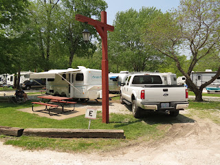
 |
| Campsite at Meziadin Lake |
Just a short drive south to Kitwanga at the southern terminus of the Cassiar where we spent a little time checking out the historic church and totem poles referred to in the Milepost guide. A local native walked over and gave us a more detailed history and a little of the story depicted on the poles.
Hwy 16 runs from Prince Rupert on the coast to Prince George and then eastward from there. It’s a modern highway with painted lines, useable shoulders, and a good pavement… things we haven’t had an abundance of lately. But apparently good roads bring more traffic and we were beginning to feel the end of our trip to the far north. Much more traffic and crazy hustle-bustle… something else we haven’t had much of in the past couple months.
 |
| We stopped and watched native Indians net fishing near Moricetown. |
We got as far as Smithers where we decided to stop for a beer and some local flavor at the Alpenhorn Bistro, Bar and Grill. We found a couple seats at the bar and fell in with a lively bartender and a few friendly locals. Needless to say we had a blast. One of them, a fellow named Stanley, offered to sponsor us if we decided to move to Smithers and become Canadians. If by some unexplained cosmic flash of stupidity makes Trump the next President, we will most assuredly take him up on his offer.
Our new friends at the Alpenhorn all decided that we needed to camp tonight at the Smithers City Park and Campground… which we did. Right on the banks of the Bulkley River, it was a convenient solution to our immediate housing need.

Monday, August 24 - Smithers to Fraser Lake (day 79)
Smithers City Park CG
 |
| More agriculture going on around here. |
After our normal morning routine, the wheels were turning and the truck was heading southeast. Oh... but wait, we had to stop for a few items at the local Safeway. Then we were back on busy Hwy 16. Dar had scoped out another provincial park near Fraser Lake and that was our goal.
We’re on the Interior Plateau up here and a sign of that is a lot more agricultural activity. It looked and felt like Wisconsin most of the time. Found a good roadside park on the eastern end of Burns Lake for a picnic lunch.

It’s really starting to get dark at night. The calendar is inching toward equinox and we’re further south every day. Dar commented that she’s having a little trouble sleeping now that it actually gets dark at night. I don’t seem to suffer from that particular affliction.
Tuesday, August 25 - Fraser Lake to Lac le Hache (day 80)
Beaumont Provincial Park CG
Another mostly sunny morning. Back on the road about 9:30am. Easterly, mostly, to Prince George where we bend mostly southward on Hwy 97. Stopped at visitor center in Quesnel (french pronunciation… no “s” sound) to make a phone call and check email. Continued through the “lake district” to Lac le Hache (french for lake of the hatchet) where we made camp at the eponymous provincial campground.
 |
| Inviting display of flowers at Quesnel Visitor Center. |
Wednesday, August 26 - Lac le Hache to Emory Creek CG (Yale, BC) (day 81)
Lac le Hache CG
Mostly sunny drive today with an increasing amount of smoky haze from wildfires east of here. We’re dropping almost due south through an area with a concentration of large log home and building manufacturers. Identified by the big cranes needed to lift the logs into place, each home is completely put together here, then disassembled and transported to it’s ultimate location where it’s all put back together once again… hopefully for the final time. It’s an expensive proposition, but these log buildings look marvelous.

The highlight of the drive today was a side-trip over a historic route used by early settlers and gold-rushers coming north. They’d follow the Fraser River canyon to Lillooet via riverboat and then transition to an overland route further north to towns still named 70 Mile House, 100 Mile House, and 150 Mile House. Those town names refer to the distance from Lillooet.
 |
| Not more than two feet to the edge of the road. |
 |
| Excuse me... is this the road to Pavillion? |
Then it was down to Lillooet on Hwy 99 through our first introduction to the Fraser River Canyon… another Wow on it’s own merits. At Lillooet we transitioned to Hwy 12, also following the Fraser to Lytton. That section of road included a couple gasps on the Yikes-meter too. From beginning to end, from Clinton to Lytton can’t be more than 70 miles by crow, but the route we took had to be far more exciting than the Hwy 97 route most people take through Cache Creek.
 |
| High above Fraser River Canyon |
 |
| One lane through here... and no traffic control. You're on your own to keep an eye out for oncoming logging trucks. |
At Lytton we got on Hwy 1 and drove as far as Yale, just a few miles north of Hope. We found a campground that, apparently, used to be a provincial park but is now a privately run affair. Called Emory Creek CG, it looked and felt like all the other provincial park campgrounds we’ve stayed at. Why it’s private, we never did figure out. A good place to stop for the night.
Just a tad over 200 miles for the day.
Thursday, August 27 - Emory Creek CG (Yale, BC) to Bay View SP CG (Mt. Vernon, WA) (day 82)
Emory Creek CG
Broke camp and on the road again by 9:30. The air was very smokey as we neared the Vancouver area… probably from wildfires east of here. High pressure has been holding the smoke in the valleys.

Broke off Hwy 1 at the Sumas cutoff. Just a few short miles to the border crossing. An informative sign said the wait was approx. 20 minutes to make the crossing. Once in line with what had to be hundreds of other vehicles, the line inched along. After 20 minutes we’d moved about two blocks, with much further to yet go to get to the quizmaster. After an hour of idling and inching we were close. I held my tongue… my comments and suggestions that may have made me feel better for a moment but surely would have resulted in fines and a prison term.

“Do you have anything to declare that you bought while in Canada?” “No” (prices in Canada do not make it advantageous to do so.)
“Any fruits or vegetables?” “One apple”
“Any liquor?” “Two cans of beer and a little wine sloshing around the bottom of a carboard box” (again, liquor prices in Canada are amazingly high, so why would anyone do this?)
“Any firearms?” “No” (Canada is concerned about bringing firearms across… didn’t know the USA is too.)
So we got through with a minimum of pain… other than some tongue spasms from trying to keep it under control. Drove south into Washington looking for a state park for the night. First one we checked out was Larabee, which we eliminated after some considerable time because it was fairly busy, had few level campsites, and just wasn’t up to the standards of the parks we’d stayed at in Canada.
We moved on to Bay View State Park which we found much more agreeable. Found a site and made camp for the night.

Friday, August 28 - Bay View SP CG to Kirkland, WA (day 83)
Bay View SP CG
Woke. Broke camp. Drove to our Son and Daughter-In-Law’s home in the Seattle area. Time to reconnect with family and see what homebase life is like for a few months.
I’ve said it before… there’s no feeling like “coming home” after a trip… unless it’s the feeling of getting ready to go exploring again.
The end of our trip to the Far North.
 |
| Thanks for following our trip to the Far North. |
Comments