
The first 8 or 9 miles of the Top of the World Highway (for the rest of this post let’s just call it the TOTWH in an effort to save my fingers from a little pain and suffering)... anyway, the first 8 or 9 miles are a pretty steep climb from the Yukon River to the top of a ridge. I don’t remember the elevation gain precisely but it was something like 3000 feet.
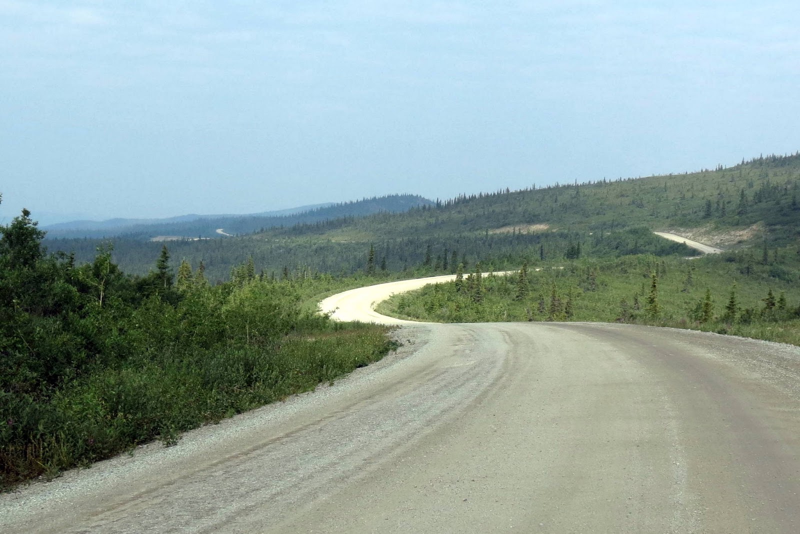
The TOTWH gets it’s name from the fact that for much of it’s length it follows high ridgelines above treeline and the surrounding streams and creeks… and one can get the feeling that you’re on top of the world. It’s an evolved trail that was first used during the goldrush days in the 1890s and, some might say, it’s not much better now than it was then. At one point years ago the Canadian Government seal-coated the road but it’s been neglected and allowed to revert back to a mostly gravel surface.
Our views of distant mountains was somewhat limited due to wildfire smoke that day. Not as bad as our drive to Inuvik on the Dempster, but not as bright and clear as one would hope. Despite that however, it was a very good drive and an enjoyable one too.
From Dawson, it’s about 65 miles to the Canada-Alaska border. This border crossing is manned by Customs during the summer only (May thru September depending on weather), and even then is only open from 8am to 8pm (PDT) Yukon time or 9am to 9pm (ADT) Alaska time. Any other time the border is closed.
Our crossing was uneventful.
After clearing customs, we stopped for the requisite pictures and to exchange our Canadian currency for our previous stash of US currency. In my opinion, Canada has it's money act together in that they've eliminated the penny and use one dollar and two dollar coins instead of paper bills. It just makes fiscal sense in many ways. But they've still got some work to do with their plastic bills -- that’s right, thin plastic instead of paper. We heard grumbling about it from natives all along our Canadian travels.
Leaving the rest area just down from the border where we accomplished the tasks of the previous paragraph, a motorcyclist went by. I noticed him as he was riding one of the few Honda Goldwings or other big bikes we've seen up here on these gravel roads. Most cyclists, (and there are a bunch of 'em) use "dual-sport" bikes that are more nimble and capable in gravel and slick mud.
Anyway, we got about 3 miles down the road, which is paved for a few miles near the border, and came upon this rider and his bike in the ditch... his bags and packs strewn about… almost got by without noticing him at all. He had run off a curve and laid the bike down in the ditch alongside the road. We stopped. He said he was OK. But with a big bike laying in a ditch, damaged I'm sure... and stuff scattered about... there was reason to be skeptical. There's no cell service here. Dar said she'd stay with him while I went for help. I stopped first at the little airport and the wide-spot in the road called Boundary. No sign of life. The only sure option was to go back the 3 or 4 miles to the border where they surely have communication with the outside world. That's what I did.
By the time I got back others had stopped and they were in the process pulling the bike from the ditch with a truck… a little demonstration of the “can-do” self-reliant attitude of folks up here. There were enough people to get this done. With the bike back on it's stand, the rider evaluated the damage. Scrapes and scuffs, a broken mirror, sheared off windshield, bent this's and that's, other cosmetic damage… it looked bad to us. The item that caught the worst of it was his helmet... which was trashed. Probably a good thing he had it on.
A border guy did respond with a medical kit, all the right questions, and a satellite phone if the rider needed to make a call to anyone.
The rider got the cycle running, and decided to try to continue on with the bike in the condition it was. He thought it'd be doable. First, he had to repack, and could do that just up the road in Boundary. The guy with the pickup that pulled him out helped get his stuff up there for him.
As things seemed to be getting back to semi-normal, the helpful crowd broke up. What could have been much worse appeared to have pretty much resolved itself.
The first 9 miles on the Alaska side of the border are the newest and finest asphalt road in the entire state. But when the asphalt stops, the road goes back to "third-world" status and we're bouncing from pothole to pothole at 25 mph pretty much all the way to Chicken.
Chicken? Whether lore or fact, the town was said to have been originally named Ptarmigan, after the Arctic fowl (think chicken-like bird) so common in these northern parts. But the residents of Ptarmigan, most of 'em anyway, had a hard time spelling Ptarmigan. So they changed the name of the town to Chicken.
The original townsite is now abandoned and on private property. But that didn't stop at least three entrepreneurs from starting three businesses... "Downtown Chicken", "Town of Chicken", and the "Chicken RV Park. We stopped at one, but it was too RV parky... and the cafe’ there didn't have a piece of pie to satiate my afternoon sweet tooth. Hmmm. But she was gracious and said the other cafe’ in Chicken… over at Downtown Chicken… were noted for their pies. She also said she was making peach cobbler for breakfast in the morning, and that we really should stop back for that. We made our way to Downtown Chicken where we hit the motherlode... fresh-baked pie, beer, and... ready for this?... free camping. It's the trifecta! We spent the night.


No comments:
Post a Comment