Dar, in particular, has waited a long time for this. I finally got around to finishing the video recap of our trip to Alaska and the Far North. It's up on YouTube... here's a direct link. Don't expect too much. It's a compilation of short clips from our almost three months up there... so it's quick and jumpy, but it works for us and produces many warm memories.
Showing posts with label Alaska Highway. Show all posts
Showing posts with label Alaska Highway. Show all posts
Travelogue August 16 thru August 22
We began this week in Whitehorse, the Capital City of the Yukon, where we lingered for a few days. From there, back on the Alaska Highway, the Alcan, through Carcross and down to the junction with the Cassiar Highway. As we dropped south on the Cassiar, we took a side trip to Stewart/Hyder.
Sunday, August 16 - Whitehorse Local (day 71)
Wolf Creek CG
The campground is max'd out this weekend. Discovered the reason why: it's a three day weekend here in the Yukon called Discovery Day. Has to do with remembering the day they found gold on Bonanza Creek, a tributary of the Klondike near Dawson City. So, like folks anywhere, they're taking advantage of a summer three day weekend... one of the last, if not the last, of the warm season this far north.
We ran into town for a much needed internet fix and a laundromat. Managed to get a bunch of photos uploaded as well as my post for last week. Another reason we're lingering here another day was to exchange some money at a bank. Our Canadian funds are getting low. However, with Monday being a Holiday, that's going to have to wait until Tuesday.
Back at camp Dar prepared a sausage and vegetable hobo dinner that I cooked on the campfire. After an hour it was cooked to perfection. A great team effort.
Monday, August 17 - Whitehorse Local (day 72)
Discovery Day Holiday in the Yukon
Wolf Creek CG
On the way into town this morning we visited a few RV parks and campgrounds for future reference. Had a few more supplies to pick up and had a light lunch at Tim Hortons (including absolutely no donuts despite Dar's plea to the contrary).
I've written in the past about food prices here in Canada (they're high), but I've also had trouble finding some specific items at any price. No-stir peanut butter made without hydrogenated oil is one. Haven't been able to find it outside of the US. Wonder why it's not sold in Canada.
Just like yesterday, the day started out sunny but quickly changed to all clouds. This afternoon, on our way back to camp, a light rain began. Kinda puts a damper on my outdoor cooking plans. Been thinking we need to begin tarping our campsite when staying for more than a day or two. Would expand our living space to include a little of the outdoors as well as some dry space for outdoor cooking.
Tuesday, August 18 - Whitehorse to near Teslin (day 73)
Wolf Creek CG
 Broke camp and headed for town. Got a couple more items for the supply bin, stopped at the bank for a little plastic Canadian money, and we bid Whitehorse a fond farewell. Time to move on.
Dar wanted to run down to Carcross, a short side trip off the Alcan. She'd read about some first nation woodcarvers and really wanted to stop by to see what was being worked on these days. So we went to Carcross.
Originally known as Caribou Crossing, the name was changed... contraction-ated... to Carcross because the Canadian Postal Service often confused it with other communities with similar names. On the way into town we stopped at a sandy area known as the worlds smallest desert. It's not really a desert, just an ancient lake bottom that local weather conditions seem to keep around, but when you're mining for tourist dollars you'll try anything to keep 'em coming.
 Carcross isn't much. The central attraction is the train station... it's the northern terminus of the famed White Pass and Yukon Railroad that runs between Skagway and here through some pretty rugged geography. The NPYR used to run all the way to Whitehorse and the narrow gauge tracks are still in place where they cross the Alcan just south of town. Any way you look at it, the narrow gauge railroad is kept afloat by tourism, principally tourist from the many cruise ships that stop in Skagway.
For you railroad enthusiasts out there, the YPYR track gauge is 914mm… or just a hair or two shy of 3 feet. Compare that to the standard gauge all other regular railroads us in North America of 1435mm or 4 feet 8-½ inches.
Besides the railroad station, there's the oldest general store in Alaska, a mini-mall of gift and craft shops, a restaurant, and the skeletal remains of a stern-wheeler riverboat that used to ply the waters of the area lakes. The old girl was set afire by vandals some years ago and the State of Alaska kicked in a million bucks to turn what was left into a museum of sorts.
We stopped in the restaurant, The Bistro, to have lunch, being famished from the 40 mile drive down here from Whitehorse. And, as often do in joints like this, we had a great time chatting with the staff and some of the few customers they had that day. It's late August and business has already dropped way off from the peak. I think they're kinda punch-drunk from a busy tourist season.
Right across the tracks from The Bistro, was the carving studio of Keith Wolfe Smarch... the place Dar really wanted to see. He's native Tlingit and has made a real name for himself in the carving world. His current project is a 70 foot high totem pole that will be a permanent part of the new heritage center being built on the edge of town. Made of red cedar, as are most totem poles in this part of the world, it's a massive job just to get the huge log made ready for carving... and then the year or more of detailed carving to finish the project. Very impressive indeed. He also shared with us some of his secrets and smaller masks and hats he's done recently. An enjoyable and informative stop.
About that time the train made an appearance. That's right... the narrow gauge White Pass and Yukon tourist train from Skagway. It kept me entertained as I watched it perform a turn around maneuver on the Y track maintained for that purpose. They like to keep the locomotive at the front of the train regardless which way it's going. Gives the passengers a more authentic experience and the engineer a better view of the track ahead. Would hate to bump into a bear or moose (or squirrel).
When we left, the wind was picking up briskly. It blew us all the way down the shortcut to Jakes Corners... back on the Alcan. From there we droned to Teslin Lake, and to a very nice government campground of the same name where we called it a day.
Wednesday, August 19 - Teslin (on Alcan) to Cassiar Jct. near Watson Lake (day 74)
Teslin Lake CG
 Cloudy this morning, with intermittent dribbles of rain. Left our lakeside campsite a little after 10am and the truck was barely warm when we stopped just a couple miles up the road at the Tlingit Heritage Center in Teslin. On the way north a couple months ago (when we were in more of a hurry) she noted in The Milepost book that she wanted to stop on the return drive. So we did. It's an excellent resource for the last 200 years of history of the Tlingit people native to this area. The noted wood carver we saw yesterday, Keith Wolfe Smarch, has many of his pieces here and used to work from Teslin up until a few years ago when he moved to Carcross.
A real mixed bag today weather-wise. Rain and a heavy low cloud deck kept mountain views limited. At higher elevations the temp dipped into the upper 40s and we even thought we could see hardened precipitation mixed in with raindrops… in another word, ice. Not sure about this as the evidence quickly dissipated.
 Otherwise, it was an uneventful drive. After 150 miles or so, we were near the junction with the Cassiar and we decided to pull into “Nugget City” to consider our options for the rest of the day. Lunch in the Nugget City restaurant, Wolf It Down, can be described as meager portions for a high price. But it filled a void and gave us a place to pause. While Dar checked out the gift shop I wandered over to the RV park/campground to see what they had. We decided to toss out the anchor and spend the night. That way we’d be fresh and ready for our first leg on the Cassiar. Perhaps the weather will improve too.
Thursday, August 20 - Cassiar Jct (Nugget City) near Watson Lake to Boya Lake (day 75)
Baby Nugget RV Park
We're clearly in a rainy spell. Check of the weather last night indicated mostly rain the next few days. Past experience has taught us the weather forecasts up here are notoriously unreliable. But a multi-day trend (like a general propensity for precipitation) is often fairly accurate. I'm sure there'll be sun-breaks, but we'll have to deal with more rain than we'd prefer.
We're staged just a mile or two from the junction with the Cassiar Highway. Since we don't know how far we'll go today, we let the showers come and go this morning while enjoying coffee in our snug little camper. Finally got on the road about 11am during a weather break.
The Cassiar Highway is about 450 miles long, aligned north-south between here and the town of Kitwanga, on Hwy 16… The Yellowhead Highway, that runs from Prince Rupert on the coast and Prince George. Reports indicate it's a decent paved road, but clearly below the standards of the Alcan. The northern end in particular is narrow and has no shoulders or center-line stripes. I found a pace of around 45 to 50 mph to be about right most of the time. There's a fair amount of traffic and some large trucks that use it to shave off some miles between southern BC and the Alcan. Generally, it was a relaxing and very enjoyable drive.
But we didn't get far today. Stopped to check out Boya Lake CG. Once Dar saw the emerald green clear lake illuminated under a brief sunbreak together with an open campsite right on the shoreline, she "called an audible" and we stopped right then and there after just 56 miles. It is probably the most scenic campsite we've had during this trip. A real gem.
Friday, August 21 - Boya Lake to Kinaskan Lake (day 76)
Boya Lake CG
 Woke to blue sky and broken clouds. Looks like a good driving day. On the road about 10am. First stop was at Jade City, a tourist-trap but of some notable interest when one learns that about 90% of the world's jade comes from the immediately surrounding Cassiar Mountains. Jade is almost literally everywhere. I’m sure I saw raw chunks of jade mixed in the gravel covering the parking lot. Dar picked up a few gift items for people back home.
It seems everyone driving by Jade City stops in. We observed a wide range of campers during our visit… from van conversions, to an Earthroamer, to a very interesting little 5th wheel made by Escape Campers. We met the folks with the Escape and they volunteered to show us the interior layout. Hmmm. There’s a lot to like about the little unit, but we’re not in a trailer mode right now. File the info away for future reference.
Through the Cassiar Mountains on a southward bearing, we wandered through Dease Lake, 40 Mile Flats, Iskut, and Tatogga. At some point along the way, the painted centerline appeared again… an indication we’re making progress toward civilization. Decided to make camp for the night at Kinaskan Lake CG.
 The human condition causes us to seek out similarities and like-mindedness in others in order to combine into groups… probably for safety, survival, and sanity purposes. During our trip we’d often run into people multiple times as there’s only a limited number of routes to take and many of us are going the same places at the same rate of travel. And a bond of common purpose and destination would occur, sparking a personal contact that made life on the road a little more fun. At Kinaskan Lake we ran into an adventurous and interesting couple from Whitehorse that we had first met in Inuvik… almost two months ago. The common bond here is the 4 Wheel Camper each of us have. We do find we have a soft spot in our hearts for others that like and use these little rigs. In this case, direction and rate of travel had nothing to do with this serendipitous meeting. They recognized our rig as they happened into the campground on their way back to Whitehorse after visiting friends near the Smithers area. We had a long and rich conversation with them and hope for more path-crossings with them in the future.
Saturday, August 22 - Kinaskan Lake to Meziadin Lake CG (both along the Cassiar) (day 77)
Kinaskan Lake CG
 Started raining about 4am, and continued light and steady until much later in the day. We've had our battles with the rain gods the last couple months, but not many all day rains. Today was nearly a total washout, as you'll see below.
We got the show on the road at our usual time... about 10am. Started the wipers when I started the truck and didn't shut them off until later in the day in Stewart. Back on the Cassiar, I'm sure the drive through the middle portion of it is gorgeous... but we couldn't testify to it. At times a bright spot would raise our hopes, only to be dashed on the rocky shoals of low ceilings and renewed rain. Just another sucker hole.
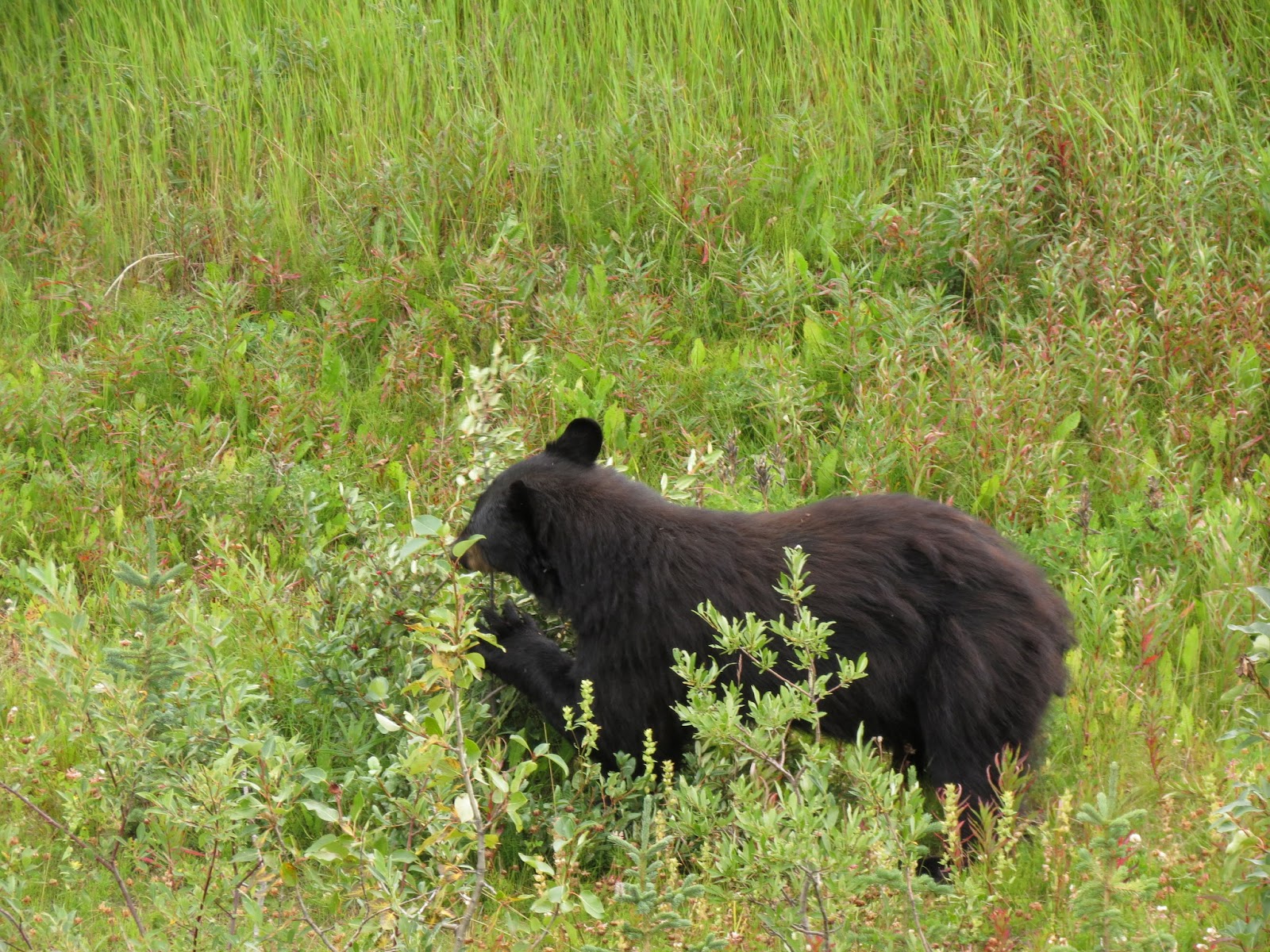
On the slow drive south, we did see a total of 5 black bear today. A couple of them were little more than fleeting glances... too fast for Dar's camera trigger finger. But the best sighting was of a sow and her little cub eating god knows what right at the edge of the road. They were totally unconcerned about us despite our stopped truck, in the lane of traffic, and the two of us snapping pics as fast as we could. They were literally just 15 or 20 feet away.
At the junction with Hwy 37A, we took it toward Stewart and Hyder. Glad we did too. The biggest tourist attraction here is bear watching along Fish Creek just outside Hyder. And being the good little tourists, we headed directly to the creek in the midst of yet another downpour. We found a few visitors, mostly huddled around shelters and peering longingly, hopefully, into the surrounding hills... trying their darnedest to will a bear into the open for that perfect iphone bear wildlife portrait.
We found a forlorn ranger on patrol, complete with umbrella and faint look of sadness on his boyish face, who said they had one bear early that morning, and another late the night before. But other than that, it's been pretty quiet. A local I talked to later said they're hopeful more fish and more bears show up next month.
Hyder bills itself as the friendliest ghost town in Alaska. I can't say much about the friendliest part, but the ghost town part is spot on. What a sad place that time left way back there in the dust. I can't help but think they're just missing some vision, some creativity, and some energetic people to clean things up and turn it around. I hope they do.
When a traveler goes from Stewart, which is in Canada, to Hyder, Alaska, one can do so without going through a border checkpoint. They probably figure that most people who go into Hyder are going to come right back out again, quickly. And since there are no roads that lead anywhere except back to Canada on the exact same road you went in on, there is little functional reason to maintain a staffed border presence. But good old Canada has their border check point right there under the Canadian Maple Leaf Flag, ever ready to snag folks who bought liquor in Hyder... or bought a gun... or picked up a terrorist to smuggle back into Canada. Never mind that there is no place to buy liquor or firearms that I could see in Hyder... they're ready in case one opens. I had to chuckle to myself at how serious this young border guard was taking his job. I'm sure in his mind the good folks of Canada are sleeping better tonight because he's on the job.
Here's a few more pics from our side-trip to Stewart and Hyder.


 |
| This old DC-3 found a new life as a wind sock. |
Wolf Creek CG
The campground is max'd out this weekend. Discovered the reason why: it's a three day weekend here in the Yukon called Discovery Day. Has to do with remembering the day they found gold on Bonanza Creek, a tributary of the Klondike near Dawson City. So, like folks anywhere, they're taking advantage of a summer three day weekend... one of the last, if not the last, of the warm season this far north.
We ran into town for a much needed internet fix and a laundromat. Managed to get a bunch of photos uploaded as well as my post for last week. Another reason we're lingering here another day was to exchange some money at a bank. Our Canadian funds are getting low. However, with Monday being a Holiday, that's going to have to wait until Tuesday.
Back at camp Dar prepared a sausage and vegetable hobo dinner that I cooked on the campfire. After an hour it was cooked to perfection. A great team effort.
Monday, August 17 - Whitehorse Local (day 72)
Discovery Day Holiday in the Yukon
Wolf Creek CG
 |
| Campsite at Wolf Creek CG near Whitehorse. |
I've written in the past about food prices here in Canada (they're high), but I've also had trouble finding some specific items at any price. No-stir peanut butter made without hydrogenated oil is one. Haven't been able to find it outside of the US. Wonder why it's not sold in Canada.
Just like yesterday, the day started out sunny but quickly changed to all clouds. This afternoon, on our way back to camp, a light rain began. Kinda puts a damper on my outdoor cooking plans. Been thinking we need to begin tarping our campsite when staying for more than a day or two. Would expand our living space to include a little of the outdoors as well as some dry space for outdoor cooking.
Tuesday, August 18 - Whitehorse to near Teslin (day 73)
Wolf Creek CG

Dar wanted to run down to Carcross, a short side trip off the Alcan. She'd read about some first nation woodcarvers and really wanted to stop by to see what was being worked on these days. So we went to Carcross.
Originally known as Caribou Crossing, the name was changed... contraction-ated... to Carcross because the Canadian Postal Service often confused it with other communities with similar names. On the way into town we stopped at a sandy area known as the worlds smallest desert. It's not really a desert, just an ancient lake bottom that local weather conditions seem to keep around, but when you're mining for tourist dollars you'll try anything to keep 'em coming.

For you railroad enthusiasts out there, the YPYR track gauge is 914mm… or just a hair or two shy of 3 feet. Compare that to the standard gauge all other regular railroads us in North America of 1435mm or 4 feet 8-½ inches.
Besides the railroad station, there's the oldest general store in Alaska, a mini-mall of gift and craft shops, a restaurant, and the skeletal remains of a stern-wheeler riverboat that used to ply the waters of the area lakes. The old girl was set afire by vandals some years ago and the State of Alaska kicked in a million bucks to turn what was left into a museum of sorts.
We stopped in the restaurant, The Bistro, to have lunch, being famished from the 40 mile drive down here from Whitehorse. And, as often do in joints like this, we had a great time chatting with the staff and some of the few customers they had that day. It's late August and business has already dropped way off from the peak. I think they're kinda punch-drunk from a busy tourist season.
 |
| Keith Wolfe Smarch, famed Tlingit Carver |
About that time the train made an appearance. That's right... the narrow gauge White Pass and Yukon tourist train from Skagway. It kept me entertained as I watched it perform a turn around maneuver on the Y track maintained for that purpose. They like to keep the locomotive at the front of the train regardless which way it's going. Gives the passengers a more authentic experience and the engineer a better view of the track ahead. Would hate to bump into a bear or moose (or squirrel).
When we left, the wind was picking up briskly. It blew us all the way down the shortcut to Jakes Corners... back on the Alcan. From there we droned to Teslin Lake, and to a very nice government campground of the same name where we called it a day.
 |
| Campsite at Teslin Lake CG |
Wednesday, August 19 - Teslin (on Alcan) to Cassiar Jct. near Watson Lake (day 74)
Teslin Lake CG

A real mixed bag today weather-wise. Rain and a heavy low cloud deck kept mountain views limited. At higher elevations the temp dipped into the upper 40s and we even thought we could see hardened precipitation mixed in with raindrops… in another word, ice. Not sure about this as the evidence quickly dissipated.

 |
| Sign near start of Cassiar... yes, you can drive south to Alaska from the Cassiar Hwy. |
Baby Nugget RV Park
We're clearly in a rainy spell. Check of the weather last night indicated mostly rain the next few days. Past experience has taught us the weather forecasts up here are notoriously unreliable. But a multi-day trend (like a general propensity for precipitation) is often fairly accurate. I'm sure there'll be sun-breaks, but we'll have to deal with more rain than we'd prefer.
We're staged just a mile or two from the junction with the Cassiar Highway. Since we don't know how far we'll go today, we let the showers come and go this morning while enjoying coffee in our snug little camper. Finally got on the road about 11am during a weather break.
 |
| Just about the nicest campsite we've had all trip. |
Friday, August 21 - Boya Lake to Kinaskan Lake (day 76)
Boya Lake CG

It seems everyone driving by Jade City stops in. We observed a wide range of campers during our visit… from van conversions, to an Earthroamer, to a very interesting little 5th wheel made by Escape Campers. We met the folks with the Escape and they volunteered to show us the interior layout. Hmmm. There’s a lot to like about the little unit, but we’re not in a trailer mode right now. File the info away for future reference.
Through the Cassiar Mountains on a southward bearing, we wandered through Dease Lake, 40 Mile Flats, Iskut, and Tatogga. At some point along the way, the painted centerline appeared again… an indication we’re making progress toward civilization. Decided to make camp for the night at Kinaskan Lake CG.

Saturday, August 22 - Kinaskan Lake to Meziadin Lake CG (both along the Cassiar) (day 77)
Kinaskan Lake CG

We got the show on the road at our usual time... about 10am. Started the wipers when I started the truck and didn't shut them off until later in the day in Stewart. Back on the Cassiar, I'm sure the drive through the middle portion of it is gorgeous... but we couldn't testify to it. At times a bright spot would raise our hopes, only to be dashed on the rocky shoals of low ceilings and renewed rain. Just another sucker hole.
On the slow drive south, we did see a total of 5 black bear today. A couple of them were little more than fleeting glances... too fast for Dar's camera trigger finger. But the best sighting was of a sow and her little cub eating god knows what right at the edge of the road. They were totally unconcerned about us despite our stopped truck, in the lane of traffic, and the two of us snapping pics as fast as we could. They were literally just 15 or 20 feet away.
At the junction with Hwy 37A, we took it toward Stewart and Hyder. Glad we did too. The biggest tourist attraction here is bear watching along Fish Creek just outside Hyder. And being the good little tourists, we headed directly to the creek in the midst of yet another downpour. We found a few visitors, mostly huddled around shelters and peering longingly, hopefully, into the surrounding hills... trying their darnedest to will a bear into the open for that perfect iphone bear wildlife portrait.
We found a forlorn ranger on patrol, complete with umbrella and faint look of sadness on his boyish face, who said they had one bear early that morning, and another late the night before. But other than that, it's been pretty quiet. A local I talked to later said they're hopeful more fish and more bears show up next month.
Hyder bills itself as the friendliest ghost town in Alaska. I can't say much about the friendliest part, but the ghost town part is spot on. What a sad place that time left way back there in the dust. I can't help but think they're just missing some vision, some creativity, and some energetic people to clean things up and turn it around. I hope they do.
When a traveler goes from Stewart, which is in Canada, to Hyder, Alaska, one can do so without going through a border checkpoint. They probably figure that most people who go into Hyder are going to come right back out again, quickly. And since there are no roads that lead anywhere except back to Canada on the exact same road you went in on, there is little functional reason to maintain a staffed border presence. But good old Canada has their border check point right there under the Canadian Maple Leaf Flag, ever ready to snag folks who bought liquor in Hyder... or bought a gun... or picked up a terrorist to smuggle back into Canada. Never mind that there is no place to buy liquor or firearms that I could see in Hyder... they're ready in case one opens. I had to chuckle to myself at how serious this young border guard was taking his job. I'm sure in his mind the good folks of Canada are sleeping better tonight because he's on the job.
Here's a few more pics from our side-trip to Stewart and Hyder.


News from the North - August 9 thru August 15
The first half of this week we were in Haines. Thursday we left, and felt the melancholic divide that separates being on a trip from heading home. It's true, there's still much new territory to explore, but there's no way around the fact that we're closer to home with each day's drive.
Sunday, August 9 - Kathleen Lake on the Haines Highway to Haines (day 64)
Kathleen Lake CG
 Broke camp and headed south to Haines. Along the way we checked most of the campgrounds for future reference. This is another out-of-this-world drive that words can't adequately convey. At times you find yourself taking it all for granted. Then, when you stop and think about what you're seeing, it's like your seeing it for the first time. One of the great views (I know... there are so many) here in Alaska is to see Chilkoot Lake from the State Park. Encircled by mountains, it Alaska at its best, geographically speaking.
Between Haines Junction in Canada and Haines in the USA, we crossed two borders on the short 150 mile drive. First, from Yukon Territories into British Columbia and then from BC into Alaska in the US. Keeping all these border and customs facilities open must be a real task.
Nearing Haines, the road closely follows the very wide, silty, and braided Chilkat River. Most of these glacier-fed rivers are full and flowing hard... the result of long warm days melting the mountain ice. This is also a bald eagle sanctuary as thousands of the big birds stop here for salmon snacks on their way south in October.
In Haines we made quick work of a few sequential tasks. First, was to see if we could book passage on the fast day cruise down to Juneau. Not cheap, but not sure when we'll be in a position again to see Juneau and one more state capitol. We got that booked for Tuesday.
Then, we made reservations at the Oceanside RV park for Monday and Tuesday nights. Time again for some laundry, showers, and a good battery charging. It also places us within a block of the boat dock for our Tuesday outing. No need to break camp for our cruise.
And on our way out to Chilkoot Lake State Park campground, stopped at the ferry terminal to see about the ferry to Skagway. Didn't book anything, but did confirm they have room for us if we choose to go that way.
On the way out to the State Park, we follow the Chilkoot River for a ways. It was very busy with people fishing and watching for bear. Very busy. Made us a little concerned that the campground might be full too. But there was no reason to fear... the campground had space for us. We made camp and called it a day.
Monday, August 10 - Haines area (day 65)
Chilkoot Lake SRA CG
Rained overnight and into the morning. Moving to the RV park for a couple days for the usual reasons, and to be parked close to the city docks for our boat cruise to Juneau on Tuesday.
Was noon by the time we broke camp. On the 9 mile drive back to Haines, Dar kept a lookout for brown bear feeding on salmon in the river. And she spotted one, actually three... a large sow with two cubs. Just had to stop for that show. Got some good picks too.

According to a local, this is a familiar bear to the residents of Haines. Her nickname is Speedy. She recently was tranquilized so a large fish hook could be removed from her nose. Guess the two little ones also got a trip to la la land while their mom was worked on. She probably got the hook in the process of fishing herself, but it made me smile to fantasize that some unlucky fisherman hooked her while fishing... and got much more than he bargained for.
We stopped at the Rusty Compass for lunch... a small local cafe. Had a splendid time talking with the two brothers who own the joint, as well as other customers who wandered in. As far as I'm concerned they've also got the best WIFI in town.
Then it was out to the fairgrounds where we visited Dalton City, the movie set where the movie White Fang was shot. It also just so happened that the current home of Haines Brewing Company is located in one of the movie set buildings. We joined a steady stream of fellow beer connoisseurs eager to sample their concoctions. It's a lean efficient operation evidenced by the fact the owner and head brew master, Paul, was the one who waited on us. He was enjoyable and a wealth of knowledge on beer history.
We also ran into a couple that's going to be on the cruise to Juneau with us tomorrow.
Tuesday, August 11 - Haines area (day 66)
Oceanside RV Park
On the road to Juneau.
Wait! There are no roads that go to Juneau from anywhere else. The only way in or out is by plane or boat. Literally everything there, everything, had to be brought in from outside.
Set an alarm last night to insure we'd be up for the boat, but didn't need it. Out the door and into a seemingly persistent, perhaps permanent, light rain for the short walk to the dock. Walked right onto the boat and took seats near the front on the starboard side.
 The Fjordland is a one-of-a-kind boat. She has no sisters. Glen, the owner commissioned it's design and construction about 15 years ago. With a true catamaran hull, it sits low in the water drawing 5 feet, and cuts through the chop and roughness of the inner-passage waters like a hot knife through butter. A much smoother ride than we were expecting. She can do close to 30 knots and today we were running at 26 knots. Has two 600hp Lugger diesels. Passenger capacity of about 50. We covered the 70 miles to the Juneau area in two and a half hours.
The geographic area of Juneau is immense... the second largest city in square miles in the entire USA. Of course, most of that area is wild and undeveloped... annexed by the city for some control over mineral rights. The population is only 32,000. The people of Juneau are used to rain... don't even notice it... as on average it precipitates 320 days per year. It gets, on average, 8 feet of rain plus 8 feet of snow.
A bus met us at the dock about 30 miles north of the city center (but still within the borders of Juneau), and we enjoyed the ride with a knowledgeable and humorous bus driver of English descent from Utah. We had about 3 hours to explore once off the bus.
First up was lunch. With 4 (that's right, four!!!) huge cruise ships in town, the place was crawling with tourists. We found a mildly busy fish joint called the Twisted Fish and had a lunch of local halibut fish and chips, washed down with some tasty craft beer.
Then, on to the Capitol building... one of our main reasons for making the trip down here. Nothing is very far away in Juneau and it's a walkable distance even in the rain. Unfortunately, most of the building was off limits due to a large reconstruction project that won't be completed until 2017. We did meet our own requirements for having visited another state capitol, got a few pics, and left. It's not a very impressive building... a 4 or 5 story block office building with a little ornateness here and there on the exterior. The bus driver joked that this Capitol consistently ranks 50th among capitol buildings of the USA. We beg to differ. Florida's is still the ugliest Capitol that we've ever seen.
To kill a little time we stopped at the Alaskan Hotel pub.
Soon we were back on the bus for a drive out to Mendenhall Glacier. On the way into the park we got a little show from a mama black bear and her cub. They crossed the road right in front of us.
During the hour we spent at the Glacier, we hiked out to Nugget Falls... about a mile each way. Recent heavier than normal rains had the falls roaring. In an effort to get closer we took a path through a creek, complete with randomly placed rocks on which to hop across without soaking your boots. Always one striving to provide entertainment and make people laugh, I was successful at this at least, if not staying dry, by loosing my balance on a tippy rock and doing a backwards ass-dunk in the creek. No injury except to my pride.
On the boat trip back we had a little more time to look for whales. And find them we did. We'd seen humpbacks in Prince William Sound while aboard the Lu-lu Belle, but we happened upon a group today that gave us a real show. They'd lay on their sides and slap the water with their huge pectoral fins. They'd breach, sometimes almost completely out of the water, not once but dozens of times. Big ones, small ones... they looked like they were having a party. What a treat.

We met a young woman today named Sionaid. But in her 20s, she's taking a few years to travel and see the world. If we ever seriously think we're living an adventurous life on the road... with our motorhome and truck camper, thoughts of Sionaid will snap us back to reality. She's been living now for a year out of her backpack and taking advantage of public transportation and serendipity to move from place to place. It's really all about attitude, isn't it? OK, maybe youth plays a role too. But when you're coming from a paradigm of a mini-mansion house hooked completely to the grid, automatically climate controlled, entertainment systems, multiple refrigerators, walk in closets, and so much space for all your stuff... all the comforts so many of us have come to expect, it's hard to understand the freedom and enjoyment of traveling light.
Wednesday, August 12 - Haines (day 67)
Oceanside RVP
Surprised somewhat that it hadn't rained overnight. But the dry spell didn't last. Most of the day it dribbled.
Kind of a chore day today. Not planning anything much. The RV park is hosting a crab potluck tonight. We did walk up to town for a few vitals, a "dish to pass" for tonight's potluck, and a dose if internet at the Rusty Compass.
The crab boil turned out very nice. Met more travelers with whom to share stories. This is the end of crab season up here, so this'll be the last crab feast of the year.
Thursday, August 13 - Haines to Dezadeash Lake (day 68)
Oceanside RVP
A more rushed morning than usual for us. We're leaving today and taking Sionaid to ferry terminal on the way out of town. My new little Nikon camera turned up missing this morning. Assume it was picked up by someone after the potluck dinner last night... hopefully a case of mistaken identity and not outright theft. Regardless, we're moving on without it. (Correction: Saturday night Dar unrolled her camp chair/sleeping pad and out rolled the camera. Lost is found. Sorry for the negative thoughts and assumptions about fellow travelers)
 The day broke bright and clear. The sun felt so good. Best weather day during our stay. The surrounding mountains were stunning. Visibility must have been a thousand miles. Can't express how clear and distinct it was. Southeast Alaska gets very few days like this during the typical year. We're happy we could share one of them.
Drove north out of Haines, crossed the border into BC, and short while later, into the Yukon.
Stopped and lingered at a wayside not far from Haines Summit. Had lunch and soaked in the views. As we drove along Dezadeash Lake decided to go in and check out the campground. Even though it was early, decided to drop anchor and enjoy the bright warm day.

Friday, August 14 - Dezadeash Lake to Whitehorse YT (day 69)
Dezadeash CG
Of all the travelers who stay one night in a campground during their trip to somewhere else, we're usually the last to leave. What's the rush? About 30 miles north to Haines Junction where we pick up the Alcan again.
This, the road from Haines Jct. to Whitehorse, is the last section of the Alaska Highway that we've yet to drive. An easy road with a generally good surface and minimal grades and curves that traverses a wooded landscape backed by distant mountains. The highway route is cleared of trees and brush for a wide margin on both sides. For much of the way an earlier alignment of Alcan is clearly visible to the south.
 We stopped at the junction with the Klondike Hwy to toast our completion of the Alcan... the Alaska Highway. From Dawson Creek to this point we did northbound. From Delta Junction to here we did southbound. The section from here to the Casiar we will have done both ways. It was a major bucket list item... and now it's finished. Mixed feelings about that. Glad we did it, but hate seeing the bucket list getting shorter. We must find some new things to add.
Since we stayed there on the way north, we knew the closest government campground to Whitehorse so we headed directly there. The other options are RV parks or Walmart. Wolf Creek CG is used a lot by locals and with this being a friday, we knew sites might be hard to come by. We arrived about 2pm and snagged the last open site. And not a bad site at all... sorta away from the large family groups and partiers. Lit a fire, savored happy hour, cooked dinner on the coals.
Saturday, August 15 - Whitehorse YT local (day 70)
Wolf Creek CG
Decided to extend our stay here for another three nights. Would like to see more of Whitehorse. That'll have us leaving on Tuesday. After scrounging together the correct change for the campground self-pay envelope, we drove into town. Stopped first at Yukon Brewing. Liquor laws in the Yukon are not conducive to a proper and satisfying craft brewery visit, but we made do with the tiny samples they had available and bought a few cans for the supply room. We're huge fans of craft beer in cans. It fits our system much better than bottles. More volume can be kept refrigerated in a smaller space, empty cans are much easier to deal with while traveling or out on a trail, and, really, cans are a superior package for beer.
The grocery store was next. This is our best bet for a full-size grocery for the next week or more, so we loaded up. Prices up here are high. How high? A guess, based on a few items I know we regularly buy in the US, is maybe 30 to 50 percent higher. The current exchange rate moderates that a bit, but it's still a penalty that must be paid to live in the far north.
Decided to do a hobo dinner on the campfire tonight. One hour of effort to keep the heat about right with fast-burning wood that didn't want to cooperate resulted in near perfection. Dar made the right amount and we ate the entire thing up with nary a scrap left over.
Sunday, August 9 - Kathleen Lake on the Haines Highway to Haines (day 64)
Kathleen Lake CG

Between Haines Junction in Canada and Haines in the USA, we crossed two borders on the short 150 mile drive. First, from Yukon Territories into British Columbia and then from BC into Alaska in the US. Keeping all these border and customs facilities open must be a real task.
Nearing Haines, the road closely follows the very wide, silty, and braided Chilkat River. Most of these glacier-fed rivers are full and flowing hard... the result of long warm days melting the mountain ice. This is also a bald eagle sanctuary as thousands of the big birds stop here for salmon snacks on their way south in October.
In Haines we made quick work of a few sequential tasks. First, was to see if we could book passage on the fast day cruise down to Juneau. Not cheap, but not sure when we'll be in a position again to see Juneau and one more state capitol. We got that booked for Tuesday.
Then, we made reservations at the Oceanside RV park for Monday and Tuesday nights. Time again for some laundry, showers, and a good battery charging. It also places us within a block of the boat dock for our Tuesday outing. No need to break camp for our cruise.
And on our way out to Chilkoot Lake State Park campground, stopped at the ferry terminal to see about the ferry to Skagway. Didn't book anything, but did confirm they have room for us if we choose to go that way.
On the way out to the State Park, we follow the Chilkoot River for a ways. It was very busy with people fishing and watching for bear. Very busy. Made us a little concerned that the campground might be full too. But there was no reason to fear... the campground had space for us. We made camp and called it a day.
 |
| black bear lunching on roadside fodder |
 |
| our camp at Chilkoot St. Park outside of Haines |
Monday, August 10 - Haines area (day 65)
Chilkoot Lake SRA CG
Rained overnight and into the morning. Moving to the RV park for a couple days for the usual reasons, and to be parked close to the city docks for our boat cruise to Juneau on Tuesday.
Was noon by the time we broke camp. On the 9 mile drive back to Haines, Dar kept a lookout for brown bear feeding on salmon in the river. And she spotted one, actually three... a large sow with two cubs. Just had to stop for that show. Got some good picks too.

According to a local, this is a familiar bear to the residents of Haines. Her nickname is Speedy. She recently was tranquilized so a large fish hook could be removed from her nose. Guess the two little ones also got a trip to la la land while their mom was worked on. She probably got the hook in the process of fishing herself, but it made me smile to fantasize that some unlucky fisherman hooked her while fishing... and got much more than he bargained for.
We stopped at the Rusty Compass for lunch... a small local cafe. Had a splendid time talking with the two brothers who own the joint, as well as other customers who wandered in. As far as I'm concerned they've also got the best WIFI in town.
Then it was out to the fairgrounds where we visited Dalton City, the movie set where the movie White Fang was shot. It also just so happened that the current home of Haines Brewing Company is located in one of the movie set buildings. We joined a steady stream of fellow beer connoisseurs eager to sample their concoctions. It's a lean efficient operation evidenced by the fact the owner and head brew master, Paul, was the one who waited on us. He was enjoyable and a wealth of knowledge on beer history.
We also ran into a couple that's going to be on the cruise to Juneau with us tomorrow.
Tuesday, August 11 - Haines area (day 66)
Oceanside RV Park
On the road to Juneau.
Wait! There are no roads that go to Juneau from anywhere else. The only way in or out is by plane or boat. Literally everything there, everything, had to be brought in from outside.
Set an alarm last night to insure we'd be up for the boat, but didn't need it. Out the door and into a seemingly persistent, perhaps permanent, light rain for the short walk to the dock. Walked right onto the boat and took seats near the front on the starboard side.

The geographic area of Juneau is immense... the second largest city in square miles in the entire USA. Of course, most of that area is wild and undeveloped... annexed by the city for some control over mineral rights. The population is only 32,000. The people of Juneau are used to rain... don't even notice it... as on average it precipitates 320 days per year. It gets, on average, 8 feet of rain plus 8 feet of snow.
A bus met us at the dock about 30 miles north of the city center (but still within the borders of Juneau), and we enjoyed the ride with a knowledgeable and humorous bus driver of English descent from Utah. We had about 3 hours to explore once off the bus.
First up was lunch. With 4 (that's right, four!!!) huge cruise ships in town, the place was crawling with tourists. We found a mildly busy fish joint called the Twisted Fish and had a lunch of local halibut fish and chips, washed down with some tasty craft beer.
 |
| The Alaska State Capitol |
To kill a little time we stopped at the Alaskan Hotel pub.
 |
| Mendenhall Glacier (left) and Nugget Falls (right) |
During the hour we spent at the Glacier, we hiked out to Nugget Falls... about a mile each way. Recent heavier than normal rains had the falls roaring. In an effort to get closer we took a path through a creek, complete with randomly placed rocks on which to hop across without soaking your boots. Always one striving to provide entertainment and make people laugh, I was successful at this at least, if not staying dry, by loosing my balance on a tippy rock and doing a backwards ass-dunk in the creek. No injury except to my pride.
 |
| A humpback giving us a show |
On the boat trip back we had a little more time to look for whales. And find them we did. We'd seen humpbacks in Prince William Sound while aboard the Lu-lu Belle, but we happened upon a group today that gave us a real show. They'd lay on their sides and slap the water with their huge pectoral fins. They'd breach, sometimes almost completely out of the water, not once but dozens of times. Big ones, small ones... they looked like they were having a party. What a treat.

We met a young woman today named Sionaid. But in her 20s, she's taking a few years to travel and see the world. If we ever seriously think we're living an adventurous life on the road... with our motorhome and truck camper, thoughts of Sionaid will snap us back to reality. She's been living now for a year out of her backpack and taking advantage of public transportation and serendipity to move from place to place. It's really all about attitude, isn't it? OK, maybe youth plays a role too. But when you're coming from a paradigm of a mini-mansion house hooked completely to the grid, automatically climate controlled, entertainment systems, multiple refrigerators, walk in closets, and so much space for all your stuff... all the comforts so many of us have come to expect, it's hard to understand the freedom and enjoyment of traveling light.
Wednesday, August 12 - Haines (day 67)
Oceanside RVP
Surprised somewhat that it hadn't rained overnight. But the dry spell didn't last. Most of the day it dribbled.
Kind of a chore day today. Not planning anything much. The RV park is hosting a crab potluck tonight. We did walk up to town for a few vitals, a "dish to pass" for tonight's potluck, and a dose if internet at the Rusty Compass.
The crab boil turned out very nice. Met more travelers with whom to share stories. This is the end of crab season up here, so this'll be the last crab feast of the year.
Thursday, August 13 - Haines to Dezadeash Lake (day 68)
Oceanside RVP
A more rushed morning than usual for us. We're leaving today and taking Sionaid to ferry terminal on the way out of town. My new little Nikon camera turned up missing this morning. Assume it was picked up by someone after the potluck dinner last night... hopefully a case of mistaken identity and not outright theft. Regardless, we're moving on without it. (Correction: Saturday night Dar unrolled her camp chair/sleeping pad and out rolled the camera. Lost is found. Sorry for the negative thoughts and assumptions about fellow travelers)

Drove north out of Haines, crossed the border into BC, and short while later, into the Yukon.
Stopped and lingered at a wayside not far from Haines Summit. Had lunch and soaked in the views. As we drove along Dezadeash Lake decided to go in and check out the campground. Even though it was early, decided to drop anchor and enjoy the bright warm day.

 |
| Camp on Dezadeash Lake |
Friday, August 14 - Dezadeash Lake to Whitehorse YT (day 69)
Dezadeash CG
Of all the travelers who stay one night in a campground during their trip to somewhere else, we're usually the last to leave. What's the rush? About 30 miles north to Haines Junction where we pick up the Alcan again.
This, the road from Haines Jct. to Whitehorse, is the last section of the Alaska Highway that we've yet to drive. An easy road with a generally good surface and minimal grades and curves that traverses a wooded landscape backed by distant mountains. The highway route is cleared of trees and brush for a wide margin on both sides. For much of the way an earlier alignment of Alcan is clearly visible to the south.

Since we stayed there on the way north, we knew the closest government campground to Whitehorse so we headed directly there. The other options are RV parks or Walmart. Wolf Creek CG is used a lot by locals and with this being a friday, we knew sites might be hard to come by. We arrived about 2pm and snagged the last open site. And not a bad site at all... sorta away from the large family groups and partiers. Lit a fire, savored happy hour, cooked dinner on the coals.
Saturday, August 15 - Whitehorse YT local (day 70)
Wolf Creek CG
Decided to extend our stay here for another three nights. Would like to see more of Whitehorse. That'll have us leaving on Tuesday. After scrounging together the correct change for the campground self-pay envelope, we drove into town. Stopped first at Yukon Brewing. Liquor laws in the Yukon are not conducive to a proper and satisfying craft brewery visit, but we made do with the tiny samples they had available and bought a few cans for the supply room. We're huge fans of craft beer in cans. It fits our system much better than bottles. More volume can be kept refrigerated in a smaller space, empty cans are much easier to deal with while traveling or out on a trail, and, really, cans are a superior package for beer.
The grocery store was next. This is our best bet for a full-size grocery for the next week or more, so we loaded up. Prices up here are high. How high? A guess, based on a few items I know we regularly buy in the US, is maybe 30 to 50 percent higher. The current exchange rate moderates that a bit, but it's still a penalty that must be paid to live in the far north.
Decided to do a hobo dinner on the campfire tonight. One hour of effort to keep the heat about right with fast-burning wood that didn't want to cooperate resulted in near perfection. Dar made the right amount and we ate the entire thing up with nary a scrap left over.
Dispatch from the North for the week Aug 2 thru Aug 8
 |
| An Ice Rose Globe... all from solid ice. |
Sunday, August 2 - Fairbanks (day 57)
Tanana Valley Campground
Stayed home today and worked on blog and photo stuff. Sometimes you just gotta have a “down” day to recharge the batteries (both the camper’s and mine), loose yourself in the pages of a book, and experience a little solitude.
Monday, August 3 - Fairbanks to Chena Hot Springs (day 58)
Tanana Valley CG

The hot springs are northeast of Fairbanks on a good 50 mile long road that dead-ends at the destination... about an hour and a half drive with a few stops along the way. Because there's minimal traffic, especially on a Monday, it was an especially relaxed and enjoyable drive.
Chena Hot Springs is really a complex complete with lodge, restaurant and cafe, activity center, an ice museum, air strip, reindeer herd, it's own power plant... all in addition to swimming pools, hot tubs, and a large rock-line outdoor soaking pool where we spent much of our time.
Besides a soak and long hot shower... we had lunch and then did the ice museum tour. A couple from the area (ref) have a workshop in the building and create these large and intricate ice carvings. These are true art pieces and these two are real artist. The results are nothing short of spectacular. Because this art must be frozen (obviously), sublimation (ice changing directly from solid to gas... skipping the liquid phase) is an issue. But due to the museum's policy of limited entry and consistent temperature and humidity, it's a slow process. Our guide pointed out two longer term items... one 5 and the other 11 years old. Both have had a few finer features (like a finger) replaced due to sublimation.
 |
| Dar at the "ice bar" in the ice museum. |
On the way out to Chena Hot Springs we had checked out a couple state campgrounds, which were neat, maintained, and perfect for our needs. But we also learned there's a number of other places where we could drive down to the river (the Chena River, of oourse) and camp on a gravel bar. And that's what we did. Tonight, we're hard on the banks of the North Fork of the Chena River, across from the Granite Tors campground.

Gravel bar on North Fork Chena River off Chena Rd.
Getting cooler at night. Saw 46 early this morning. But the same clear sky that let the heat escape will make for quick warming as the sun climbs this morning.
We drove back to the Fairbanks area on Chena Hot Springs Road but made a slight detour a few miles north on the Steese Hwy to a Trans-Alaska Pipeline viewpoint. Could wander around and under a few hundred elevated feet of the beast that was built in the mid 1970s. It was quite an engineering achievement as provision had to be made to keep the hot oil (about 100 degrees at this point on it's 800 mile trip south) from melting the permafrost. Wherever the pipeline traversed permafrost it is above-ground and supported on structures designed to dissipate heat and keep the ground frozen. The 48" pipeline itself is wrapped with insulation too. Due to the normal production decline over time of oil wells, these days the line is currently at less than 50% of it's full capacity.

Time to find camp. Dar had picked a state recreation area near North Pole called the Chena Lakes Project to check out. This was a COE project constructed after the Chena River flooded big-time in 1967... almost wiping out all of Fairbanks in the process. As the COE tends to do, in addition to all the diversion channels, lakes, and dikes, they included serveral recreation areas for the public. This included two very nice campgrounds. We found a spot in the Chena Lakes CG and dropped anchor for the night.
Wednesday, August 5 - North Pole to Big Delta on the Alcan (day 60)
Chena Lakes CG
First on the agenda this morning was a stop at the Santa Claus House in North Pole. I did not go in, preferring to wait in the truck, work on my blog post for the week, clip my fingernails, and think a little about income tax strategies for 2016
 |
| Rika's Roadhouse |
Slow as she goes... decided to make camp tonight a couple miles north of Rika's at Quartz Lake State Recreation Area campgound.
Thursday, August 6 - Big Delta to Tok on the Alcan (day 61) Quartz Lake CG
Rained overnight. At times, heavy. But despite all the overnight commotion, we woke to clearing skies and some sun. I like this rain schedule... more or less clear during the day with rain at night. All right.
The big wildlife sighting today was just outside the Quartz Lake campground where a large cow moose strolled out of the woods and right in front of the truck. "Moose!!" She began trotting ahead of the truck in an effort to get away from us and eventually angled back into the cover of the woods. A second cow, a little smaller than the first, could also be seen just on the edge of the trees. Of course this all happened so fast Dar could only get a couple quick shots of the first one. But it was, I believe, the closest and best moose sighting during our time in Alaska.
Stopped at the visitor center in Delta Junction... at the official end point of the Alaska Highway and took a few pics. The historic Sullivan Roadhouse is right there too, and we paid a short visit there as well. We missed a big section of the Alcan on the way up a month ago, between Whitehorse YT and Delta Junction AK, when we went north on the Klondike to Dawson City. But our intention is to drive every mile if we possible can.
The 100 miles between Delta Juction and Tok went by quickly, but an old nemisis plagued us again today. Just as the last time we were in Tok, smoke from wildfires was fairly heavy. It degraded the great views of the Alaska Range of mountains to the south of the road. Some day, we'll actually get to soak in these views on a good crystal clear day. Based on what we could see through the smoke today, it must be awesome.
In Tok, we refueled ourselves and the truck, and then headed for another State campground... this one was Tok River SRA. Found a good site along the river and made camp for the night. During the day the weather cleared even more, the wind picked up... brisk out of the northwest, and the temps dropped a few degrees. Should be a good sleeping night.
Friday, August 7 - Tok to Destruction Bay on the Alcan (day 62) Tok River SRA campground
 |
| On the Alaska/Canada border... note the alley of cleared trees in the center of the pic. That's the border and it's a cleared alley for as far as one can see. |
There's a long term project, partially funded by the US, to completely rebuild the Alcan from Haines Junction to the border. Apparently, it's going kinda slow. There were many miles of gravel road in the "constuction zones"... but many of those miles hadn't been worked on for a long time, and areas of potholes and very rough gravel surface were common. Even though we had to wait up to a half hour for a pilot car to lead us through some long stretches, we didn't see evidence of much work going on. It was the most nerve rattling and frustrating area we've encountered on the Alcan.
By the time we reached Destruction Bay we were ready to make camp. A good source led us to Congon Creek CG a few miles south of Destruction Bay... and they were right. Perfect for us. Set up camp, lit a campfire (free firewood!!), and settled our nerves.
Oh, along the way today, we stopped at a visitor center in Beaver Creek, where we met two of the most enjoyable hosts we've run into in a long while. Free with the "insider" information, we got the straight skinny on all the nearby goings-on. They even offered their outside water connection to us to top off our fresh water tank.
Saturday, August 8 - Destruction Bay to Kathleen Lake south of Haines Jct. (day 63) Congdon Creek CG
Woke to a chilly 42 degrees this morning. We think we've been seeing a little early fall color, and maybe we are. The fireweed is sprouting seeds in some areas, and the legend goes that once the fireweed is done seeding, winter is not long off.

Had thought about extending another night at Congdon Creek, but after running into Destruction Bay for fuel and a light lunch, decided to hit the road again. It was just too nice a day to not travel. The splendid mountain scenery led us ever further southeastward.
We've been considering our options for the Haines and Skagway area. We could, on the one hand, drive the 150 miles from Haines Junction (on the Alcan) down to Haines, see what's going on, and drive the 150 miles back up to Haines Junction to continue our journey. Or, on the other hand, we could take a ferry from Haines to Skagway, which means we'd drive the South Klondike Hwy back up to the Alcan near Whitehorse. With option one we'd be able to say we've driven every mile of the Alcan when our trip is over. With option two, we'd be saving about 250 miles of driving (think gas, wear and tear, etc.). As this is being written, a decision has not been made. Stay tuned to next weeks post for what we decided.

The weather really cooperated with us today. It was one of the best in recent days.
Tok to Wrangell - St. Elias National Park

But about 30 miles out things started to clear. At least the smoke was mostly gone. Still, clouds above and a few drips... but under the clouds one could see for dozens of miles. And then the clouds showed signs of breaking up too. Our spirits brightened with the sky.
On this route we drive through the Alaska Range of mountains. I don't know what or how or why soaring mountain scenes do what it seems to do to people, but there's something going on beyond simple pretty pictures. It's almost like we lead our lives in two mundane dimensions most of the time, and being in the presence of soaring mountains adds a third dimension that we don't often experience. (The flip-side of "You don't know what you've got till it's gone...") It's also awe at the power of nature, and a tiny sense of the immensity of time... (a fourth dimension).
During our travels we're trying to visit every one of the "big" full-fledged National Parks. I believe there are 59 of them. Today, we added Wrangell-St. Elias National Park to the list of visited Parks. (I'll get back to you with the current count when I can find my list.)
While this is the largest Park in the system, it's one of the least visited. There are only two roads into the interior. Today we drove Nabesna Road... all 40 miles of it... an out and back road through a valley between the Mentasta Mountains and the Wrangell Mountains. Like many areas in Alaska, there was some mining activity down here years ago.
After a few miles of pavement the Nabesna Road becomes a two vehicle wide gravel road, then a one and a half vehicle wide gravel road of lesser quality, then narrower yet. There are a number of places a vehicle must ford a stream... not deep today with the lack of rain and snow this year. Since the ranger said the stream must be "forded", not sure what we would have done if we'd had a Chev or Dodge.
This is truely back-country Alaska. We're camped tonight in a lakeside pull-out at about the mid-point on our way back out. As I write this there's a moose making noise and feeding on whatever moose eat along the shore of the lake. A bear wandering by tonight is a very real possibility too.
Oh... almost forgot... at the end of the road this afternoon, we found the Devil's Mountain Lodge, a back-country lodge that caters to hunters, fishermen, and adventure seekers. They have their own private landing strip and a few planes to take those so inclined to even more remote spots in the surrounding mountains and valleys. The Ellis family that owns and runs the operation, and has since the 1950s, was very friendly and warm. This might be the spark for a future adventure.
 |
| The visitor center in Tok... notice the mowers on the sod roof |

 |
| this is how you Ford a creek |


 |
| Devil's Mountain Lodge |
 |
| our road-side camp for the night |
 |
| our neighbor |
Chicken to Tok... and an Improbable Meeting

Decamped and ran over to the diner/cafe at one of the other RV parks in Chicken where yesterday we had been promised fresh hot peach cobbler for breakfast this morning. Sign said the place opens at 8am. We arrived a few minutes before 9. Closed. Some other hungry looking folks were milling around and could add nothing to the mystery of the locked diner, so we left. And there was no scent of fresh peach cobbler floating in the air. Headed on down the road. But boy-o-boy, did I want a taste of that cobbler.
Didn't go far as we found a great BLM campground just 19 miles down the road. Uncrowded, free firewood, only $5. The only thing it didn't have is good WIFI... just like all the other campgrounds and RV parks we've been to. We made camp in the best site and diddled away the afternoon. Not many bugs either. Finished the day with a good campfire and hit the sack early.

Left the campground mid-morning for the short run down to Tok. The Taylor Highway (which connects the Alaska Highway with Chicken and Eagle) is what you'd call a "variable" road. North of Chicken, it's all gravel and dirt and downright treacherous in spots. Between Chicken and the Alaska Highway it is paved, (sorta'), with long gravel-breaks every few miles. Since doing the Dempster to Inuvik and then the Top of the World Highway, our sense of what a good road is has become somewhat skewed... and we're happy with anything that's not mud.
At Tetlin Junction the Taylor Highway ends at the Alaska Highway, and it was a nice, smooth, 12 more miles into Tok. Tok is the historic junction of the Alaska Highway with the Tok Cutoff portion of the Glenn Highway.. the road that takes the eager traveler southwest toward Anchorage. We needed to give the camper batteries a good soaking and we needed a good shower... so we found a campground with both for a reasonable price and set up camp.
Originally, we had planned to do the core Alaska experience in a counter-clockwise direction. This would have taken us to Fairbanks first, then down past Denali to Willow, Palmer, Anchorage, and the Kenai Penninsula before finishing the loop at Tok again. Due to our slow pace and travel plans on the part of good friends we'd like to connect with, we decided to reverse that course and do the big loop in a clockwise direction. So tomorrow morning we'll head south out of Tok and toward Valdez, the Kenai Peninsula, and Anchorage.
So here's the big story some of you have been waiting for: Today in Tok, after having lunch at Fast Eddy's, I was out in the parking lot doing my cursory walk around before driving off. I met the eye of a guy who was parked next to me and he said he was curious about our little camper. We chatted for a few minutes. When he found out we were from Wisconsin he pointed to his Green Bay Packers cap and more conversation ensued. He said there's a sports bar in his hometown, Wasilla, where all the local Packer fans gather on game days during the season. It's called the Arctic Circle Bar... and he said we really need to stop and check it out when we come through. He's a real fan of the Pack, in part, because he went to school with Jerry Kramer, a very good Packer offensive lineman from the past. The conversation was getting long but it was clear we were both enjoying it. Topics switched and we touched on politics. He made the comment that his daughter was kinda' into politics too. He paused for a moment, gave me a smiling sideways glance with a raised eyebrow, and said "You may have heard of her. I'm Sara Palin's Dad."
"You're kidding me, right?"
He was serious. And a few minutes later his wife, Sara's Mom, came out of the restaurant and we talked for another 30 minutes... about dogs, and Alaska, and family, the state of education and how the USA was going to hell. He was an educator during his working years and just was having a hard time dealing with the sub-standard education most of our kids are getting these days.
We exchanged cards and will try to connect up with him when we go through Wasilla. And that's the improbable story of how, in fact, we ran into Chuck and Sally Heath, Sara Palin's Mom and Dad, the nicest couple you'd want to meet.
 |
| View from our campsite south of Chicken |


Subscribe to:
Posts (Atom)