 |
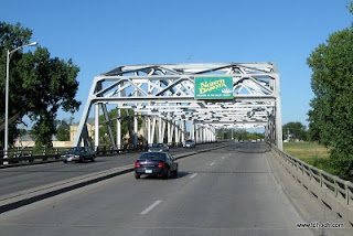
| US-2 bridge over the Red River in Grand Forks. |
As we neared the community of Devils Lake, the lake started showing itself here, there, and then everywhere. We've learned that the area has been battling with rising water for over the past 17 years. You see, the lake sits in a basin with no outlet. Water flows into the lake but doesn't flow out. Since records have been kept, starting about 1900, the lake went through an extended dry period when the lake levels were receding, then a period of rising and, arguably, more stable levels. But in 1993 the lake started rising and hasn't stopped to this day. See the graph (click for larger size)...
Today, the lake covers an area almost 4 times larger than it was in 1993. It's risen over 25 feet, inundating farmland, homes, businesses, and recreation areas. The lake is ringed with dead trees poking out of the water. There are continual efforts to raise the levels of dikes, levees, and roads. The state has developed a project to pump water from the lake and into a nearby river that flows away from the lake. In my next post, I'll delve into this rising lake subject in more detail... after we've had a chance to explore and learn more.
 |
| Causeway to Grahams Island. |
We found the Park and Campground to be to our liking and set up camp. On Friday we'll explore the area in greater detail.
Looking for my life vest...
T


No comments:
Post a Comment