June 30 - Red Lodge MT to Bighorn Canyon NRA (WY and MT)

Bighorn Canyon Camp
Forgot to mention yesterday that we had our first sour experience at a micro-brewery/brewpub. The establishment was Red Lodge Ales and Brewing. We sat at the bar... our preference when tasting craft beer. In all fairness, the gent who was working the bar was swamped with customers re-filling their growlers, but I think he could have been more attentive to his bar customers instead of working the line of re-fill customers exclusively. It was unfortunate, but these things happen.

We broke camp and headed east out of Red Lodge on MT-308 to MT-72 to US-310 south toward Lovell WY. We're straddling the border through here and weave back and forth between Montana and Wyoming. Generally, we're headed toward the Bighorn Mountains which we'd like to cross on US-14A.

Of note, we were amazed at the little town of Cowley (WY, I think). The main street through town was wide... very wide... and brand-spanking new. The new sidewalks on both sides of the street were wide... almost as wide as some little towns side streets. Something I hadn't seen before. What gives? A little research reveals that the town (less than 1000 population) was founded by Mormons... and therein lies the probable reason for the wide streets. Ever been to Salt Lake City? Wide streets. It's a Mormon thing, and very foresightful.

Just outside of Lovell we find the Bighorn Canyon National Recreation Area Visitor Center. Always suckers to learn a little something and get the old National Parks passport book stamped, in we go. Sounded interesting and there's camping available up along the canyon, so "left turn" and up into the canyon. It was still early.

Found a good campsite with a view of a reservoir, paid for the night ($15 w/elec and NP pass) then continued north to explore. Wildlife included a herd of wild horses, of which we saw quite a few. Also found a few really nice places to camp further down the canyon (to the north).

=====

Miles today: 132
Elevation: 3750
Location: N42.962 W108.262
Weather: generally nice, sunny; but north wind and cool.


two wild horses


June 29 - Yellowstone to Red Lodge MT

Broke camp at Canyon Village CG and headed north toward Tower Falls and the Northeast park entrance. Everyone in Yellowstone was happier today due to the bright yellow warm sun. First bright day in many.

First of many highlights today was a good, relatively close, sighting of a grizzly bear... brownish/copper-ish in color, large in size. Found along Grand Loop Road just south of the Tower Falls area. Got a few good shots, er..., pictures. It was unmistakably a grizzly per the hump on his shoulders.

We stopped at Roosevelt Lodge near Tower Junction for breakfast. We get a kick from consuming food and/or drink at the old lodges in whatever park we happen to be exploring... and we'd never been to this one. It's not my thing to comment about food on this blog, but for some reason (atmosphere? sunny day? good mood? or ??) my scrambled eggs with chilies and jack cheese was notable. Too many people overcook scrambled eggs. These were perfect.

The Lodge itself is a small rustic timber structure surrounded by many cabins rented to guests of more modest means than those who stay at the grand lodges or hotels in the Park. Although Roosevelt (Teddy) never stayed in the eponymous lodge, he did camp in the area during his 1903 visit.

From the Lodge we headed northeast on US-212... the Beartooth Highway... and through the Lamar Valley. Home to a wide variety of wildlife, we saw thousands of bison during our transit, and a few elk and deer. Those who are more persistent in their sighting efforts can be rewarded with bear, mountain lion, wolves, and more. It's a well known hotspot for wildlife sightings.

During our drive out today we checked out a couple park campgrounds. Tower Falls, which I have the recollection of having stayed at during our 1974 trip (Dar's not so sure) got a big thumbs down from us. Pebble Creek CG closer to the northeast park entrance got a bigger thumbs UP. Maybe next time.

Soon after leaving the Park we found Cooke City MT. US-212 between there and Red Lodge MT is known as the Beartooth Highway. It's an "All American Road" (whatever that is) made famous by Charles Kurault (remember his "On the Road..." series?) who dubbed it "the most beautiful drive in America". This is another place I've been yearning to see for many years.

And it certainly didn't disappoint. Due to the nearly 11,000 ft. elevation of it's summit, this road is only open for a few months in the warmer months. Snow storms can pop up any month of the year. There's one 12 mile section where the elevation changes by 5,200 ft! Much of the road is narrow with no shoulders. But the views and vistas are spectacular. It's only 69 miles from Cooke City to Red Lodge but we managed to gawk-away almost four hours. And we can't wait to do it again... from east to west next time.

We snagged the last available campsite at Parkside CG (NFS) a few miles west of Red Lodge.

=====

Miles today: 136
Camp: Parkside CG NFS
Elevation: 7,000 ft.
Location: N45.059 W109.708

Here are a few pics from our day... but I'd encourage you to check out all the images in our online album here (click)

Our big ol' bear

on the porch of Roosevelt Lodge in Yellowstone

almost 11,000 feet


Early Impressions of our Four Wheel Camper

At this point in our experience with the Four Wheel Truck Camper we've camped with it about 30 nights. In a nutshell, it's working out as good as we'd hoped. As with all things RV, it's all about compromises, your camping/traveling paradigm, your expectations, and you're ability to be flexible. I've written about this before.

Some folks would never, ever, choose a camper as small as this one. It's just so outside they're comfort zone. And I've got to tell you, we had concerns about it too... coming from a 40 foot diesel pusher motorhome. But in our minds, the motorhome is our "home". The truck camper is our "camper". Few people would consider a tent an acceptable "home", but many (I'm continually amazed at just how many...) use tents as their fold-up "camper". It's all your frame of reference, the paradigm you're starting from.

For us, the trade off is space for nimbleness... for the ability to go anywhere, to park anywhere. And we've certainly achieved that.

Comfort? The number one thing that needs to be comfortable is a bed. And we can report that after nearly of month of sleeping on the firm 3" foam pads in the FWC (ok, Dar added a 1-1/2" memory foam topper to her side) the quality of sleep is surprisingly good. We generally sleep through the night, wake refreshed, without aches and pains. This experience of ours makes us wonder what in the world people are looking for when they buy those 12 and 14 inch thick mattresses that are so popular today?

I'll do a more extensive review of the Four Wheel Camper (FWC) at some point in the future. This post is more about first impressions.

June 28 - Day four in Yellowstone

Stayed more or less local... around Canyon Village today. Woke with hope for a little sun today. Getting tired of rain and cold. 30s last night. Remember, we are at 8000 feet.

First up was Red Rock Trail for arguably the best front-on view of the lower falls. Also drove out to Inspiration Point and watched sunshine advance down the Yellowstone valley.

After fueling at Canyon Village (3.999/gal) drove up to Washburn Hot Springs Overlook for a snack lunch.

As the weather was still a little iffy, crowds were still manageable so we did walk down to the brink of the upper falls. However, felt no need to buck the congestion along the more popular south rim drive. Headed back to camp (Canyon Village CG) early to allot time for showers and to enjoy what looked like was going to be a more sunny afternoon.

Miles today: 17
Same camp as last night: Canyon Village CG
=====

I'm not fond of crowds and congestion; lines and the teeming masses. But here I am, one of them... and here for the same reason -- to see the wonders of Yellowstone. All of them have every right to be here. And I have options: I can choose to avoid the crowds and NOT see Yellowstone, or I can boost up the tolerance level a notch or two and endure the throngs. In this case, I'm managing OK. I've seen what we came to see. It's all part of the experience. It's important to be adaptable.

Along the Yellowstone... just above the upper falls.

Osprey in nest. Long zoom...

Yellowstone Valley below the falls.

June 27 - Day three in Yellowstone

"Selfie" at the brink
Have noticed many trees in the Park, in some areas literally every tree, have the barked scraped or rubbed off from 2 or 3 feet to maybe 5 or 6 feet above the ground. We've seen this before and have always guessed these are animal "rubbings". But the phenomena was so extensive it was time for a definitive answer. A veteran park ranger confirmed our guess. The trees effected the most are lodgepole pine, which have a very thin bark. The culprits are elk, bison, deer, even bear... there's a chance you can identify which by examining left behind hair or fur. It's considered a part of the natural ebb and flow of things and the Park doesn't seem to be overly concerned about it. What's to be done anyway? Often the scrapings will completely girdle the tree, killing it. But the forest has a life cycle like other living organisms, and must renew itself on a regular basis. Fire is another example of a natural process that causes the forest to renew... to bring forth another generation.

We broke camp at Bay Bridge today and headed to Canyon Village. The weather was cloudy with light rain. Took a shot at driving down North Rim Drive, hoping that the relatively early hour combined with the light rain had most folks sleeping in this morning. And our hunch was right. Parking was plentiful and we headed down the trail to the brink of the lower falls. I look forward to this stop. There are few spots where, for me, one can get so close and really feel the raw power of nature. Sure, waterfalls are everywhere. But the sheer scale of this one... especially early in the summer after a big snow year, is stunning. Also stopped at Lookout Point where, as mere kids in 1974, we snapped a few pictures of each other.

Back in Canyon Village we claimed our reserved campsite, A14, then ran over to the Canyon Grill for lunch.

The weather was still iffy, intermittent light rain, so we drove over to Norris Geyser Basin to walk the trails and perhaps see a geyser in action. A small one, Vixen, as about the only real action (only 5 or 10 minutes between spews... maybe 30 or 40 feet high), but we enjoyed the walk.

Back at campground we ran into a Swiss couple who were on a 4 year journey of the Americas. Have already spent 2 years in South America, a half year in Central America, and have recently started North America. This summer heading to Canada and Alaska so they could be back in the USA by fall. We actually saw their 4wd Sprinter van (loaded with gear and solar panels and adorned with small flags from every country they've been through) a few days before down in Grand Teton NP. Enjoyed talking with them.

=====

Miles today 47; odo 8412
Camp: Canyon Village CG (NPS) site A14
elevatiion: 7985
GPS: ?

and, a few pics of our day...

Nature in the raw.

Redux of a pic taken in 1974

Had to stop to let this guy cross.

Norris Geyser Basin.

June 26 - Day two in Yellowstone

Woke to rain this morning. Took advantage of a hole to pack up and head out, but a steady slow rain continued as we headed north along the west side of Yellowstone Lake.

First stop along the way was the Lake Hotel and Lake Lodge area. Hard on the shore of the Lake are two impressive structures that became a destination of early visitors to the Park. Built in the 1890s and early 1900s the large hotel building (4 floors and hundreds of rooms) has been through cycles of neglect and renovation over the years... the latest renewal was just completed earlier this year. I'm told every room was touched and our walk-around/through of the public spaces revealed an impressive result that people are lining up to pay somewhere north of $300 per night for a standard room. There are 9 lodges in Yellowstone Park with a range of amenities but this one must be near the top.

There's another lodge on the Lake property known as Lake Lodge. Build in the early 1900s, this is a more rustic affair that catered to crowds of more modest means, which it still does. Built in a traditional mountain lodge style (lots of wood, huge lobby, rustic)... I gotta tell ya', Lake Lodge was more my style... was more comfortable to us. We lingered in the dining room for a while with a light meal and just absorbed it all. This place also has a history but unfortunately is overshadowed by it's larger lakeside companion. We had a stimulating conversation with an enthusiastic woman who opened the information floodgates when I asked about the history of the place. Very cool.

Back on the road north we took the next right turn, drove through the "Fishing Bridge" area along the road toward the east entrance to the Park. This section of road gives visitors their first views of Yellowstone as they come into the Park by way of Cody, so there was plenty of pulling over and gawking going on. By this time the rain had given way to sunny broken skies so we found a pull-off high above the eastern side of Lake Yellowstone and had a snack lunch while enjoying the views. Another short stop at Lake Butte Overlook finished our touring for the day. We made an "about-face" and scooted to camp before more threatening rain.

=====
Camp tonight: Bay Bridge Campground (NPS) site G318 ($12)
Miles: 60 (odo 8365)
N44.542, W110.429

Lake Hotel; recently refurbished.

Lake Lodge Lobby.  More my taste.

A spot to linger on east side of Lake Yellowstone.

Campsite at Bay Bridge CG (NPS)

June 25 - Day one in Yellowstone NP

This morning we headed into Yellowstone without a clue as to where we'd be staying. Figured worst case was finding a semi-hidden place to parking-lot-dock. The climb into the Park is gradual but steady... on up to the 8,000 feet level where things flatten off a bit. First stop was the Grant Village area where we made a bee-line for the campground office to beg for any site they might have. As luck would have it we snagged one of the last 4 available sites for the night (cancellations... no-shows...). My Senior Pass is certainly paying off this trip... this one was $14.80/night including showers, half what it would be if I was a young kid (less than 62).

Our observations of NP campgrounds are that they're old (just like this author), designed years ago for tents and much smaller rigs, are plumb-full three months out of the year, and get a lot of wear and tear from all the traffic. But we're here, right? We're here to see the Park and there really aren't good alternatives unless one has hundreds of dollars to spend every night on the nice Park hotels that cater to... well, those with hundreds of dollars to spend every night. That's not us. So we endure the less-than-ideal conditions and enjoy the people around us as best we can.

After securing our site for tonight, we thought we'd try out an idea. We drove to the next campground to the north... Bay Bridge... to see if they might have a site available for tomorrow night. They did. So with credentials in hand, we drove further north to Canyon Village. Once again the campground office came through and we nailed down a spot for two more nights... giving us a total of four nights in the otherwise "sold-out" Yellowstone Park.

On the way back to Grant Village we tried to stop at the trail to the brink of the lower Yellowstone Falls (too danged many people, cars, trucks, buses, RVs -- Yikes) but did find a more-or-less secluded pull-off along the full and flowing Yellowstone River where we lingered for a while. We also stopped and walked around the Mud Volcano area and a little later, the West Thumb Geyser Basin.

A brief observed "duh?" moment occurred at the Geyser Basin. First, it's important that the reader understand the setting: the Geyser Basin is along the shore of an arm of Lake Yellowstone... the "West Thumb" as it's called. All sorts of bubbling and gurgling thermal things are spewing hot steamy sulfur-y water, and the pools of all this water recently liberated from deep underground fill-up and eventually flow into the Lake. It's been going on for who knows how many hundreds or thousands of years continuously.

Anyway, we observed (and overheard) a woman asking a veteran Park Ranger the following question. "Why does the Park Service allow all this stinky water to flow into the Lake?" The dumbfounded Ranger searched for an answer and could only muster that "it's a natural process that has been doing this for many years... the system has adapted." I'll just bet he also passed that one along at the Ranger happy-hour later that evening.

Home to some yummy leftovers.

========
Camp tonight: Grant Village NFS CG site B51
Miles today:  161
Odometer:  8305
N44.395, W110.563

Pics from the day... a few.  For more click here.

Bison aplenty. 

Yellowstone Lake

Good spot along the Yellowstone to rest and have a snack.

West Thumb Geyser Basin... and all that "stinky" water.

Camp at Grant Village CG (NPS)

Sunday June 22 thru June 25 - Grand Tetons National Park

A few days of exploring the GTNP... both on foot and on wheels. Our camp was at Gros Ventres (site 300) which was acceptable considering the proximity to the Park but certainly wasn't the nicest or roomiest camp we've experienced. But our mission was to see the Tetons and get a few miles of hiking on the boots.

Sunday we started with the Jenny Lake boat shuttle over to a trailhead for the Hidden Falls and Inspiration Point hikes. Both are located right at the foot of the Teton peaks and provide some good training for muscles suffering from a little atrophy after a few days riding in the truck. The falls was OK but the more challenging and rugged Inspiration Point hike, with somewhere shy of 1,000 feet of elevation gain was more agreeable.

Afterward we checked out more of the park... an "overview" if you will... including Jenny Lake and Jackson Lake lodges. Our stop at Jackson Lake lodge was notable as we availed ourselves of nourishment and precious fluid replacement ($37.80) while watching thunderstorms forming over the peaks and sweeping down the valley. Photos often do not do justice to spectacles of nature, and that was certainly the case with these. We also checked out Signal Mtn. Lodge (too new and bland to be of much interest) and Signal Mtn. Campground, which rated a big "thumbs-down" from us. It's probably the most centrally located CGs in the Park but just too tight, hilly, and packed with campers to rate higher.

Monday started with a light breakfast at Dornan's Chuckwagon near the south entrance to the Park followed by a 4 mile hike back to Taggert Lake. A pleasant little hike with minimal elevation gain, it's another of the more popular walks mapped by the NPS. The plan was to have a snack lunch on the shore of the lake, which we did. However the experience was spoiled somewhat by a loud and irritating youth group of some kind that broke the quiet solitude for nearly our entire time at the lake. Don't know what they were doing but it just seemed like it would never end. But that's the way it is. There are so many people visiting some of the National Parks during peak season that the only way to see them is to put up with the hassles and irritations of masses of people. We got over it.

Later, we drove to the north end of the Park, checked out a couple other CGs, and stopped at a wayside viewpoint to have a picnic "lunner". On the way back to camp, just off Gros Ventres Road, we stopped and watched three moose going about their business along and in the Gros Ventres River. Wondered if we'd see any moose so this encounter took care of that.

Back at camp we had drinks on "the Lanai" (our picnic table) at 6pm. Later heard some commotion and saw a big ol' moose trotting right through the Gros Ventres CG. Certainly had our moose fix for the day.

Tuesday. Money-spending and chore day. Yes folks, even explorers have to take a break and get the laundry done once in a while. Besides the laundromat ($18), and considering the weather wasn't all that great, we did an hour or two at the Jackson Recreation Center ($17), had lunch at Chinatown restaurant ($20), Ace Hardware for a few supplies (including bear spray) (more $), and topped off the truck's wing-tanks ($3.66/gal). And no visit to Jackson would be complete without a stop at Snake River Brewing. A full day... I'm ready for another hike.

Wednesday, we broke camp and headed north into Yellowstone.

Hidden Falls... not so hidden afterall

Trail to Inspiration Point got a little tricky in spots

Break-time at Jackson Lake Lodge. Watched a
thunderstorm over Tetons

Taggert Lake

Along the Taggert Lake trail.

Moose sauntering through our campground

June 21 - Victor to Jackson via Teton Pass

Trail Creek CG to Gros Ventres CG NPS near Jackson ID
77 miles
6500 elevation
N43.613; W110.671
Weather: Mixed sun and clouds. Nice day.

Camped at Gros Ventres CG (NPS) near Jackson but on south edge of Grand Teton NP. $11.50

Highlights from Day:
Teton Pass… Wow. Now there’s a mountain pass. No wimpy 6% grades here. No Sir. It’s quite a climb. Long 10%+ grades on both sides and it summits out at over 7,300 feet. But truck, complete with camper, gear, and two explorers, handled it fine. We didn’t go up as fast as a diesel pickup would… or come down as fast as many with diesels do… but it was a respectable showing for a naturally aspirated gas engine at 7,300 feet.

Jackson is a bustling town both summer (Grand Teton National Park visitors) and winter (skiers and other winter sports types). Might be a little less busy during spring and fall… don’t know for sure. The place reminds me somewhat of other tourist destinations (Gatlinburg comes to mind) but this one seems to have more of a heart for some reason.

Gotta love the America the Beautiful Senior Pass. Right through the gates of Grand Teton National Park and saved $25 as we did it. But considering the big bubble of baby-boomers about to hit their mid-60s, you gotta wonder how long it can last.

Got a very knowledgeable guy at the Inter-agency Visitor Center in Jackson who had a bunch of tips of what to see and what to avoid… kind of the insiders view of the area. At least, that’s how we felt. He was very helpful and fun to interact with. We’ve got a lot to choose from in the next few days.

We snagged a campsite in the Gros Ventres CG just a few miles outside of Jackson and on the southern edge of the National Park. For future reference, it’s pronounced “grow-von’” with the accent on the second syllable. Supposed to be a French word meaning “big valley”. I don’t think I’ll get into how the name “Grand Tetons” came about. Will save that for another day or you can Google it if you’d prefer. (link)

The campground is large (something like 350 campsites) among a bunch of Cottonwood trees along the Gros Ventres River. We’ve found campgrounds in National Parks to be wanting… for space, for level-ness, for solitude… but this one is perhaps slightly better than others we’ve seen and stayed in. As with many other compromises in life, location often trumps other needs.

Since the truck camper has no shower we’re looking for said facilities every couple days. Our plan has been to use campground showers when available and motels for a night here and there when we need to. But in Jackson we hit on another idea (actually provided by the knowledgeable guy in the visitor center)... the local Recreation Center. Often these facilities offer daily rates for folks travelling through, and that’s exactly what we found in Jackson. The top-notch facility there… with swimming pools, hot tubs, gyms, workout room and equipment… has daily rates for $7 per day. One could shower early in the morning, go out and do a vigorous hike or climb, and return in the evening for a second shower… all for the 7 buck fee. We took advantage of this a couple times.

Weather has been great. 70s during day, 40s at night. Good sleeping weather.

A few pics from the day...

Teton Pass summit. 8400 ft.
10% downgrade with 20 mph tight curves for next 5 miles.

The Grand Tetons

Campsite at Gros Ventres CG in the National Park.

June 20 - Mesa Falls and West Side of Tetons

Clark Canyon Reservoir CG to Trail Creek CG NFS near Victor ID
231 miles today
elevation: 6700
N43.540; W111.038
Weather: Mix of sun and clouds; warm.

Camped at Trail Creek CG (NFS) just outside Victor; site #7 no … #6 no … #5. $6

Highlights of Day:
Again, the varied geography in this part of the world is amazing. Deep in the mountains for a while but in just a short while we’re among flat agricultural fields irrigated by runoff from the aforementioned mountains.

Stopped at a king-sized waterfall called Mesa Falls. As waterfalls go this one ranks right up there near the upper bracket. A bit out of our way but worth it.

ID-33 runs north/south along the eastern edge of the Grand Tetons. The afternoon sun lit-up the western side of those jagged snow covered peaks… a scene unseen by most who only view them from the east side… from within Grand Teton National Park. There are a few trails through the mountains but I think I’ll have to get into better shape before even thinking about that. It’s tempting though.

Found a sign a few miles out of Victor leading us to Trail Creek CG in the National Forest. Determined it was agreeable and grabbed site 7. Campground host came by and told us site 7 was reserved. Hmmm. The tag said last camper had left this morning. Turns out a second tag was behind the first and there was a reservation for tonight. OK, we’ll move to… site 6. Fine. Ten minutes later the campground host came by apologizing profusely… he forgot to put new tags out today and this site was reserved too. Hmmm. OK… I guess we’ll move to site...5. “Are you sure this one’s OK?” “Yep”. For our trouble he agreed to give us whatever wood we needed for a campfire. Unfortunately, the wood was not seasoned (dried) and that, combined with a 6700 foot elevation (less Oxygen), it was all I could do to get a couple hotdogs warmed. More smoke than heat.

A few pics from the day...

Upper Mesa Falls

The Tetons from the west side... a view not many foks see.

Brand spanking new mountains.

Trail Creek CG (NFS)

June 19 - To the Top of Lemhi Pass

Camped tonight on the shores of Clark Canyon Reservoir at the junction of MT-324 and I-15 near Dillion MT. A surprising deal from the US Bureau of Reclamation -- campsites are free. The only bad news was that they did not accept my Senior Pass.

Highlights of the Day:
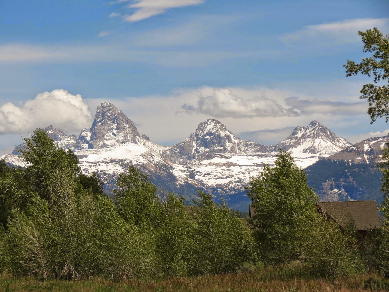
Nice sunny morning. Cap clouds over the peaks of the Bitteroots (or Beaverheads?) east of Salmon. Those peaks are the Continental Divide through here. Being this close we felt some real motivation to get going.

Today is Lemhi Pass Day. I’ve explained before how we missed this segment of the Lewis & Clark trail a few years ago and have ever since wanted to stand on that pass.

From the west side the road to Lemhi Pass starts at Tendoy ID. There you leave pavement behind and take one-lane gravel and dirt roads up some pretty amazing terrain… through some pretty amazing places… trails carved on mountainsides. The Forest Service provides a 36 mile loop road to the top and past historic points of interest. With an elevation gain of 4,000 ft. and grades of 20% or more… it’s an uncommon road and an uncommon experience. Once at the pass, a modern day explorer can descend down the east side in order to make a complete transit of the pass instead of completing the loop on the west side.

Today we met not a soul during the climb, nor during our 2 hours at the pass itself. We had it all to ourselves -- just us and the faded spirits of the 1804/1805 Corps of Discovery. And, yes, we did this rugged little drive in the truck and camper. And, yes, we do hope to return another day to do it again… in the opposite direction.

At the top, the “saddle” of the pass, 7,373 elevation, we lingered… had a light lunch… climbed the hill on the continental divide that Lewis did and looked out on the same view he saw to the west… nothing but mountains for as far as he could see. Hopes for a quick passage down the western side went up in smoke. Unless he could connect with Indians and trade for some horses the expedition might very well have ended in failure as, at this late date in the fall of 1805 and with Winter just a few short weeks away, they’d be forced to retreat down the Missouri to the east.

The expedition’s Indian guide woman, Sacagawea, was originally from the Lemhi area before she was kidnapped some years earlier by Sioux and carted off to the Mandan Villages in North Dakota. With her knowledge of landmarks and the terrain in the Lemhi area she may have been a critical element in the eventual success of the expedition. Amazingly, the Lemhi Indians they encountered near here were lead by a Chief who was her brother.

There’s a spring that spouts from the side of the hill about a quarter mile from the Lemhi Pass saddle. It’s now preserved as the Sacagawea Memorial and is considered by some to be a source of the Missouri River.

We dropped into Montana from Lemhi Pass on that aforementioned dirt road down the east side… most of which goes through the Bar Double T Ranch (-TT) before hitting MT-324, which we took all the way to the Clark Canyon Reservoir. We camped on the east side of the lake (there are numerous campgrounds scattered around all sides of the impoundment).

Setting up camp is a 5 minute procedure - also known as the 5 P’s: Park, Pop top of camper, Pop top of wine, Park butts in camp chairs, and Post-audit (discuss) day.

During this camp at Clark Canyon Reservoir we ran into the most unique set of characters we’ve met in a long time… There was Hazel the 83 year old camp host; Dick the super-friendly and retired almost everything (car seller, gold miner, etc. etc); Dicks delightful wife Chris; Windy the gentle old gentleman who couldn’t get his new-fangled digital camera to work right. We had more fun in a couple hours with these folks than we’ve had in a long time. Great memories.

=====
Morgan’s Bar CG to Lemhi Pass to Clark Canyon Reservoir CG BOR
94 slow miles today
N44.996; W112.856
Elevation 5500 feet
Weather was sunny, windy, and cool. Perfect for exploring historic mountain passes.

Monument on Lemhi Pass

Dar strikes a "Lewis & Clark" pose. This is the spot where
Lewis first saw the west side of the continental divide.

Thom strikes his own "L&C" pose.  Guessing this wasn't here
in 1805.

Camped along Clark Canyon Reservoir. Not too bad for free.

A Minimalist

A Minimalist A blog post I've recently been involved with helping to clear out the living spaces of someone who died. These are a few of...

Slightly Better than Most