Mar 30, 2015

Arrival at Base-camp Oregon

We're back in Sutherlin. Arrived this past Thursday late afternoon, the 26th of March. The days drive from Susanville started superbly, with a very pleasant meander through the middle of the Lassen National Forest on CA-44, and, later, through the Shasta-Trinity National Forest on CA-89. The former route is a newer wide roadway; the latter, older and narrower. Truck traffic can be heavy but it wasn't particularly bothersome to us that day. Bright skies and clear air provided some spectacular views of Mt. Shasta along the way. I really like roads like this.

But once we got on I-5 at Mt. Shasta things deteriorated. The pleasant peaceful pace changed to a terrifying race of clenched-jawed idiots paying more attention to their smartphones than their cars while jockeying for any imagined advantage over someone else... anyone else. Two lanes full of moving metal made passing the rare slower vehicle tough. It was three hours of hell on wheels and we were happy to be back home... happy, but tired.

So we made the return trip in just 4 days. I had an extra day or two of flexibility built into my plan for the return migration to Oregon. With weather being unpredictable, or the possibility of fatigue or mechanical issues popping up, it just seemed prudent to build-in those extra days. But, you might say... "hey, you're retired! What's the rush? Why even plan at all? Just take each day as it comes. If you feel like stopping, stop. If you feel like going, go. Sheesh... get a life."

Fair enough. Criticism accepted. We do indeed strive for that "day-at-a-time" ideal. Whether my "plan" is just a target or perhaps a vestige urge from earlier business days, I still haven't been able to be a nomadic purist all the time.

And here we are for the next month or so with task list in hand. Mostly it involves prepping the bushouse for long-term storage... deep mothballs, and the truck camper for a long summer trip.  At this time, we'd like to be heading out again by early May.

As usual during our time in a base-camp, updates to the journal will be less frequent.

Here's a very short video made along the way while I should have been concentrating on driving.


Mar 25, 2015

Make Hay while the Sun Shines... and Travel Together

Today, Wednesday March 25, was an easy day on our planned northward migration. Only a little over 200 miles. Tried to find a place to camp for the night that was just, oh... another 60 or 80 miles further. But came up dry. With just the little camper it would have been easy. But with both the camper and the bushouse the possibilities diminish. And many federal campgrounds are not open this early in the season.

That was all a long way around to the fact that we're here in Susanville CA tonight, after an easy 217 mile jaunt. We've decided that tomorrow we'll keep the momentum going and finish the migration back to Sutherlin. It'll be a "big" day for us... something like 325 miles... but we're up for it. As I said last night, we can smell the barn.

We had one interesting situation today when we were exiting from I-80 to US-395 in downtown Reno. The off-ramps are close and a little confusing to the occasional traveler through here.  I was in the lead, Dar following close behind. We both could see the exit... but there are two different exits very close to one another. I mistakenly pulled into the far right lane when I should have stayed in the next-to the far right lane. At the last moment I realized my mistake and had a clear shot at changing to the correct lane... and did so. Dar wasn't so lucky. She was committed and blocked... and it was too late. She went into downtown Reno and I was heading out of town on 395 north. Hmmm.  While traveling in tandem like this we use little FRS two-way radios, with a real life range of just a mile or so (despite the package claims of 22 miles!!!), and we used the last few seconds of signal strength to bid each other good luck, agreeing to meet down the road as soon as reasonably possible. Some stories might have ended there. ("Believe it or not little one, that was the last I saw of her. Lost her to the siren-song of the big city. We had a good run while it lasted.")

But it didn't end that way. The good news is that we did get back together about 10 miles down the road. I slowed and found a good stealthy spot at roadside, and she used her innate inner compass to home in on the correct route... and the rest is history.

And for those newbie grasshoppers out there who are contemplating full-time life on the road, here is my message after making a couple trips with us driving separately:  Don't be fooled into thinking you can have the same quality travel experiences by driving separately in order to take two vehicles from place to place. I mean, it's like saying... hey, I'll meet you in Rome for a few days next May. No sir, no madam, you will be missing so much... the joys of shared experiences... the side comments... the unspoken vibrations and emotions only possible when in the same place at the same time... within eye contact. Remember, much of the lifestyle is about the journey... not just the destination. Would you take your wife/partner to a nice dinner and sit at separate tables?... maybe connected only by two way radio... so you can "share" the experience??? Huh? No. Of course not. The thought is ridiculous. Do what you have to do to shun this urge. Travel together, as a twosome. You miss sooo much if you don't.

Tonight we're resting in Susanville. Tomorrow we'll be back at homebase.

Mar 24, 2015

Making our Way Back Home

Tonight we're resting near Hawthorne NV after two days of driving. Pulled out of North Ranch Congress a little after 8am Monday morning and kept a good pace all the way to just short of Las Vegas. There we stopped to have lunch with good friends Doug and Kay. And not only was the conversation lively and interesting, we found a casino buffet on a senior citizens "buy one, get one" day... which means we stuffed ourselves for less than $5 each.

By a little after 3pm we were at the SKP coop park in Pahrump. Checked into "boondocking" and found Jimmy and Julianne... two more good travel friends we cross paths with often. The rest of the night was spent using adult beverages to lubricate some productive conversation. A very enjoyable time for sure.  I did fail to find time or energy to write the promised update post on our days travels.

This morning, Tuesday, we were rolling by a little after 9am on the nearly 300 mile drive to Hawthorne NV.  The sunny start to the day grew cloudier and windier as time went on. (and yes, it was mostly a headwind!)  Nevada has some stunning views along this route... severe steep mountain ranges separated by wide sinking valleys. Towards the end of the drive the high Sierras, snow-covered and stark, form a backdrop... the horizon line... for everything else in the foreground.  Layers of mountain ranges as far as one can see.

Our intention is to continue tomorrow, blowing off a built-in day of rest, to keep the momentum going. We're about half-way and can "smell the barn".

Mar 22, 2015

Back on the Road... Heading North for Spring

We're clearly anxious to get moving again. The past few days we've stowed and prep'ed and packed with vigor... to the point we're all set to take off in the morning. This'll be a full two days ahead of our original plan. Without a doubt, we're ready to get Winter behind us and, like a flying flock of flickers, start our summer migration northward.

Had a very agreeable visit with Dar's sister Cher this afternoon. Introduced her to one of our local hangouts here in the Congress area. Since most of our work was long done, we could enjoy the time and the conversation without distraction. Really quite enjoyable.

Early start for the bushouse tomorrow. Dar will take command of the truck/camper and I'll  be tagging closely behind. Will post an update tomorrow night.

Mar 19, 2015

Random Restless Ruminations

Lately, regardless of who we're talking to or what we start talking about it seems talk usually comes around to something related to our planned Alaskan trip. And we've been finding no shortage of folks offering their advice regarding where to go, what to see, how to fish, needed equipment, how to handle mosquitoes, and on and on. Everyone has advice about mosquitoes. The best we've gotten so far is that AVOIDANCE is the only really effective way to deal with the little buggers... and that the best months for avoiding them are months that end with -ary.

With signs of Spring popping all around it's almost time to start our reverse migration northward and back to our base in Sutherlin Oregon. It's been an enjoyable Winter what with all the family doings, our sporadic excursions with the truck camper, and our successful escape from most of the snow, ice, and cold. But we're also ready to get back to our home community, reconnect with family, and get started on preparations for summer travels.

On the subject of coffee:  Almost half of the coffee section of our local grocery store is now taken up by K-cups. The Keurig/Green Mountain system of cup-at-time machines will certainly go down in history as a monument to the effectiveness of advertising and hucksterism... not to mention the desire for some people to demonstrate how cool and hip they are by having the latest new thing. Anyone who can convince so many people to pay 50 cents or more for a cup of coffee that they had been making with their old drip machine for only a nickle... well, I'm just stunned. Sure, there is a measure of convenience in the system, but com'on... 10x the price? I don't have one so I may not be giving this topic a fair shake... but is there enough value in the convenience and the variety of flavors and things you can make worth all the extra money? I just don't get it.

Future plans:  As things stand as of this writing, we're heading back to our homebase in Sutherlin in a week or so. Both truck/camper and bushouse are going... we'll be driving separately.  Once back, preparations begin for putting the bushouse in mothballs for a few months, as well as a number of expensive deferred maintenance items that really should be done. We'll also use that time to get the truck camper ready for Alaska. Also on the agenda is spending some meaningful time with family and grand-kids. Then, early May we're heading for Alaska by way of Wisconsin. (What?) Makes sense to us as we've got family and friends to see, and a few annual medical/dental appointments to keep. About the 10th of June we'd like to be heading northwest-ward, into Canada, through the Canadian Rockies, then to Dawson Creek and beyond to the land of the midnight sun.

Dawson Creek is the beginning of the Alaskan Highway (originally known as the Alcan). Our intention is to drive every mile of it on our way up.. all the way to Fairbanks. Then we'll explore as much of Alaska as we can fit in before having to begin the return trip... probably sometime mid to late August. On the return we'll take alternate highways and routes to experience as much of the north country as we can. There are a few things that could get in the way of our plans, but for now, it's full speed ahead.

Mar 16, 2015

Run for the Border

In early March Dar and I made another foray into the Sonoran desert... this time almost due south. Thought it was time to re-visit Organ Pipe Cactus National Monument and the Why-Ajo area. (Why Ajo? Why not?) We were down here for the first time a few years ago, with the motorhome, and stayed on BLM land just south of the crossroads of Why. Our objective this time was mostly to get away... to trade our normal basecamp routine for some flexing of the exploring muscles... ya' know? Nomads and vagabonds can't sit still for long.

On the way south we tried to stay off the main roads, opting for more interesting secondary roads when possible. Vulture Mine Road out of Wickenburg and Old US-80 to Gila Bend. But once in Gila Bend there's but one road (AZ-85) that cuts through the Goldwater Bombing Range on the way to Ajo... and I don't think a prudent person should stray too far from the pavement along through here. As it was, we had to slow down a couple times to let a pack of 3 low-flying F-16s cut across the road in front of us. Out here, they have the right-of-way.

Ajo is an old mine town. Copper was the primary metal being sought and the Ajo mine was the first large scale copper mine in the Arizona Territory. Currently, there's little going on at the mine today, but you can't help but notice the remnants of it's earlier peak times. Huge piles of overburden and tailings form man-made mountains on the south and east side of Ajo, surrounding a large deep open pit mine that can still be seen from above. The community is certainly struggling but if one looks hard enough there are signs of new growth and a good community spirit. Let's hope so.

A bit further down the road is Why. Not much to report here, except there is a reasonably priced gas station and C-store here, and even a cafe that serves breakfast and lunch... again, at reasonable prices. If one is boondocking out on BLM land, these things can be important.

We drove on to Organ Pipe Cactus National Monument, re-acquainted ourselves with the park at the Visitor Center, and checked into the nearby park campground. As National Park Service campgrounds go, this is certainly one of the best. As with most, all the sites are "no hookups"... it's all drycamping. But it's laid out in a logical, well-designed way. Except for the tent sites, all sites are concrete paved and mostly level... about 200 in all. Even the largest RVs have no problems getting in or getting level. Alright... it does feel a little like an RV park... but not quite. There's just enough spacing and desert plant life between the sites to provide a measure of privacy and a campground-like experience. Stargazing is excellent here, except during a nearly full moon like we had during our stay. Only minimal campground lighting interferes so its got to be a great place to peruse the heavens at night.

The last time we were here we did the Ajo Mountain drive on the east side of the Park. So this time we tackled the twice as long (37 mile) Puerto Blanco Loop Road. This loop road had been closed for years due to cross-border smuggling activity, but it was recently opened again to the public. We found the road, trail really, to be in rough shape in spots. The Park restricts travel to high-clearance vehicles only. We had no issues making it with the nimble 5 ton truck and camper other than some additional desert pinstriping. Never engaged the dif-loc or 4wd. High clearance was needed however.

Fence on the border
The last 10 or 12 miles are hard against the border, which through here is demarcated with a substantial anti-vehicle fence. About 4 or 5 feet high, it has big square steel posts in the ground, a couple steel rails between posts, and some horizontal steel cabling filling the gaps between the rails. I think it would stop a Sherman tank, but is absolutely NO obstacle for a person. I stood next to it and could have slipped into Mexico easier than getting through the checkout line at Frys.

We did experience a weird juxtaposition along this part of the drive. The road we were on, South Puerto Blanco Road, was completely non-maintained, rutted, corrugated, and washed out in spots -- a lousy road. Tough to even make 5 or 10 mph. Next to us is The Fence. Next to The Fence, on the other side, in Mexico, was a divided four-lane, smooth as glass, superhighway. We both smiled at the comparison between poor old backward "almost-third-world" Mexico and our own affluent super-country USA.

We stayed at the Park campground for two nights. On the third night we moved north to the BLM area just south of Why. During this trip we took the opportunity to check out the BLM area just south of Ajo off Darby Wells Road and were greatly under-whelmed... completely unimpressed. Now maybe we just didn't see the prime area for boondocking up there, but for us, the Why BLM boondocking area has much more to offer. Perhaps just a personal preference.

Our excursion to the border was a short one, but, regardless of duration, we seem to always enjoy these trips. The weather was superb during the entire time, we ran into some neat people, and learned more about a place we're really growing to love... the Sonoran Desert.

V. nice couple on a four year journey through N. and S. America.
They can go anywhere with that rig.
Hold on there Pard'nr... would that be in Pesos?

Mar 2, 2015

Searching for Stanton Arizona

In the last couple weeks we’ve visited Stanton Arizona twice. Not many of you have probably heard of Stanton, one of a large number of old mining towns sprinkled around this part of Arizona, but it's a well-known place among prospectors, gold bugs, and rock hounds. Located just a handful of miles from our winter base in Congress, it's off the beaten path... not to mention any hard-surfaced road. Here’s more from wikipedia:

The town of Stanton, like the towns of Octave and Weaver, owe their existence to a group of pioneers who discovered gold in the area in 1863. Led by the frontiersman Pauline Weaver, the explorers were camped along Antelope Creek when one of the men - a tracker named Alvaro - decided to go chasing after a runaway burro. After climbing to the top of what would become known as Rich Hill, Alvaro tripped over a pile of gold nuggets that were "as big as potatoes." Soon after, Pauline Weaver and a friend named Jack Swilling found another pile of gold on top of nearby Antelope Hill. Weaver said that gold was so plentiful in the area that he could pop nuggets out of the ground with a knife, and that one acre yielded nearly $500,000 in gold.

The 1863 strike transformed Antelope Station into a boomtown overnight. Originally just a small stage stop, by 1868 Antelope Station supported a population of 3,500 people. Chuck Stanton first arrived in town a few years later. He wasted no time in recruiting the help of some Mexican bandits so he could wipe out his competition and take control of the town. His first two victims were his neighbors, George "Yaqui" Wilson and William Partridge, both of whom owned a store and a stage stop. In August 1877, Stanton tricked Partridge into killing Wilson over some pigs, and so Partridge was arrested and sent to the Yuma Territorial Prison.

Once Wilson and Partridge were out of the way, Stanton focused on Wilson's business partner, John Timmerman, who arrived in town from Smith's Mill and formed a new partnership with a family-man named Barney Martin. Stanton's plan for dealing with Timmerman and Martin wasn't nearly as clever as Wilson's murder had been planned. He simply had his bandits ambush them out in the desert. The bandits also killed Barney's wife and his two little boys in what has since become known as the "Martin Family Massacre." Stanton was arrested for the murders, but due to the testimony of several false witnesses, the charges against him were dropped. Later on that year, however, Stanton was killed by a Mexican gunman named Lucero, and buried about a mile outside of town.

Following Stanton's death, the town continued to thrive for several years, but it was still considered to be a dangerous place. In 1892, for example, a Prescott newspaper reported that the residents of Stanton liked to "drink blood, eat fried rattlesnakes and fight mountain lions". Nevertheless, by the 1890s, Stanton was a legitimate community filled with miners, their families, a general store, a stamp mill, a hotel, a boarding house, and several other associated buildings. For some inexplicable reason, the town's name was officially changed back to Stanton in 1896. It didn't survive for much longer, though. By 1905 the gold in the area was just about gone. That same year the Stanton Post Office was closed, for good, and the town was abandoned.

Then in the late 50s, the Saturday Evening Post bought the ten acre ghost town and gave it away in a contest. The “lucky” new owners didn’t know what to do with it so they sold it. In the late 60s a band of hippies moved in and started tearing apart the wooden buildings for firewood. In 1976 the Lost Dutchman Mining Association bought the property. They’ve restored a few of the old buildings, built a “member-only” RV park, and as time and money are available plan to make further improvements.

February 17 - First visit to Stanton and Old Stage Road drive to Yarnell
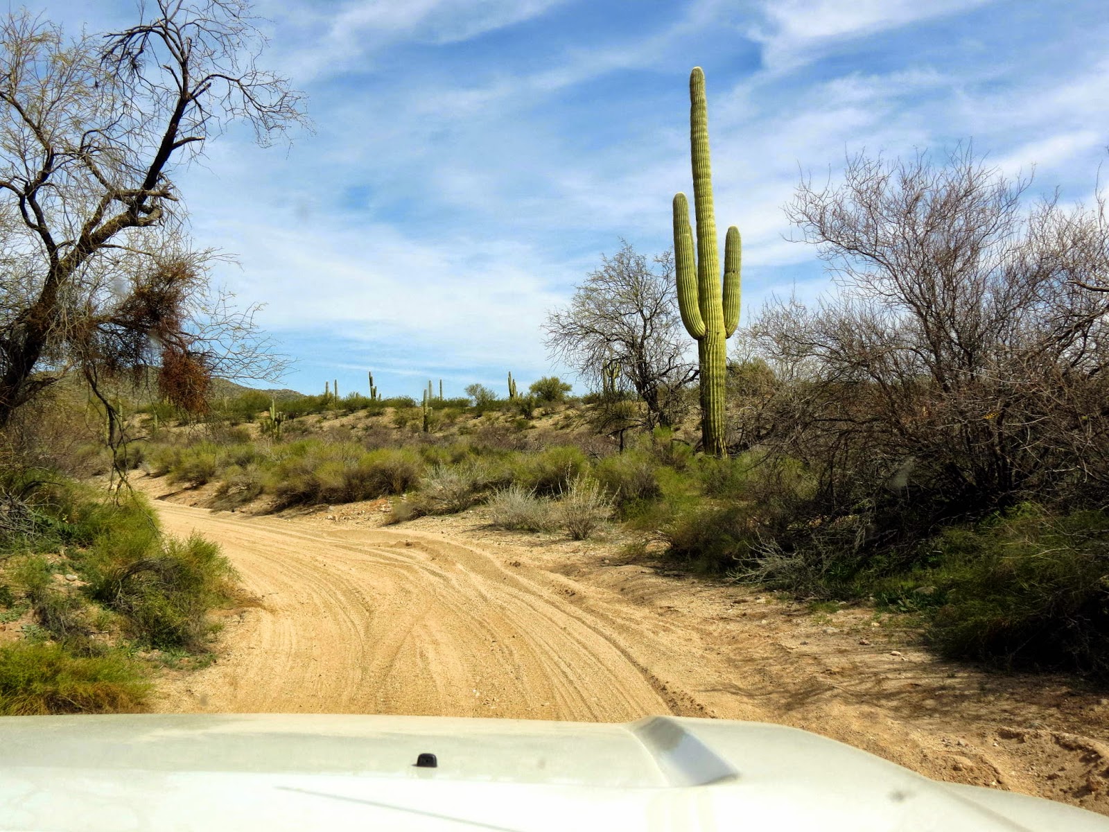
I mentioned earlier that Stanton is only a few miles from our basecamp in North Ranch. That’s true, but it’s across an expanse of rugged desert. The easy way to get there is via Stanton Road off Hwy 89 north of Congress. A wide gravel/dirt road with a few rough corrugated patches, it’s about 5 or 6 miles back to Stanton, tucked away in a corner of the hills.

The day was warm and sunny as we slowly edged our way along Stanton Road, no hurry, and stopped in a few places so Dar could snap a pic or two. Somewhere about 4 miles from Hwy-89 the dirt road makes a bend around an arm of the mountain and buildings and RVs and then more RVs pop into view, seemingly multiplying faster than dreams of finding the mother-lode.

The place has a rustic feel. Except for the ubiquitous cloud of dust, the steady din of 4x4s, razors, and other OHVs, and the jumble of white RVs scattered about, the ambiance of Stanton probably hasn't changed much since the 1860s. A large fire pit is the centerpiece of the "town square". The few historic buildings are not impressive save for their age and originality, but are far more interesting than the interpretive re-creations that we sometimes find in historic places.

As stated above, the town is now owned by the Lost Dutchman Mine Association and is mostly an RV park used exclusively by it's members. The common thread that binds all these folks together is their interest in mining and prospecting. Like many hobbies, passions, and interests, there's no accounting for how these kinds of recreational pursuits are kindled in the hearts of those afflicted. But they so seem like a happy bunch and were very welcoming and forthcoming with answers to the questions we had.

From Stanton we had a choice to make. Do we go back the way we came in? Do we strike off "cross-desert" in the direction of Wickenburg? Or do we attempt an old stagecoach road up the hill toward Yarnell? Best two out of three... paper covers rock... and we were off uphill toward Yarnell.

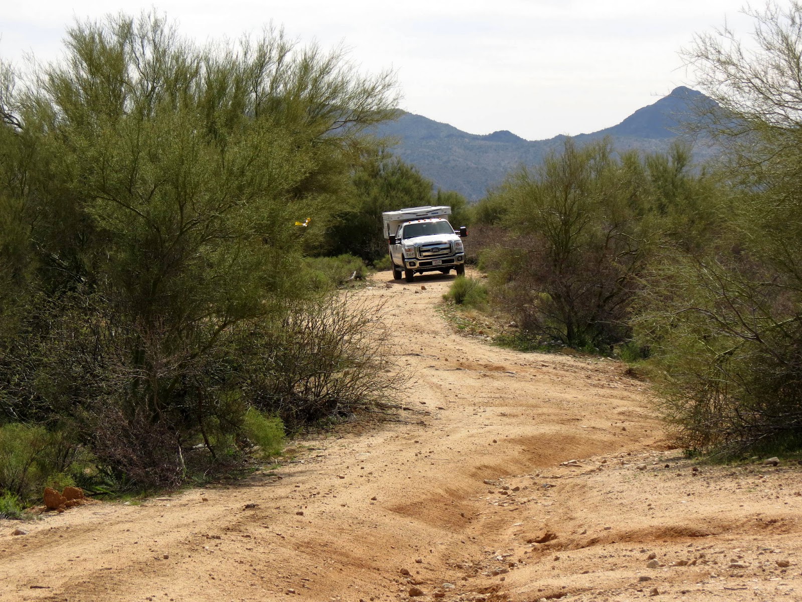
This is a doable road for almost any vehicle, at least it was that day. But "they" usually recommend high clearance and 4 wheel drive. In places the road, trail really, is rough and rock covered, steep, narrow with blind curves, or, often, all of the above. Surprisingly we encountered three or four other vehicles along the way... but no other RVs. Probably not too many campers get through here. After an hour or so (we do like to travel slowly) we topped out at Yarnell with empty stomachs and a little trail tangling experience under our belts.

A late lunch sounded good but the diner in Yarnell was closed. So down the hill (Hwy 89) we rolled and didn't stop until the Arrowhead Bar and Grill outside Congress where we found the appropriate elixir for a trail-weary twosome.

February 21 - Desert roads and trails from Wickenburg to Stanton
Not satisfied with the first easy-as-pie excursion to Stanton a few days ago, Dar and I thought we'd try a longer and, in all likelihood, more difficult route to the old mining town. This would be more in keeping with the prospecting and wild-west theme of the area. Hopefully we wouldn't have to worry about being ambushed by Chuck Stanton's gang, but we were hoping to challenge the truck with more "interesting" trails... trails that were not unlike those the early prospectors used 150 years ago.

Our day started at the intersection of US-93 and Scenic Loop Road a little north of Wickenburg. I say "intersection", which brings up visions of traffic lights or roundabouts or, at least four-way stop signs. But this intersection was a little harder to find. And it is entirely possible to miss it altogether if you're not paying careful attention.

Little old Scenic Loop Road quickly goes from asphalt to gravel to dirt and sand, the ubiquitous substrate of this upper corner of the Sonoran desert. I'll try to keep this short or at least to the point.

Aided by my trusty Garmin GPS, we jittered and vibrated our way, generally, to the northeast. At many spots the trail V'd (some might say why'd) forcing us to choose a track that appeared to be heading off in the right direction. All along, Gertie Garmin indicated we were on Scenic Loop. We stopped at a boondock campsite to stretch and have a snack. We drove down steep embankments, through loose sand washes, and up the opposite side, sometimes spinning, clawing for traction, diff-loc and/or 4 wheel drive engaged, and watching the terrain and our slow pace sucking down the half tank of fuel we'd started with. Comon'... we're only going something like 10 miles. Don't tell me a half tank isn't enough.

Along our path there's often no place, literally, to turn around. The truck is being decorated with new "desert pin striping" from creosote bushes that line our path. If one of the side windows is down you can get slapped in the face by yucca or mesquite or one of dozens of desert plant life... all of which are covered with protective spines and thorns.


After an enjoyable spell, oh... maybe an hour and a half... we get to a spot where the GPS tells me the trail continues directly straight ahead. The only problem was that the trail, in reality, clearly did not go straight ahead. All we could see was native desert and not so much as a footpath. There was a even more rustic track that did make a sharp right (which wasn't on the Garmin), our only option at that point. With this much time invested in going maybe 5? miles the last thing I wanted to do was turn around in defeat.

To make a too long story only slightly shorter, we rummaged around that corner of the desert for another hour... searching for a path to what I was convinced was a road paved with gold that would take us directly to Stanton. We never found the road El Dorado... and eventually had to execute another 17 point U turn (I'm getting good at these) and retraced ourselves about half the way back to our starting point.

At that point we found a road named Stanton-Hall Road that took off to the north. Hadn't seen this one earlier. What the hell... let's give it a go. In another effort to shorten the story and get to that IPA reward at the end of the trail, let me just say we put in another couple hours of jostling and bouncing... and did eventually find Stanton.

It was a fascinating day of scrumaging through the desert, getting stuck a couple times, getting un-stuck a couple times, learning to pick the best path through a rock-strewn hillside, and eventually reaching our objective. I think it would have been easier with a horse. But we had a blast.

Beyond Branson; Pondering Future Travel

This past Tuesday, we moved from Branson to a very nice Corps of Engineer’s Park on Wappapello Lake.  We’re in the Redman Creek CG. This fac...