Last Post for a While

For the latest updates on our travels, check out our Google+ page by clicking on the “The Latest” tab above, or by clicking here:
https://plus.google.com/u/0/+ThomHoch
Link to our photo collections


For Facebook fans, click here: https://www.facebook.com/OnTheRoadWithDarAndThom/

-------------------
The Evolution of a blog. 

In the beginning, 2006, I gave birth to this blog with two objectives in mind: first, to serve as an easy means to keep family and friends informed about our whereabouts and activities, and second, as a permanent record of our travels for our own purposes… a personal journal.  Ten years have now passed and while these two objectives are still valid and important to us, I've re-evaluated the means to achieve them.

Keeping family and friends up-to-date:  Regardless of one's opinion about Facebook or Google+, the reality is that most of the people we want to reach in our "family and friends" category are looking at their Facebook pages every day... multiple times each day... and some, I swear, are on it all day long. An update I make to Facebook automatically shows up on their page, amidst posts from all their other "friends". The point is... they see it. It just pops up in front of their face, automatically, with no additional effort whatsoever.

Compare that to a post I might make to our RV Sabbatical Journal blog. Over the years I've been aware that many, perhaps most, of the people in my intended blog audience, specifically family and friends, do not check in on the blog very often... or at all. They might see it occasionally, if they happen to think about it, but then only quickly scan it and look at a few pictures. Although, arguably, just an easy click away, they must remember us in the course of their daily lives and make a discrete decision to follow a link when they happen to be in front of their phone or computer. Furthermore, the long posts that I tend to write... that I've spent hours composing, improving, nurturing, changing, correcting... become a dis-incentive to check in with us. Too long... takes too much time to read. Most people these days have a lot going on in their lives. Attention spans are short. Let's get to the point here. Their main interest is quickly finding out where we're at and that we're OK, and they're less interested in the little detailed minutia that we might find interesting.

So, some time ago I started updating our Facebook travel page in earnest, almost daily while we're traveling. Feedback indicates we're getting the word out more effectively now, with Facebook, than we were before with the blog. A quick update on Facebook can be done in just a couple minutes, and can be easily done with any device... including a smartphone. In contrast, my updates to the blog... because they included so much more information and... could take hours to assemble. Using Facebook is so much more efficient, both for the reader and the author.

In some ways I prefer Google+ over Facebook. Most importantly, a person without an account is able to see our Google+ page without being prompted to open an account of their own. We have some readers who don’t have Facebook and don’t want to ever have a Facebook page, and it’s tough for them to see our post updates on FB with all the clutter and prompting to sign up. Google+ at this point, at least, doesn’t do this.

A permanent record of our travels:  To cover our second purpose for writing about our travels, I've been keeping an offline personal journal that's for our eyes only. Because it's just for us, I don't waste time correcting grammatical errors, mis-spellings, or wordsmithing insensitive or offensive (to some) comments. I can be me, I can say what I want, and I don't have to worry about the PC police or hurt feelings. How refreshing. All those “faubles” are me... and perhaps, someday after I'm gone, someone will find the real me in all those words.

I’ve written all that as background to say this: In 2017 I will stop posting updates to this blog. Some of you are probably thinking this has already happened, based on the lack of activity this year. The blog has been on life-support since this past summer, that is true. But I used the time to really evaluate the situation and to give the alternatives a go before making this decision.

I will still keep these pages and the 1,177 posts as a searchable archive as well as a portal to other blogs, pages, or projects I’m working on.

Thank you so much for your interest in our blog these past 10 years. We’ve had our ups and downs, ins and outs, but it’s been a very positive experience for me. Things evolve as time passes. The way we travel and explore has evolved. And the way we communicate has evolved.

We wish you all the best.

New Video

Dar, in particular, has waited a long time for this. I finally got around to finishing the video recap of our trip to Alaska and the Far North. It's up on YouTube... here's a direct link.  Don't expect too much. It's a compilation of short clips from our almost three months up there... so it's quick and jumpy, but it works for us and produces many warm memories.

Wisconsin to Oregon, 2016

Between September 11 and September 27 we traveled between Wisconsin and Oregon. For those unfamiliar with our travel and living pattern, we consider Wisconsin our summer homebase, and Oregon is becoming our rest-of-the-year homebase. So for the past few years we’ve worn a pretty good path between the Midwest and the Northwest. It’s the journey, not the destination, that we focus on… so we look for new routes between here and there. And, as shunpikers, we prefer trading Interstate highways for more sedate state and county roads.

The general route for the first part of the trip this year, oh, roughly between Wisconsin and Montana, is to follow US-12. We did depart from this plan at times, but that was the basic path. The back-half of the trip was still unplanned, except for my desire to do the Beartooth Highway again.

In Wisconsin on sideroads and backroads, we followed WI-33 up and through the Kickapoo River Valley in Western Wisconsin. Stopped for lunch in Wonewoc where we found the local Lions Club had big grills set up on Main Street and were offering lunch as a fund raiser. Think I had an entire half chicken with all the fixin’s… way more than I should have eaten. In Cashton, we got involved in a parade of some sort that slowed our progress. Then, just outside of Cashton, found our road to LaCrosse was closed due to some construction, and the detour was long. Crossed the Mississippi between LaCrosse and LaCrescent, and then up to our old neighborhood in Burnsville MN. where we overnighted at the home of good friend Jim.

Blue pins are camps; Red pin is motel

There it is... over 7 feet high... all twine. Why? 
Highlights of the drive through Minnesota and South Dakota included seeing the worlds largest ball of twine and an incongruous petrified wood sculpture park in Lemmon SD. Strange as it seems folks flock in huge numbers to Yellowstone and the Grand Canyon but, for some reason, don’t bother with peculiarities like twine balls and wood turned into stone. Hard to explain. We later found out we inadvertently drove right by the world’s largest hairball in Webster SD. Dang.

Between Miles City and Billings in Montanta we stopped again at Pompey’s Pillar, a must-see if you’re a history buff and a fan of the Lewis and Clark Corps of Discovery. We’ve been here before but we have found repeats can be as enriching the second (or third) time. The significance of a place can be more firmly embedded in your mind with repetition. And there are some of us who just forget. An excellent ranger-guided walkabout and discussion made this stop notable.

During this trip west I estimate we were on Interstate Highways for just 350 miles (out of 2500 or so). A big chunk of that was between Miles City and Billings… about 150 miles. I can’t stress the pleasure of getting off Interstates enough. Just so much more rewarding and relaxing.

Just outside Billings we picked up US-212. The Beartooth Highway and Beartooth Pass is between Red Lodge MT and Cooke City MT… one of the most spectacular drives in the USA. We stayed at a campground near Red Lodge for two reasons: first, to give Red Lodge Ales brewpub a second chance after our less-than-agreeable stop the last time we were here. And second, to position ourselves for a morning start on the Beartooth… with the sun on our backs. For the record, Red Lodge Ales redeemed themselves in our book.

The next morning we headed “up the hill”. And we lucked out with just about the most perfect day to do it. I’m serious when I say it’s almost impossible to adequately describe that drive on a perfect day. It’s just got to be experienced.

Wildlife jam in Yellowstone.
US-212 dumps travelers into Yellowstone NP at the northeast entrance. We were merely transiting through the park in order to meet up with good friends Doug and Kay near West Yellowstone. Shocked at the number of visitors still in the Park this late in September, and the traffic was snarled continually as we moved from one wildlife sighting blockage to the next. Took hours to get through to the west entrance and West Yellowstone. One 12 mile long section alone took an hour. Laid low for the next two nights enjoying good weather and the company of friends.

Then up to Bozeman for a quick dinner with professor Bill at MSU. US-191 runs between West Yellowstone and Bozeman, following the Gallatin River. I’ve written about this before, but we have a special place along this road we like to visit each time. It’s a gravel pull-off between the road and river where we stopped for breakfast, just the two of us, before kids, way back in 1974. The memory is of sitting on top a large rock in the river, munching a bowl of cherios. Somewhere we have some pics from that stop, but haven’t found them yet. That rock out in the river is really, for us, a monument to our relationship and we just have to stop by every once in a while. Ya know?

"our" rock is the big one behind Dar. 

After Bozeman we point the nose westward again. In keeping with our shunpiking theme, we took some backroads and sideroads through Wise River, Wisdom, stopping at Big Hole National Battlefield, the location of a sad tragic battle between the US Army and the Nez Perce Indians as they were attempting to relocate to Canada during the brief Nez Perce War. Very moving and puts a different perspective on history. Just west of the battlefield, up Joseph Creek, we crossed Chief Joseph Pass, and eventually down the Bitteroot Valley to Missoula. Stayed in a motel that night, our only motel of the trip.

From Missoula followed the Clark Fork River to Sandpoint and Ponderay in the Idaho panhandle. Stayed at a favorite campground on the lake... Riley Creek COE.  We were both feeling a tad poorly the past couple days and denial wasn’t making it any better. Our original plan to see the kids in Washington on our way to homebase Sutherlin was scrapped and we headed south from here. Don’t want to show up and infect the grandkids… not the kind of thing good grandparents should do. Right?

So, after two nights at Riley Creek, we altered course to the south, through Lewiston and Clarkson to WA-129 south -- Rattlesnake Highway. We’d not heard about this road before… really just stumbled on it. But what a find. I’ll let the pictures do the describing. One doesn’t want to be in a hurry on this road, nor would I advise texting while driving. Briefly, it’s a canyon cut by Rattlesnake Creek, with a road stuck on the side of the canyon walls.

Click to expand. Wherever you see road, it's the road we're on.

The last night.
We’re back in Oregon again. Enterprise, Wallowa, Minam, and LaGrande. After another short chunk of Interstate, Starkey, Ukiah, Long Creek, and Mt. Vernon. Stayed two nights at Clyde Holliday State Park, soaking up sun and feelin’ good.  We did spend one more night out, at Crane Prairie Lake down in the Cascade Lakes area southwest of Bend. A fitting last night out, with great views of Mt. Bachelor, Broken Top, and the Three Sisters… all while watching a group of mule deer playing, socializing, lunching… right along the lakeshore in front of our campsite.  The following morning we wrapped up our trip by crossing the Cascades on OR-138, having lunch at the Steamboat Inn, and following the North Umpqua river home.

16 nights, about 2600 miles, some familiar things, some new. Perhaps a little faster than we’d ideally prefer. But it’s good to be home.

A few more pics...
Along the Beartooth

Along the Beartooth

Clyde Holliday State Park in Oregon

Believe it or not... the only petrified wood park in South Dakota.


Red Lodge Ales

A Good Old-Fashioned Garage Raisin'

Breathing life back into the old blog, we’ll make an attempt here to bring it up to date before the end of the year. Let’s see… when we last heard from anybody at Dar and Thom’s RV Sabbatical Journal the new garage at the farm was just getting started. And my eyes (both of ‘em) were healing from cataract surgery.

But there was a garage to be built. There’s no doubt things started getting a bit more frantic as all the materials for the garage were delivered in early August. Piles of materials… wood, shingles, trusses, garage door parts, windows, sheathing and siding, and much much more… were scattered around the yard in strategic locations to make access easier and yet leave room for working and maneuvering. Rain predicted for later in the delivery day made the first effort one of getting it all protected from water damage.
The following day we were on the slab and nailing walls together. During the week, the core of the crew was Dar’s brother Dennis, Dar, and me. On weekends and a few scattered days here and there we had a larger crew who wanted to be part of this good old fashioned barn raisin’. That first weekend we had access to a handy hunk of equipment, a large construction fork lift owned by a neighbor, that made short work of setting trusses and lifting plywood and shingles onto the roof. Without it, the work would have progressed much more slowly and been accompanied by twisted joints, sore muscles, and mental anguish. As it was, the structure rose quickly and was covered within a week.

Dennis is the lead guy on this job. It’s his property and he has the most carpentry experience among the rag-tag group of helpers. He’s knowledgeable but he doesn’t have a lot of time for gold-bricks, slackers, or retired guys who think their hard working days are behind them. Unfortunately, I’m all three of these things. His motto is: if the sun’s shining he wants to hear nails being driven, wood being cut, and progress being made. Seven days per week, 12 or more hours per day. There will be no breaks until it’s built. We had an incredible period of sunny weather and I couldn’t find a rainy day anywhere to save me.

Dar's Mom, Marion, was a key member of the crew too. She supplied the food and refreshments to keep the crew moving so the job would be done before the snow flies.

After about three weeks the pace did slow down somewhat. The building was almost weather tight and work evolved to puttering with problems, internal stuff like wiring and trim, and landscaping around the outside. My last job was a small “well house” built from scraps and in the style of the garage itself.

Our summer evaporated as the calendar turned to September. Time to head back west again. We left September 11.

Here are a few photos of the various crew members. And, of course, there are more pics in our online photo album.

Dennis, Ralph, Thom


Thom, Dennis, Dar, Bill

Thom, Dar, Dan, Dennis, Steve, Pat, Jim, Ron


Steve, Thom, Ron, Dennis

Dar and brother Steve. Pretty darned happy about a door installation.

Thom, Gage, Steve, Dennis, Jon, Brooke

Our fearless leader... Dennis

One of our Summer Projects

Just in case someone thinks we've been resting and relaxing here at the farm this summer, here's a glimpse of a summer project we've been working on.


Blackwaters break.

Taking a break. There comes a time... every once in a while... you just gotta take a break.

Where’d You Get Them Peepers?

Well, it turns out this is the year. Tests and measurements of the worst eye indicated it’s time to get on with it. Wasting no time, I signed up for the next date open on the surgery calendar… about a week out. One eye would be done and the other a couple weeks later. There was a 3 day period of prep, a series of eye-drops that needed to be installed in the target eye, and the wait.

I arrived bright and early on a Tuesday and reported to surgery, my trusty patient advocate and moral support at my side. Mustering up courage and my best game-day face, I struggled to keep things light by bantering with the staff and joking around a bit to keep my mind off the chamber of horrors in the next room. It was fine. I’m going to get through this.

I don’t remember much after getting to the operating room. I climbed on the table, positioned myself where they wanted me, an injection of a drug cocktail including versed, my personal amnesiatic of choice, and I was in la-la land. Vague memories of 70s music… some conversation… the doctor talking his way through the procedure… and it was over. I’m told the procedure usually takes just 12 to 15 minutes, but it seemed like just a minute or two to me. Just another minute or two to come out of the drug stupor and I climbed down off the table and into an awaiting wheel chair for the ride to my prep room. Into a recliner, cup of coffee, and the best toast I’ve ever eaten.

One must be a little careful the first few days after cataract surgery. No bending over or heavy lifting or anything that could cause strain or raise the blood pressure. I was fine with that, mellowing in the afterglow of knowing that it was over.

Anyway, the eye healed and I was happy with the result. My previous prescription glasses no longer worked. As expected, I will need reading glasses for close-up work, but the clarity and crispness of my new vision is really something. I wonder what Alaska looks like with these new peepers?

A follow-up visit to the eye doc proved that all was going as it should for the first eye, and that the second eye would be following along just a couple weeks later. That procedure was an almost identical repeat of the first.

And now I’m done. Two eyes… two new lenses… new clearer and crisper vision. In a few more weeks I’ll get a new prescription for glasses, but I can tell already that it’s quite possible to function without any correction at all for most things. I can even read without glasses if I hold what I’m reading at a stretched arms length. A remarkable ordeal. A remarkable change for the better.

And now we’re ready to go exploring again.

Fear

Medical advancements can be divided into two separate but overlapping categories: those that improve the quality of life and those that extend the quantity, or length, of life. IOLs, Intra-Ocular Lens implants fall clearly in the former. After installation they function like the originals with no needed care or anti-rejection drugs or anything. They truly improve the quality of life with virtually no negatives at all for most people. And they haven’t been around for very long. Someone born just 50 years prior to me would’ve been largely out of luck. Other than increasingly powerful correction with decreasing results, they would have slowly lost this incredibly important human sense. Adaptation was the only remedy.

Here’s an unfortunate fact. I’m not very strong when it comes to medical procedures of almost any kind. I’ve passed out from blood draws and other needle sticks. Donating blood is a worthy cause that I’ve done, but a few times the ordeal ended with me on the floor... even after getting my cookie and orange juice. Putting eye drops in has required a team of people. Eye clinics have rarely had patients that needed so many hands to hold open the eye lids for the dreaded glaucoma test. Contact lenses were not even a consideration when I needed glasses. So, the idea of surgery on my eye was simply off-the-chart. Fear, even baseless fear, is a powerful force.

But the prospect of going blind is an even more powerful force. A force that’ll make even the weak strong. And, over time, I came to accept, even look forward to, the idea that someone would be sticking a hot poker into my eye, shattering and sucking out the old lens, and sliding a new plastic replacement in through the hole made by the hot poker. And all this, mind you, while I’m awake? Really?

Me and My Eyes

New eyes. Well, at least new lenses. The original lenses, the ones that came with this body, were rapidly becoming a problem (cataracts), and my big hope as we drove into Wisconsin this year was that I’d be able to have them replaced during our visit this year.

Beaver Dam was (is?) our hometown. We both grew up here. But like so many kids who grew up in small towns, we couldn’t wait to get out into the bigger world beyond the borders of our little town. For some, like me, who weren’t particularly “popular” in high school, that desire to get away was probably also driven by a chance to start over, to hit the reset button.

Fast forward through most of our working years… which were coming to an end while we lived in Geneva Illinois. This is when, after a long period of soul-searching and deliberation, we decided to chuck it all and hit the road as full time RVers. That’s a story for another time. At any rate, we needed an official place to get mail, file taxes, and other such administrivia, so we took an address in Beaver Dam and that’s been our “official home” since. It’s where our doctors, dentists, and other medical shit happens. And included in that grouping would be my eye doctor.

I’ve known I had cataracts brewing for some years, but only in the past couple years has the situation degraded to the point where my quality of life was affected. Last summer, just prior to our Alaska and Yukon trip, tests indicated one eye was almost ready. Close, but not quite. As it would have screwed up our big summer trip, I was happy to put it off. But this year I was really ready. I want to see clearly again.

Into Wisconsin and our Summer Home - Day 10

Thursday, May 12
Our last traveling day for this leg of our travels.  Usually looking for new routes we hadn't taken before, we took IA-3 from the Cedar Falls/Waterloo area to Dubuque. Now we're back to our original stomping grounds.

And first on the agenda, now that we're "home", is a stop for lunch in Potosi WI, at the famous Potosi Brewing Company. Enjoyable, as always. We learned that they have a penchant for hiring brewmasters named Steve. They're on their third one.

Learned that Dar's Mom and Dad, our hosts for the summer, were having visitors tonight. Bill and Nancy who spend the summers in the UP of Michigan would be stopping by and spending the night. On our way into town we stopped for a few dinner supplies, and arrived at our summer home about 4pm.

Recap:
This trip from Oregon to Wisconsin was 10 days (9 nights on the road).  It was 2,473 miles. The F350 used 199.8 gallons of gas ($436), got 12.4 mpg. We camped for 5 nights, motels for 4 nights. 9 nights averaged $44 per night.  Gas, camping, and motels totaled $830.


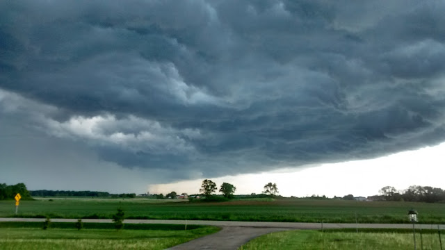
The Dark Nasty Cloud that followed us from Oregon. 

Into Iowa - Day 9

Wednesday, May 11
When a couple travelers (us for example) travel from west to east across the continental United States, one runs the risk of getting under a nasty dark cloud and then following it all the way to your destination. Weather generally moves from west to east too. It's just the way it is.

Much quieter morning after the fireworks last night. Continued on US-30 into Iowa, crossing the Missouri River between Blair NE and Missouri Valley IA. Mostly cloudy all day today... that dark cloud mentioned in the preceding paragraph.

Just east of Ames, picked up US-65 north to US-20 east. Not much to report about the drive today. It is Iowa after all. Oh... we did stop in Carroll IA for lunch at a Culvers.

We have some friends who live in Cedar Falls IA so we thought that'd be a good place to stop for the night. Weather was still "iffy" (that same cloud) so a motel seemed like the right choice once again. Attempts to reach our friends were eventually rewarded with a return call. They had just gotten off a cruise ship to some exotic destination and wouldn't be home for a few more days. I treated my sweetie to dinner at the truckstop next door to the motel, which had an incredible selection of pre-made sandwiches and roller dogs and even more. Then settled into our motel bed and fell fast asleep... by 8pm.  High living indeed.

Through Nebraska, Stormy Night - Day 8

Tuesday, May 10
A nice quiet morning, partly sunny. No wind. A long day today as we follow US-30 east, through North Platte, Lexington, Kearney, and Grand Island. The temperature was climbing as the day wore on, and could only be described as "hot" when we stopped in Central City for an ice cream cone. A little further on, near Columbus, we checked out some possible camps, none of which was agreeable to us. Tired, hot, a dearth of camping possibilities, and increasingly threatening weather prompted us to "call an audible" and check into a Days Inn on the east side of Columbus.

Weather continued to deteriorate, heavy weather warnings were issued, and between watching out the window and keeping an eye on the weather radar we entertained ourselves until things settled down late in the evening. Nature provided entertainment is usually preferable to what's on the tube these days. Decided our decision to motel it tonight was the right choice.

Scottsbluff National Monument - Day 7

Monday, May 9
Woke in Scottsbluff at Riverside CG, a very nice city park along the North Platte. The sun was shining and it looked like a good day. We've noticed high water all along the North Platte as we've followed it east, the result of strong snow melt and some heavy rains higher in the hills. But here in Scottsbluff, the water is so high, and rising, that it's predicted to go into flood stage any day now. In all likelihood, Riverside CG will be closed in a day or two until the river subsides.

Just across the river to the south is Scotts Bluff National Monument. Serving as a landmark for thousands of years for early Americans, and then for emigrants as they walked to new lives in the West, this series of tall sandstone bluffs dominates the surrounding flat land. Mitchell Pass on the Old Oregon Trail runs directly between Scotts Bluff to the north and South Bluff to the south. A trail follows this historic route through the pass. It's possible for smaller vehicles to drive to the top of Scotts Bluff, which we certainly did, for hiking and great views of the surrounding prairie.

Another similar stop is a few miles to the east at the historic Chimney Rock... another emigrant landmark. We didn't hike out to the rock itself as it's on private property, but we did stop at the closest point to it for a quick picnic lunch. Another sandstone bluff of note in the area is Courthouse Rock.

Not far down the North Platte from Scottsbluff is Ogallala. Nearby McConaughy Lake, a reservoir just north of town, features a series of campgrounds that we found agreeable. We set up camp at Little Thunder Bay, site 27, for the night. Weather was still a tad threatening, but it looked like it'd hold for the night. Until a late day straggler came in toward evening, we were the only ones here.

Into Nebraska - Day 6

May 8 Sunday
After a quick nearly all carb breakfast, we were on the road again by 9:30. The Baymont motel in Casper was comfortable and preferable for us. Camping in near freezing conditions with the little camper takes some effort and at this point in my life, taking advantage of a motel once in a while is a viable option.

South (east) on I-25 for 90 miles to x92, for US-26. To Guernsey.  Checked out Oregon Trail Ruts Monument and Register Wall -- two places where real evidence remains from the passage of the emigrants. Quite impressive.

Continued down to Fort Laramie (the town) and stopped at Fort Laramie (the fort). During our visit there the sky darkened and a huge T-storm gathered to the south, eventually chased us out. As we drove east on US-26, I thought we'd outrun it, as radar indicated it was heading north. And we kept outrunning it until we got to Scottsbluff, checked the radar, and it looked like we were out of harms way. But don't get too comfortable, as it kept expanding and eventually made it to Scottsbluff.

Got campsite at Riverfront Park (nice camp hosts Richard and Darlene). Paid $10 for a no-hookup site, parked, took a little walk along the swelled river, and checked out the area facilities. By the time we'd gotten back to the camper the dang storm had found us. It was all I could do to get the chairs inside and get myself inside before the rain, and hail, hit. Rained the rest of the evening.

Checking the forecast, I'm tempted to high-tail it back to Wisconsin. Anywhere I look between here and there it's going to rain, T-storms, wind, and cold for the next few days.

South Pass Wyoming - Day 5

May 7 Saturday
The rain that messed with us yesterday wasn't falling as we left Jackson, but it looked like it could at any minute. We made the quick run down to Hoback Junction south of town, to regain our trail, then made the turn onto route 189/191 which carried us toward the east and south. Initially, the road follows the Hoback River through the spectacular Hoback Canyon. This is the land of the original mountain men. Men like Jim Bridger, Jedediah Smith, and Bill Sublette lived and worked in these mountains during the early 1800s. It was a unique time, sandwiched between discovery and the arrival of emigrants, that lasted about 30 years.

Off to the east and below the threatening clouds were the snow-covered Gros Ventre Mountains; to the west, the Snake River Mountains. Whether a day is clear or cloudy, the mountains are rewarding. I don't know why, but they just do something for me.

On our way south toward Farson there is an interim summit that made us ascend into the low cloud deck. For a few miles and until we descended again, we drove slowly through fog as visibility was very limited. Along through here we crossed the historic Lander Cutoff of the Emigrant Trail. Precipitation was on-again off-again, and with temperatures getting close to the freezing point, becoming various kinds of frozen water. Near Farson, where our path makes a hard left toward the east on WY-28, the sun made a brief appearance.

South Pass is the area where most of the emigrants in the middle 1800s crossed the Continental Divide. It was the easiest route close to available and, oh so necessary, water. The grade is gentle. The Divide is actually hard to discern. As we ascended, sleet and snow started building up on the road, eventually several inches of the stuff that was wet and slick. Several cars and a jack-knifed semi took the easy route into the ditch.

At the summit, there's a pull-off with a short trail, along which are interpretive signs about the pass. We pulled in... based on the lack of other tracks in the 5 inch deep snow, the only ones to recently do so. Since South Pass was my prime objective for this trip, there was simply no way I was going to short-change myself once we're actually here. Dar chose to stay in the truck while I ran around the circuit, stopping at every sign, wiping the thick layer of snow from the sign, snapping a photo of it, and jogging to the next. Jog, wipe, snap, repeat. By the time I was back at the truck, I was wet, hands frozen, shoes soggy, but I was happy I did it. I'm sure, at some point, we'll be back through here. And hopefully, the weather might be more tourist-friendly and we'll be able to spend a little more time.

From the Continental Divide, the road, counter-intuitively, goes UP. Eventually, reaching 8,400 feet before dropping back down toward the east. Driving became easier and we made Casper before deciding to drop anchor. Weather made the decision for us... it'll be another night in a motel.

Jackson Wyoming Overnight - Day 4

May 6
Rained during the night. Woke to an overcast sky and the promise of more precipitation. Broke camp during a lull and rolled out the gate at Craters of the Moon National Monument before 9am.

Uneventful drive to Idaho Falls, where we fueled and filled-in a few desired grocery items at an Albertsons store that was experiencing a widespread electrical and refrigeration problem. All freezers and coolers were wearing sheets of plastic and people were scurrying about trying to solve the problem.

Out of town on Hwy 26. Stopped at Palisades Dam on the Snake for a look see. As we sat there we were hit by a burst of very high wind and heavy driving rain. Waited out the heaviest. But slow going against the storm for a while. At Hoback Junction, due to weather, time of day, slim prospects for resources around South Pass, we decided to go the 20 miles into Jackson and call it a day. Room at Pony Express Motel at corner of WY22 and US26. Beer and lunner at Snake River Brewing. We'd spent some time here last year... really familiarized ourselves with Jackson. Knew our way around pretty good. Our spontaneous visit this year felt like coming home.

Craters of the Moon National Monument - Day 3

May 5
Dawn broke early over our camp at Silver Creek. Unfortunately, we slept through dawn and awoke at the break of, maybe, 8am. A fine morning. From camp, in most directions, there were no physical artifacts or evidence to suggest that anyone had ever been here before. I could see the snow capped Sawtooth Range dominating to the north. There was Silver Creek some 20 feet from the camper, riffling as it rushed by. There were miles of prairie between the two. But nary a structure or road or power line or anything that wasn't natural. From this point, this may have been the same scene I would have seen 100 or 200 years ago. Who knows?

Drove through Carey and made our way to Craters of the Moon NM. A brief stop at the Visitor Center was cut short by a swarm of kids from a local high school. Got campsite then went exploring. A series of short hikes... one to top of a cinder cone, another to a feature called tree molds - where hot lava inundates areas of standing and fallen trees, covers them with hot molten rock which then cools, leaving cavities that are essentially molds of the original trees. Observed lichen... all kinds, colors, and reflected on the similarity to life on this rock called Earth. Is life on earth analogous to lichen covered rocks?  Did a nature trail or two and had a picnic lunch at a trailhead. Overall, a grand day of exploration.


Into Idaho - Day 2

May 4
After a fine sleep at Clyde Holliday State Park, we were up and moving by a little after 9. It's beginning to look like the weather will push us to some degree as a system is forming that's going to turn the whole western USA into a shitstorm for a few days over the weekend. With our motivation thus heightened, moving becomes a higher priority.

We're aiming for the Craters of the Moon National Monument in Idaho. Neither of us have visited this place in the past and it's right along an east/west route segment we've likewise not taken before. So the decision was made to set course, without haste, for CRMO.

The route used US-26 from John Day to Ontario, I-84 through Boise to Mountain Home, then US-20 up and over to Carey ID. A bit bedraggled from the longish 300+ mile drive, we found an agreeable camp along a creek on BLM land about 8 miles south of Carey.

Tomorrow, which the weather gods have predicted will still be mostly sunny and nice, the plan is to explore Craters of the Moon NM. From our camp, it's only a short drive on US-26 between Carey and Arco.

The drive today was a mix of high forested mountains and low agricultural land. The section of US-20 in Idaho was through the high (5,000 feet or so) Camas Prairie, that was known to some emigrants in the mid-1800s as the Goodale Cutoff, an alternative to the Oregon Trail that made travel somewhat easier.

There aren't an overabundance of camping spots through the Camas Prairie. The few we checked out were suffering from one deficiency or another until we snagged this one along Silver Creek south of Carey.

On The Road Again - Day 1

May 3
I love traveling. But I don't love getting ready for travel. The past couple days have been brutal. Putting a camper in mothballs every couple months almost makes one consider just taking the big old beast along instead of parking it. Tempting, at least during times of work related stress. But I know that wouldn't last long either as we've come to like exploring in a smaller rig. OK... end of the negativity.

We made it out of the chute today. Began the trek back to Wisconsin... our homeland. Unfortunately we both have medical check-ups scheduled back there for the week of May15. That gives us barely two weeks to cover 2400 miles. Not a "balls to the walls" cannonball run, but also not the leisurely, month-long, trip of a couple years ago. It is what it is. We'll make it enjoyable.

For the record, we followed the McKenzie River on OR-126 up into the high Cascades, down the backside into Sisters, then over to Redmond and Prineville. Pressing eastward from there on US-26, passed through Mitchell, Dayville, and Mt. Vernon. We made camp for the night at Clyde Holliday State Park. The secret word for the evening is "mosquito".  And no negativity intended. I am positive there were a lot of mosquitoes at our first night's camp.

Enjoying history and geology, we try to stop at historical markers, overlooks, and natural wonders. Today, Good Pasture Covered Bridge is an example. I couldn't stop in time when it came into view, so I did an abrupt U turn and went back to investigate. What a wonder. What a work of art. The bridge clear-spans the wild McKenzie River at 165 feet, which makes it the second longest covered bridge span in Oregon. Built of local timber in the late 1930s, and refurbished somewhat in 1987 (mostly approaches and the intersection with OR-126), it's original massive wooden trusses continue to support anything up to and including logging trucks. This, and examples like it, are a testament to the abilities of people to do amazing things without the aid of computers and large mechanized equipment. This one wins my "man-made wonder of the day" award.

And the "natural wonder of the day" award goes to Sahalie Falls near the headwaters of the McKenzie. With an abundant precipitation Winter behind it, and a near normal snowpack in the high cascades, the stream was flowing strongly today. The 120' falls delighted with volume and drama what it lacks in vertical drop. I don't know... some people get jaded by waterfalls. Some people say "you seen one you seen 'em all". But we both get a real kick out of the majesty and power.

Check back... pictures to follow.

Winter in the Southwest 2016 (part one)

Alright, it’s time to do a post on our Winter in the Southwest. While procrastination has it’s benefits, there comes a point when it’s actually easier to just get the job done. The effort to resist the nagging reminders and the reality that it will have to be done at some point anyway becomes too great to put it off any longer.

But it’s been a nice break from posting.

Overall, our two months in the Southwest was, for the most part, a repeat of the model that was cast during our Winter last year. We spent about half our time at Dar’s Sister’s house, Casa de Cher, and the other half of our time out in the desert in southwest Arizona and southern California. With few exceptions, most of our overnight camps are boondocks on government land.

People ask if we’re concerned about our safety when boondocking. Early in our full-timing life, oh… maybe 8 or 9 years ago, there were some thoughts of concern. We didn’t b-dock a lot back then, but when we did our senses were heightened and our perimeter of concern, our personal “space”, grew quite large. Like maybe a quarter mile or more. We were more watchful than usual and attuned to any sounds that might be out of the ordinary. Like most people, we’re accustomed to being around others and find comfort in numbers… relying on the idea that there are more good folks than nasty ones and the larger number of good ones provide a measure of safety to all. We are social animals after all.

But let’s get real. Let’s think about this for a moment. When is the last time you heard about someone being assaulted while camping on BLM land? I’m sure there are incidents, perhaps fed by alcohol and provoked by unreasonable conflict between people that know each other, but I can’t remember ever hearing about someone being randomly harassed or assaulted by total strangers while b-docking. The reality is that the vast majority of those out on public lands are there for the same reason we are. The short answer is that we don’t think about it any more, preferring to enjoy the peace and solitude of being among the mountains, or next to a stream, or on the desert floor. We may be social animals but we do enjoy… even crave… days of solitude like this.

We do, however, believe that some folks we’ve met have indeed been abducted by aliens and had their minds altered, or in some cases, sucked out altogether. How else can you account for the bizarre beliefs and ideas that seem to emanate from the mouths of some people?

And that get’s me to the larger subject of fear. Almost wherever you turn these days, someone is doing their best to make you fearful of something. Fear sells. Whether it’s that big snowstorm heading your way, the big earthquake that’s due at any minute, your aches and pains, polarized politics, terrorism, product recalls, the quality of our food supply, even much of what’s fed from person to person on facebook and other social media… we’ve learned to be fearful. Fear will make you tune into the newscast. It’ll make you “ask your doctor” about new drugs to alleviate what in reality are normal symptoms of the natural aging process. It’ll get you all ramped-up about those bastards on the other side of your politics. And it’ll make people fearful of being alone in the desert. The best advice I can provide is to live fearlessly. Not foolishly, but fearlessly. The situation is almost never as bad as others tell you it is.

Now that I’ve gotten more than 500 words into this post about our Winter in the Southwest, I suppose I should get to that subject.

Our Winter in residence at Casa de Cher was comfortable and enjoyable… mixing plenty of family “doings” with partaking in the cultural, social, and recreational opportunities of Sun City West.

During our various forays into the desert, we boondocked in more than a dozen spots, each with it’s own unique environment. Hiking and climbing opportunities in every direction. We climbed to interesting looking saddles and peaks… just to do it, and to see what’s on the other side.

While at one boondock in the Saddle Mountain BLM area, early in the morning, Dar became aware of a nearby hot air balloon. The morning stillness was broken by the roar of a big propane burner… a good sign there’s a ballooner in the neighborhood. But this one wasn’t doing a normal fly-by. Oh no. This one was very low, close to the ground, and very close to the mountain, and appeared to be on a collision course. We watched in anticipation of being called on as rescuers. But the balloon quietly and without incident slid behind a fold, a crease in the mountain… like a boat feeling it’s way through a narrow fjord. But a boat can be steered, the balloon, even with the best pilot, is at the whim of the wind.

So this ballooner, somewhere on the risk continuum between gutsy and crazy, slid the bag of hot air through a crack that couldn’t have much wider than the balloon itself. We lost sight of it and prepared ourselves for the inevitable rescue mission. Tense moments turned into minutes. Probability was closer to certainty as the clock turned the future into the past.

Balloon got our attention. Very low, moving from left to right.

Starting to slip through a crease in the mountain.

Almost out of sight. We were preparing to mount a rescue operation.


But then, maybe 10 or 15 minutes later, it reappeared over a saddle between two shorter peaks of the complex. That must have been some impressive ride. Pictures attached.

Apparently unscathed, re-appears a few minutes later.


(To be continued…)

January Trek to the Southwest

During our fulltiming years, we’ve tended to gravitate southward during the core of Winter. For a few years we found a cold-weather home along the Gulf Coast of Texas, but with the evolving transition of our homebase to the Pacific Northwest, we’ve recently found the Southwest more to our liking, and certainly easier to get to. And so it is that this Winter again, we’re heading off to Arizona for a couple months. After a dreary month or two in the PNW, a little sunshine and warm-ish weather works magic on the spirits and emotions of a nomadic traveler.

With preparations more or less completed (at last), we were finally underway about 9:30 Sunday the 10th. I passionately like travel, but the preparations drive me crazy. I’d love to just toss a quick bag in the truck and go… head out on the road. But Dar keeps reminding me that it might be good to have a few supplies, a little food, some gear. You know, a few things that our survival might depend on?

Screenshot 2016-01-15 at 2.03.00 AM.png


I was really looking forward to the route. I-5 to CA-89 on the south side of Mt. Shasta, CA-44 at Old Station to CA-36 which took us into Susanville. Just outside of Susanville we picked up US-395 which was the centerpiece of the trip south this time. 395 is a north/south route that hugs the back side of the Sierra Nevada Range along the eastern border of California. At Kramer Junction we take CA-58 over to I-40, then AZ-95 through Lake Havasu City and the Parker Strip to AZ-72 to and through Bouse and down to I-10 and into Phoenix. Took the 303 up the west side to Sun City West. According to Google, total driving time and mileage should be about 20 hours and 1200 miles.

And it also looked like the weather was going to cooperate with our plans… a veritable hole in this year’s “El Ninõ” storm, as it were.

CA-89 on south side of Mt. Shasta

The first night we spent at a Courtyard by Marriott on the southern edge of Carson City. It was over our usual budget by we splurged because it was after sunset, I was done driving, and because every once in awhile you just gotta treat yourself. The joint was certainly not busy (Sunday night, January) but they did have alcohol and some food. Don’t normally pay $12 for a glass of wine… but we did. And it was actually a wine that was almost worth that, some version of Estancia. Enjoyed it a lot. Also split an expensive sandwich and soup.

The second night we stopped in Lone Pine, literally in the shadow of Mt. Whitney, tallest peak in the lower 48 at an elevation of 14,505. Stayed at a Best Western… the Frontier Motor Inn if I remember correctly. The front desk of the motel directed us to The Grill, what they claimed was the best bet for a good meal in the little town of 2000. After a quick perusal of the famed Alabama Hills movie set area west of town, we did stop for dinner at The Grill and had an exceptional time with the waiter, Bobby. He’s an older… ah, mature… gent who I thought was the owner. No, not the owner… just loved his job. We were early enough to be the first patrons of the evening. He saw us walking to the front door from the parking lot and had our table completely set, including waters, by the time we passed through the door. Both the company and the food was very agreeable. He must have enjoyed our banter too as he topped off our by-the-glass wines with nearly a second glass… no charge. Considering it’s a Monday, in January, in a very small town, I was impressed with the steady flow of customers through the restaurant. No doubt it was the happenin’ place in Lone Pine.

The third night we stayed in a previously visited desert boondock spot near the junction of I-40 and AZ-95. Turned off at the next exit to the east, and drove a mile or so south out into the desert. We had been here a few years ago while visiting the Lake Havasu area looking for boondock areas for future reference. This one was definitely NOT motorhome accessible, but was “easy-as-pie” for an F-350 and little camper. Got there early enough in the afternoon to soak up some sun, but no effort was made for a campfire. Not another person for almost as far as we could see. By morning the temperature was near freezing, but we had slept well.


Notable observations and happenings along the way:

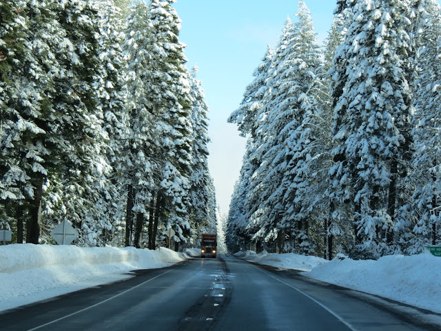
The “winter wonderland” drive through the Shasta National Forest. The day was windless and bright clear blue sky made for a wondrous scene. Recent snow filled the boughs of pine trees to capacity, which randomly surrendered and dumped their snow load in a mini-blizzard, much to our delight. Even in Wisconsin, winter days like this were rare.

Gas prices in California, especially along 395 and out near the Mojave Desert, were just stunningly high. With per gallon prices hovering near $2.20 in Oregon and under $2.00 in Phoenix, this area in between was selling the same stuff for between $3.00 and $3.79.

During our trek, the Powerball Lottery jackpot was over one billion dollars… highest ever. The Wednesday night drawing produced three winners who will share the $1.6 billion jackpot. The furor did motivate us to contribute $4 for two nearly impossible chances. A few bucks for a fantasy, is how I look at it.

The drive on Hwy 395 between Carson City and Lone Pine was better than hoped for. Once again, we lucked out with about the best weather conditions a traveler could ask for. With a coating of winter snow, the Sierras are just spectacular. This was the reason we drove this route. This was what we came to see.

At one point, Dar encouraged me to turn around and go back to a small parking area at Mono Lake. She had a picnic in mind and it was a good idea. The asphalt parking lot was still coated with an intermittent layer of snow and ice which mostly kept other travelers from intruding. An enjoyable break in a scenic drive.


Nearly constant sun during the day is such a contrast to the nearly constant gloom that can be the PNW during winter. More than warmth, old Sol is what I crave during the winter in the Southwest. This winter, a strong Ninõ has resulted in a rather wet Southwest, and a somewhat cooler period as well. We’re hoping for a moderation of that effect.

We also made a quick stop in Barstow at the historic Harvey House, also known as CASA DEL DESIERTO. Another in a series of handsome railroad terminals along the old Sante Fe main line, it’s currently a community multi-use facility. The main level has two large rooms that were dedicated to food service… one more formal dining room and the other a huge lunch counter that could seat more than 50 people at once. While not as architecturally significant as La Posada in Winslow, it’s another glimpse into the elegant history or rail travel in the early 20th century.

Here are a few more shots from our trek.

Dar spotted this unique form in the rocks near Lone Pine
and zoomed in on it.

Historic Rt66 - Now just a rough Museum piece.

The Harvey House in Barstow

First Desert Boondock of the Winter

A Minimalist

A Minimalist A blog post I've recently been involved with helping to clear out the living spaces of someone who died. These are a few of...

Slightly Better than Most