Showing posts with label Washington. Show all posts

Wisconsin to Oregon, 2016

Between September 11 and September 27 we traveled between Wisconsin and Oregon. For those unfamiliar with our travel and living pattern, we consider Wisconsin our summer homebase, and Oregon is becoming our rest-of-the-year homebase. So for the past few years we’ve worn a pretty good path between the Midwest and the Northwest. It’s the journey, not the destination, that we focus on… so we look for new routes between here and there. And, as shunpikers, we prefer trading Interstate highways for more sedate state and county roads.

The general route for the first part of the trip this year, oh, roughly between Wisconsin and Montana, is to follow US-12. We did depart from this plan at times, but that was the basic path. The back-half of the trip was still unplanned, except for my desire to do the Beartooth Highway again.

In Wisconsin on sideroads and backroads, we followed WI-33 up and through the Kickapoo River Valley in Western Wisconsin. Stopped for lunch in Wonewoc where we found the local Lions Club had big grills set up on Main Street and were offering lunch as a fund raiser. Think I had an entire half chicken with all the fixin’s… way more than I should have eaten. In Cashton, we got involved in a parade of some sort that slowed our progress. Then, just outside of Cashton, found our road to LaCrosse was closed due to some construction, and the detour was long. Crossed the Mississippi between LaCrosse and LaCrescent, and then up to our old neighborhood in Burnsville MN. where we overnighted at the home of good friend Jim.

Blue pins are camps; Red pin is motel

There it is... over 7 feet high... all twine. Why? 
Highlights of the drive through Minnesota and South Dakota included seeing the worlds largest ball of twine and an incongruous petrified wood sculpture park in Lemmon SD. Strange as it seems folks flock in huge numbers to Yellowstone and the Grand Canyon but, for some reason, don’t bother with peculiarities like twine balls and wood turned into stone. Hard to explain. We later found out we inadvertently drove right by the world’s largest hairball in Webster SD. Dang.

Between Miles City and Billings in Montanta we stopped again at Pompey’s Pillar, a must-see if you’re a history buff and a fan of the Lewis and Clark Corps of Discovery. We’ve been here before but we have found repeats can be as enriching the second (or third) time. The significance of a place can be more firmly embedded in your mind with repetition. And there are some of us who just forget. An excellent ranger-guided walkabout and discussion made this stop notable.

During this trip west I estimate we were on Interstate Highways for just 350 miles (out of 2500 or so). A big chunk of that was between Miles City and Billings… about 150 miles. I can’t stress the pleasure of getting off Interstates enough. Just so much more rewarding and relaxing.

Just outside Billings we picked up US-212. The Beartooth Highway and Beartooth Pass is between Red Lodge MT and Cooke City MT… one of the most spectacular drives in the USA. We stayed at a campground near Red Lodge for two reasons: first, to give Red Lodge Ales brewpub a second chance after our less-than-agreeable stop the last time we were here. And second, to position ourselves for a morning start on the Beartooth… with the sun on our backs. For the record, Red Lodge Ales redeemed themselves in our book.

The next morning we headed “up the hill”. And we lucked out with just about the most perfect day to do it. I’m serious when I say it’s almost impossible to adequately describe that drive on a perfect day. It’s just got to be experienced.

Wildlife jam in Yellowstone.
US-212 dumps travelers into Yellowstone NP at the northeast entrance. We were merely transiting through the park in order to meet up with good friends Doug and Kay near West Yellowstone. Shocked at the number of visitors still in the Park this late in September, and the traffic was snarled continually as we moved from one wildlife sighting blockage to the next. Took hours to get through to the west entrance and West Yellowstone. One 12 mile long section alone took an hour. Laid low for the next two nights enjoying good weather and the company of friends.

Then up to Bozeman for a quick dinner with professor Bill at MSU. US-191 runs between West Yellowstone and Bozeman, following the Gallatin River. I’ve written about this before, but we have a special place along this road we like to visit each time. It’s a gravel pull-off between the road and river where we stopped for breakfast, just the two of us, before kids, way back in 1974. The memory is of sitting on top a large rock in the river, munching a bowl of cherios. Somewhere we have some pics from that stop, but haven’t found them yet. That rock out in the river is really, for us, a monument to our relationship and we just have to stop by every once in a while. Ya know?

"our" rock is the big one behind Dar. 

After Bozeman we point the nose westward again. In keeping with our shunpiking theme, we took some backroads and sideroads through Wise River, Wisdom, stopping at Big Hole National Battlefield, the location of a sad tragic battle between the US Army and the Nez Perce Indians as they were attempting to relocate to Canada during the brief Nez Perce War. Very moving and puts a different perspective on history. Just west of the battlefield, up Joseph Creek, we crossed Chief Joseph Pass, and eventually down the Bitteroot Valley to Missoula. Stayed in a motel that night, our only motel of the trip.

From Missoula followed the Clark Fork River to Sandpoint and Ponderay in the Idaho panhandle. Stayed at a favorite campground on the lake... Riley Creek COE.  We were both feeling a tad poorly the past couple days and denial wasn’t making it any better. Our original plan to see the kids in Washington on our way to homebase Sutherlin was scrapped and we headed south from here. Don’t want to show up and infect the grandkids… not the kind of thing good grandparents should do. Right?

So, after two nights at Riley Creek, we altered course to the south, through Lewiston and Clarkson to WA-129 south -- Rattlesnake Highway. We’d not heard about this road before… really just stumbled on it. But what a find. I’ll let the pictures do the describing. One doesn’t want to be in a hurry on this road, nor would I advise texting while driving. Briefly, it’s a canyon cut by Rattlesnake Creek, with a road stuck on the side of the canyon walls.

Click to expand. Wherever you see road, it's the road we're on.

The last night.
We’re back in Oregon again. Enterprise, Wallowa, Minam, and LaGrande. After another short chunk of Interstate, Starkey, Ukiah, Long Creek, and Mt. Vernon. Stayed two nights at Clyde Holliday State Park, soaking up sun and feelin’ good.  We did spend one more night out, at Crane Prairie Lake down in the Cascade Lakes area southwest of Bend. A fitting last night out, with great views of Mt. Bachelor, Broken Top, and the Three Sisters… all while watching a group of mule deer playing, socializing, lunching… right along the lakeshore in front of our campsite.  The following morning we wrapped up our trip by crossing the Cascades on OR-138, having lunch at the Steamboat Inn, and following the North Umpqua river home.

16 nights, about 2600 miles, some familiar things, some new. Perhaps a little faster than we’d ideally prefer. But it’s good to be home.

A few more pics...
Along the Beartooth

Along the Beartooth

Clyde Holliday State Park in Oregon

Believe it or not... the only petrified wood park in South Dakota.


Red Lodge Ales

Late Fall Mountain Tour


Mt St. Helens pre-eruption
Once upon a time, way back in the twentieth century, a work assignment caused me to drag our little family from the Upper Midwest out to the Pacific Northwest. Family and friends left behind weren’t real sure what to make of us. Why would they move way out there? Have they lost their minds? Don’t they realize Oregon and Washington are populated by drug-using hippies and weird folks that just don’t fit in anywhere else? Ok, there were enough semi-normal people to make some jet airliners up in Seattle, but everyone else is just plain strange. Maybe, after a few months, they’ll come to their senses and come back to Wisconsin.

It felt like raw adventure. I’ll never forget my first close-up view of a snow-capped Mt. Hood as the plane skirted its flanks on the long final into Portland. I was mesmerized. It was the embodiment of a rugged pioneer spirit, the raw power of crashing landmasses, and a reminder of the impermanence of the status quo. In some small way we were following the Lewis and Clark Corps of Discovery. I was changed.

Once a year or so, during that span of 8 years out here, Dar and I would load the kids into the family station wagon and head for Mt. St. Helens, about 40 miles north of our home in Vancouver Washington. The first time was about 7 or 8 years after the mountain de-topped itself in 1980. Windy Ridge was usually our destination, an area on the north-northeast side of the mountain, directly adjacent to Spirit Lake, the closest easy access point for urban explorers like us.

During the 1980 eruption, a massive landslide and the resulting lateral blast were directed northward, toward Spirit Lake and Windy Ridge. It blew off the top 1300 feet of the mountain and created a 2000 feet deep divot down through the core of the mountain. With all that pent-up energy suddenly set free, the blast moved across the landscape at more than 300 mph with temperatures that exceeded 700f degrees… killing 57 people who were unlucky enough to be in the area. It literally sterilized the ground to the point that nothing grew on this baked soil for years afterward. To reinforce the sense of lifelessness, the landscape of white-ish gray ash was also littered with lightweight light-colored rocks called pumice. The foamy air-filled rocks are so light they will float on water. A “fallout” produced during the eruption, pumice is created when superheated lava is quickly depressurized and cooled, and then carried out of the volcano by the blast.

Through a series of these visits during our 8 years out here we witnessed the land slowly, very slowly, coming back to life. Our first visits revealed no sign of anything growing, not even the smallest weeds. And this was 7 or 8 years after the eruption. But a few years later a few small tenacious snippets of green started to pop up through cracks in the baked crust.

Life was returning.

==========

In October, from the 15th through the 20th, we took a few days between grandkid childcare duties to take a closer “peek” at a couple peaks of the northern Cascades. But rather than explore the western slopes of our two targets, Mt. St. Helens and Mt. Rainier, (the slopes in easy view of the traveling masses on busy I-5 between Portland and Seattle… well, when visibility permits... which isn't often this time of year… but I digress), we thought we’d do the lesser-explored eastern sides. The normally “iffy” late Fall PNW weather was predicted to be nice for a couple days, so we hit the road before that could change. We had about 5 or 6 days before we’re due at our son and DILs home in the Seattle area.

Day One

Under mostly sunny skies, we started in Woodland WA and drove eastward along the Lewis River on the eponymous road. The drive from Woodland through Cougar and on up to Windy Ridge in the Mt. St. Helens National Volcanic Monument is close to 100 miles, but it’s slow going. With the curves and slow-going, a traveler should plan for at least three, maybe more like four, hours. But the good weather and the lack of traffic on this weekday made for easy and enjoyable traveling. About the last third of the drive is on Forest Road 25, which is paved but not in the best condition.

Mt. St. Helens behind us
We found the intersecting road that goes into the National Monument toward Windy Ridge. For the first couple miles, memories of our family visits nearly 30 years ago were kindled. Things hadn’t changed much. The eruption had minimal impact at this point in the drive and adding 30 years to already very large trees just made them a little very larger. But after a few more miles, we entered the blast area and now I’m paying attention -- looking for change. You can imagine, if you try, how the blast raced over the ridges and hills here… creating devastation on some slopes and leaving others, in the lee of the blast, virtually unchanged. But the further into the Monument one goes the more complete the devastation is. And still is. Even after 35 years. I was anticipating more growth, more life, to contrast with my memories from my last visit. Don’t get me wrong. Life is returning. It’s just not as much as I was thinking I’d see. The ground was so utterly cooked that even after 35 years of seeds floating around and finding cracks in the soil in which to embed… after 35 years of growth promoting rain and sun… there’s still a long way to go.

We drove to the parking area next to Spirit Lake… the same one we had taken the kids to all those years ago… and hiked around the area. An overlook perched atop a hill, 368 steps above the parking area, provides a wonderful overview of the area and the hollowed-out mountain just 4 miles away. From this vantage point you can see inside the crater, through the eruption created breach on the north side, where the new growing volcanic dome inside the crater is visible… the plug that will one day blow away with the next eruption.

Forest Road 99
Wanting to retrace our route during one of our earlier visits, we took the less traveled Forest Road 99 northward. When things settled down after the eruption, sometime around 1985, somebody decided to spend some money on roads and facilities to handle the influx of anticipated visitors.

What’s interesting about this road is that it traverses a complete range of devastation from complete to nearly nothing at all. It’s a primitive road, only one lane wide in most places, with spaced wider spots to facilitate passing other vehicles from either direction. Well, they decided to completely re-pave this road with top grade quality asphalt. They also put money into very stately rock and mortar masonry monuments/signs to demark the border of the new National Volcanic Monument as well as a large state-of-the-art wayside park at Ryan Lake.

Well, it’s all slipping away. It’s neglected, not maintained, and rapidly deteriorating. It doesn’t appear they’ve spent a dime on it in the ensuing 30 years.. The nice asphalt road is being undercut by water in many places… and has actually washed away in a few. At least someone dumped a load of gravel into the gaping holes to keep the road open. Only the basic structure of the stately monument/sign remains… and that is leaning at a precarious angle in preparation for washout, collapse, and a slide downhill any year now. The state-of-the-art wayside park is similarly neglected. We felt like we were getting an early preview of the ruins from the once-great American Civilization. Our best guess as to the reason for the condition of the Monument over here is that resources and energy have been diverted to the Johnson Ridge Observatory over on the other side of Spirit Lake. This new facility is closer to civilization, and caters to travelers on I-5. I guess, from a bang for the buck standpoint, it does make some sense.

During our time on and along Forest Road 99, we didn’t see another person. Not one. The night we spent boondocked at the Ryan Lake wayside was one of the quietest and darkest nights we’ve ever experienced.

Day Two

The next morning we broke camp and headed north again to the junction of Road 99 and Road 24, which then heads on into Randall WA. The northern end of 99 looked even more neglected than the southern end… if that was possible. It was along in here that we did actually see another person, the one and only during those two days, a very surprised and wide-eyed fellow in a small pickup going south. I believe he was as surprised as we were.

We drove to the town of Randall, on US-12, and then eastward through Packwood. A few miles further US-12 takes a bend to the east but we took WA-123 to the north and into Mt. Rainier National Park. Since National Parks pretty much close up by this time of the year (budget cuts, idiot politicians, misplaced priorities…) there was no discernable official presence of any park staff whatsoever. I don’t know where they all go in the Fall and Winter… but there wasn’t anyone here this day.

Climb through Stevens Canyon to Paradise
The drive up to Paradise from the east side gate is spectacular. The road follows Stevens Creek, a stream descending the flanks of Rainier and a tributary of the Cowlitz. This little stream, not so little today as a result of recent heavy rains, has cut a significant canyon over the years. Stevens Canyon reminded us of the many similar canyons we drove through during our Alaska trip his past summer. And with the bright autumn blue sky, the Stevens Canyon drive was a real “trip” to remember.

Paradise Visitor Center - Closed
At Paradise, the parking lot was nearly full. Nice weather in Fall, especially in the PNW where people know what’s coming, is something to be savored. But despite the crowd, there was not one Park official to be found. I think it was a Friday and this time of the year the large Visitor Center is only open on the weekends… so it was locked up. The large Paradise Inn Hotel was likewise closed… only a handful of workers sealing it up for the Winter. There was one toilet facility that was open (thankfully), but that was it. Despite all these folks paying taxes and supporting the National Parks, and wanting to enjoy a great October day at a National Park, there’s no money to keep facilities or people on staff. We’d rather buy bombs and war machinery than spend a little on National Parks in the Fall. It’s amazing how many people are hoodwinked by career politicians into being fearful and going along with this bullshit. End of mini-rant.

We decided to hike “up the hill” a ways to see what we could see. Took Skyline Trail up to Glacier Vista at about 6400 feet of elevation. The glacier we’re closest to here is the Nisqually glacier, and the highest part of Rainier is right there in front of you… soaring another 8,000 feet into the bright blue sky… just a couple miles away. The clear air and unlimited visibility provided a rare visual treat.

Not being acclimated to 6000 feet of elevation, the vertical component of our hike was a good workout and a bit of a challenge. Felt good though.

Our camp on Summit Creek
With daylight growing short, we retreated back down the hill to the east in search of a camp for the night. The resources we had pointed to a small NFS campground off US-12 and a few miles further down a dirt road. Summit Creek Campground was a weird little facility. Perhaps 5 or 6 campsites… about as rustic as a drive-in campground could be. No other campers. Neglected, but with a stocked pit toilet. Difficult maneuvering, even for our 4WD pickup truck. We selected the most level site which still wasn’t very level. We’re in dense forest, the weather had turned cloudy and colder, and night was falling. Good night.

Day Three

Over coffee, decided to explore along US-12 to the east, the White Pass summit area, and Rimrock Lake. Stopped for lunch at a cafe at White Pass, where we perused a logbook of thru-hikers on the Pacific Crest Trail. I’m impressed with the number of people that use that trail. Long distance hiking like that is attractive to me in some ways, but I don’t feel enough passion for it at this point in my life to take steps to actually do it. And that makes me sad. We make our choices, life goes on, and the world continues to turn.

Slopes decorated with Larch trees - the only Coniferous
tree that loses it's needles every year.

Rimrock Lake is a large impoundment of the Tieton River that provides water for agriculture and communities on the east side of the Cascades… the largest being Yakima. We drove the loop around the south side of the Lake and checked out (and noted) a few campgrounds and boondocking areas.

Continued on US-12 all the way thru Naches and to the edges of Yakima before turning around and going back to a NFS CG along the Tieton River called Windy Point. We picked a primo site along the river and set up camp.

Day Four

Inclement weather kept us in camp all day. A nice break in our excursion.

Day Five

Mountain Goat
Drove east again on US-12 to the junction with WA-410, which we took northwestward toward Chinook Pass. Another nice day kept us busy absorbing sensory inputs from the environment. WA-410, which follows the Naches River and then the American River to the summit of Chinook Pass and back to the west side of the Cascades. This is not an all season road. It’s closed in the Winter through the highest portion over the pass. During the Winter, there are only 4 routes through the Cascades in the State of Washington: US-2 (Stevens Pass), I-90 (Snoqualmie Pass), US-12 (White Pass, which we visited a couple days ago), and WA-14 along the Columbia River. The resulting sense of isolation is something savored by true “west side” Northwesters.

A peek at Rainier from Sunrise
Our goal for the day was the Sunrise area of Mt. Rainier National Park. That’s right, we’re going back into the Park. Paradise isn’t the only destination close to the mountain, the other is Sunrise on the northeast side of the peak. Of course, there won’t be anything open up there, but we’d like to drive up and see what we can. The closer we got to the pass and the mountain, it became clear that the peak was occluded by clouds, not a solid deck of clouds, but enough to keep it mostly hidden.

So it was over the pass, down the hill a ways to White River Road, and back up toward Sunrise. There were fewer people at the top than I’ve got fingers on my left hand, and the cool temps and wind kept us inside the truck cab for our planned picnic lunch. But for a few minutes, the clouds parted and treated us to a good view of the mountain from this side. A very enjoyable time.

Along WA-410 east of Chinook Pass
So now what? Time to think about a camp for the night. Our resources didn’t show many prospects further down the hill and toward the Seattle metro area. We ultimately decided to backtrack again… go back over Chinook Pass… to another NFS CG we checked out earlier in the day. Sawmill Flat CG was open and completely vacant, so we had the run of the place. We picked another pleasant site along the Naches River and settled in for the night.

Day Six

We started the day not sure if this would be the final day of our excursion or if we’d find another camp further down the hill for one more night. For the third time we drove over Chinook Pass and continued toward the Metro area. Didn’t find a camp for the night but did find a very good time at the Historic Mint Restaurant and Alehouse… lunch and good craft beer over which we reviewed the past few days.

Time to shift gears from explorers to grandchild care.

Oct 6 - Back at Home in Sutherlin

Along the Columbia, s. of the Walulla Gap
We left Cabelas in Post Falls ID without dropping a dime in the store. I know... that doesn't show much gratitude for the free RV parking they offer, but over the years I've spent a lot of bucks with this good company. They probably didn't even notice.

The drive into the Portland area on Friday, the 3rd, was the best of the 5 drives this trip. The route was I-90 to US-395 to the Pasco - Kennewick (Tri-Cities) area where we caught US-12 as it bends around to the east side, across the Snake River and along the Columbia, and down through what's called the Wallula Gap. This narrow opening in the high surrounding rocky hills is what plugged up with ice during the last glacial retreat, creating a giant lake that spread across eastern Washington and into western Montana. When the ice dam let loose... as it did numerous times, the biblical flood of water was so great... of such a proportion... that it literally carved out what we now see as the Columbia River Gorge. Yes, the Wallula Gap is certainly a place to see.

When we reached Umatilla OR, we crossed back over to the Washington side of the river, and took WA-14 the rest of the way into the Portland area. Most people go through the Gorge on the Oregon side, on I-84. A more relaxed and often more spectacular drive can be had by driving down the WA side on 14. That day, the sun was bright, the wind light, and the views?... well,... just the best.

We arrived at our daughter and SIL's place mid-afternoon. The first order of business was hugging the grandkids... and then on to unloading the trailer. Much of what we brought was staying right there. Then, good time catching up with everyone, dinner at a new Chinese restaurant, and more talking until some of us were getting a bit "noddy". Sleep came easily and quickly.

If you had peeked through a keyhole Saturday morning you would have seen 4 people in a queen sized bed. That'd be Dar, 2 grandkids, and me... talking, watching short videos, and horsing around. Of course, we miss these times when we're traveling, but what's that they say about absence?  Something about making the heart grow fonder?

By 11am we were back on the road, heading toward Sutherlin. For the three hour drive we reminisced our trip, talked about the future, and felt good about "going home". There's nothing like the feeling of going home... unless it's the feeling of leaving again on another excursion.

So, how'd the old bushouse make it through the hotter-than-normal Oregon summer? Overall, pretty darned good I'd say. The battery in the car was dead, but the batteries in the bushouse were in tip-top shape... kept that way by the 400 watt solar system. It's a lengthy process to re-commission a camper after returning... especially one in a deep state of mothballs. But system by system, things woke up, fired up, filled up, and lit up. She did good.

Some may remember we caught a mouse a day before leaving last June in one of my always set "tell-tale" mouse traps. This could have been a sign of trouble and we did fear what we'd find when returning. But ultimately there was nothing to worry about. Not a single varmint in any of the dozen or so traps we set. Clean as a whistle.

The past day or two we've also been slowly unpacking and cleaning and doing laundry and reconnecting with friends around the Park.

It's good to be home.

But I can't wait to leave again.


Home

June 14 - We're on the Road Again

Portland area to Wildcat Creek CG near Prineville OR
180 miles

Today marks the beginning of what we’ve been calling Sabbatical II. For us that term, “Sabbatical II” was meaningful as a demarker of the difference between our travels and explorations with the bushouse over the last 7 years, and this new travel style with the small camper as we move into the future. It served a purpose for us as we living “Sabbatical I” but were planning for “Sabbatical II”.

However, now that we’re more or less underway, I hope the use of that term fades away. Dar and I are still just plain old “on Sabbatical”... we’re just doing it a slightly different way. In the future we may well have other rigs or contraptions we use to see and do what we want, but it’s all going to be just an extension of what we started 7 years ago next month.

This past Friday was our Grandson Ryan’s birthday so we made sure our plans for heading back to Wisconsin included stopping in Camas to help him celebrate. It was a big day that included an hour or two at one of those warehouses filled with trampolines that kids really dig, dinner at the Spaghetti Factory (his choice, and a favorite I might add), and a small intimate party before turning in for the night. We enjoyed it immensely and were happy we could be there.

Today, Saturday, we got the show on the road about Noon. Route today was out I-84 to a convenient slip through Gresham traffic (busy) to US-26 east, also called the Mt. Hood Highway. Interestingly, something called the Mt. Hood Expressway or Freeway was on the drawing boards back in the 60s and 70s, envisioned as an Interstate-standard route (four lanes and all) that went east out of the Portland area to (and over?) Mt. Hood. It was eventually killed -- but not before about 10 miles of it was built. Those few miles of Interstate-like roadway are still there, having been incorporated into US-26. If you know the story a person can bore their friends with it on the way to the mountain.

US-26 is one of a small number of routes through the Oregon Cascade Mountains. It’s humbling to know that even today there are only a handful, 7 or 8 routes (and some of them are closed in the Winter) that can get you to the “other side”. US-26 carries travelers over the flanks of Mt. Hood, Oregon’s tallest peaks, and down the other side into Ponderosa forests and, eventually, the high desert of eastern Oregon.

Our Noon departure, without having much for breakfast, had us looking for some place for a late lunch as we ascended Mt. Hood. Ended up stopping in a town called Zigzag (no kidding) at the Barlow Road House. Although a little more expensive than we’d like it was time to fill that void.

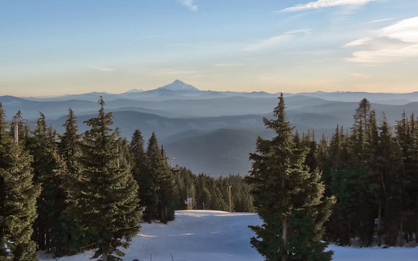
Weather today was cloudy so we never saw the top of Mt. Hood despite being on the side of it. Things cleared somewhat as we descended the eastern side, so a few peaks (Mt. Jefferson most prominently) were visible further south in the Cascade Range. As is normal, the sun asserted itself on the eastern side and there was about an equal mix of sun and clouds the rest of the way.

Just east of Prineville we took a sideroad to the north… which started as asphalt but quickly turned to gravel… and about 10 miles back found the Wildcat Creek Campground, a small NFS facility of about a dozen sites. Even though it was a weekend night we were a little surprised that more than half the sites were occupied. We found a spot we liked right along Wildcat Creek and settled in for our first camp of Sabbatical II.

It turned out to be just what we were looking for. You see, there is no electric power at all to this campground… that means no courtesy or security lights blazing in your window. Cell phones won’t work out here. Water? There’s a well with a manual pump if you run short. Trash? No dumpsters so you gotta pack it out when you leave.

So, how did it go with the little camper? Actually pretty darn good… about like we were hoping it would be. It’s a really small space that requires a bit of choreography and two flexible people… both physically and mentally flexible… to manage everything that needs doing. In regards to traveling, driving, with it… it’s a breeze. We were looking for “nimble” and I think that word best describes what we’ve got.

June 13 - Last Minute Business in the Portland area

Some might think we're hunkered down today because of the Friday the 13th thing, but that would definitely NOT be the case. No, we needed to stop here to drop off some "stuff" that needed to be dropped off here, and, more importantly, we needed to stop here to help our now 9 year old grandson celebrate his birthday. This is a big one because it's the theoretical half-way point to independence for a kid... a milestone perhaps more important to his Mom and Dad than to him right now. Happy Birthday Ryan.

Two things happened in the last day of buttoning up the bushouse down in Sutherlin that gave me pause... and created some degree of concern. First, one of our "always ready" bushouse basement mousetraps decided this would be a great time to catch a mouse. Oh, I guess "catch" isn't the right word... maybe smashed would be closer to accurate. Now?  Why NOW?  Haven't had a mouse in well over a year. In fact, I'd become rather lazy about maintaining my 4 or 5 hidden traps down there since there was literally no activity for so long. How did this little bugger get in? Is there more than one?.. almost always is. Was he (her?) an advanced scout so the whole herd could move in as soon as we moved out for the summer? And I always thought mice look for indoor and protected quarters in Fall as they prepare for a cold Winter. Why would this one invade our space in June for gods sake. In any event I had a dead mouse and a lot of questions.

The last night we were in the bushouse I had set no less than 10 traps (baited with fresh Jif) in strategic locations (you gotta think like a mouse... ya know.) If there was another on board I get it for sure.  We'd taken extra effort to make sure there was no access up hoses or power cords... which would all be disconnected and stowed during the summer anyway. If there's a mouse in there I'm going to get it!

Morning came and all 10 traps were clean. Not a puddle of splashed mouse brains anywhere. And now I'm taking solace in the belief that the one we got was a loner... perhaps an outcast. Please don't try to convince me of any errors in my belief. Thank you.

The second thing that hit us the last day was that one of our credit cards was compromised. This now semi-annual event is making me weary and causing me to carry a couple extra twenty dollar bills around so I can get back to the old days and not have to pull out the plastic for every little thing. The hassles involved with deactivating one account, opening another, getting new cards (made especially difficult when traveling), and updating any autopay or recurring payment accounts with new information is so much fun and entertainment... I almost can't wait till next time. I'd love to say a lot more about this but fear I'll get myself so riled up I won't sleep tonight. (happy thoughts... happy thoughts...)

We're still determined to get rolling tomorrow morning.

Mar 29 - A Few Days in the Seattle Area

We're in the Seattle area for a few days to spend some long overdue time with our son and daughter-in-law... JT and Kaytlyn. Mostly due to my knee-jerk dislike of big cities and congested traffic, we don't get up this way often enough. (Have I mentioned lately how much I like big cities and congestion??)

This super-duo is expecting our third grandchild (their first) in the next couple months. And we "ain't" going anywhere far until that little newborn is here and safe. With the big event drawing closer preparation activity has picked up considerably as boxes of new baby furniture are piling up and the previous "guest room" is being converted into a kids room. But no need to worry about where we'll sleep now that we have a truck camper that can serve as our "mobile apartment". Visiting friends and relatives that don't happen to have a 40' long level bushouse parking pad next to their house has become much easier.

And after a spectacular string of really nice Spring days over the last week or two, we're back to a more normal PNW March pattern. It's important to remember that rain is a key necessary element to the environment of this part of the USA.

Dec 31 - Our Christmas Holiday with Family

We had a good holiday with the kids and grandkids. For the most part, it's been an easy go... plenty of down-time with a party or two thrown in for good measure. Of course, "down-time" may not be the right term. When there are two energized boys on winter break from school around, it's gonzo-frantic around here much of the day.

As a family we haven't been together on Christmas in 7 years, so this one was special. Both kids, their spouses, the two grandkids, and us. It was a very enjoyable gathering... even if I had to sleep on an air bed for two nights.

It's the same every year. Much anticipation, planning, gifting, food preparation, libations, some football... and then it's all over. Just like that. I shake my head wondering what the heck happened.

Yes, we still have tonight... New Years Eve. But neither Dar nor I have ever been big NYE partiers, preferring to transit into the new year in our own quiet way. I mean, there really is no better time to contemplate the absurdity of life, the passage of time, the immense cosmos, and our tiny dust-speck place in it all.

Dec 7 - An Epic Cold Wave

(I'd like to write about something other than the weather, but weather is dominating the news these days... some even going so far as to call it an "epic" event. Besides, I don't have much else to write about.)

The big news around the Pacific Northwest is the unusual cold blast that's descended over the area... not to mention most of the rest of the country. The weather folks say it's unusual for two reasons. First, cold waves of this magnitude don't hit the Northwest every winter... perhaps, to one degree or another, every two or three or four years... maybe longer. Second, this one is notable for it's persistence. It's just hanging around... not moving along like good cold waves should. By the time we're back to a more "normal" pattern the better part of a week will have passed.

And we were there!

In addition to the cold, we woke to a half-inch of snow on Friday. OMG! It must not have been snow... it must have been the sky falling. Schools were closing, cars and trucks littered the shoulders and ditches of roads and highways, travel times were reported in hours instead of minutes. It was crazy. Of course Dar and I could read and hear about it all from the comfort of the bushouse as we had no schedule or place to be that day. For the uninitiated, this is the reason for the trouble: road salt is not used out here. When a light dusting of snow is repeatedly driven on it packs down and turns to a thin layer of ice. Good old fashioned slick ice. Add to the mix drivers that have little experience with (or memory of) winter driving skills. Then, when these drivers are preoccupied with their electronic screen devices, well, it all adds up to some fine entertainment for the rest of us.

Road salt is one of those love/hate things... another big compromise in life. It certainly helps keep roads ice free in winter, but it plays hell with steel parts on cars. You'll find driving is much easier, but you'll have to buy a new car when the old one rusts away in a few years.

Tonight is supposed to be the worst of the cold in the PNW. The predicted low tomorrow morning is in the single digits... 8 or 9 degrees depending on the forecast. While close, it won't be a record for us and the bushouse. We saw 6 degrees one morning in Marathon Texas a few years ago.

How are we doing? Having spent most of our lives in the Midwest (where, even now, it's much colder than here) we're managing just fine. With a good attitude and the right clothes we 're enjoying this "epic" cold wave. We are, however, going through mass quantities of energy keeping everything warm.

Later... Thom

Dec 3 - Cold Snap

When I last wrote in this forsaken and neglected blog we had just arrived in Portland after a marathon week of 400 mile days, headwinds, cold nights, and junk food. In retrospect, it now seems like a quick and painless transit from the Midwest to our someday-soon new homebase in the Northwest. And we're certainly enjoying being close to the Northwest branch of our family - especially during the holidays.

As usually happens when we park and become preoccupied with family affairs, the old blog suffers. And that's just the way it is. Probably isn't going to change anytime soon.

We've been splitting our overnights between the "flat" (our apartment at Gage and Andrea's house) and the bushouse. Having our own more or less set up apartment at their place is a real convenience. Instead of driving back to the bushouse after a long day of chasing after the kids, we can just slip upstairs and climb into bed.

But after six and a half years simple momentum keeps us coming back to the old bushouse. There's a comfortable familiarity about the old 'wheel-estate" that's hard to describe... I mean... it's home, ya' know?

A couple Fridays ago we did take a day, just the two of us, and drove the Gorge - Hood River - Timberline Lodge - Hwy 26 loop around Mt. Hood. I'll do a separate post on that. And we spent the long Thanksgiving weekend with Justin and Kaytlyn at their home in the Seattle area.

Supposed to be cold this week. Some forecasts are predicting lows in the teens and highs barely making it above freezing. So I cut some extra wood for the bushouse fireplace, filled the propane tank and the fresh water tank, and stuck a trouble-light (hot bulb variety) down in the water bay. We dial-down the furnace when we're not staying over there but even if the power goes out, for whatever reason, we should avoid frozen water lines in any case.

The way things look now, we're delaying our train trip back to the Midwest until January. One thing I'm realizing is that life gets more complicated when you have two RVs.

Apr 30 - The Sabbatical Continues...

Grandson Ryan at Multnomah Falls
Just on the off-chance that some readers out there are still tuning in once in a while to see what we're up to and where we're at... well, our Sabbatical adventure travel is soon to begin again. Tomorrow, May 1, Dar and I will be hard at work preparing the bus-house (and ourselves) to hit the road again on Thursday, the 2nd.. The next travel chapter will be about one month long and will take us from the Pacific Northwest to the Midwest and our home State of Wisconsin.

As of this writing we're still in Vancouver, where we've been for the past 6 weeks. Between our daughter and SIL's home here, and our son and DIL's place near Seattle, we've been busier than a couple of orchard bees in Springtime. One of our main objectives was to set up a mini-apartment in the bonus room over at our daughter's place... and that has been completed. It's a comfortable space that we've thoroughly tested by staying there about 10 days in the past month. This is all in preparation for the next phase of our traveling lifestyle... what we're calling Sabbatical II.

So the hiatus from blogging is now officially over and new posts here will once again be coming along at regular intervals.

Mar 19 - End of Winter; Journal on Hiatus

We're in Vancouver Washington. The 180 mile drive up from Sutherlin yesterday, Monday, was good, but we always marvel at the amount of traffic on I-5... even on a Monday when it's presumed many folks are at work. We took on 73 gallons of #2 diesel between Salem and Portland where we found it for $3.999/gallon. I'm told it's good to have the tank as full as possible when parking for a longer period of time in order to keep condensation from forming in the tank. And in a wet climate like the Pacific Northwest, especially in the Spring, they don't get much wetter than this.

The plan is to be here for the next 6 weeks or so. The project jar is full so there won't be much lounging around. We'd like to get a start on outfitting our apartment at our daughter and son-in-laws house... one of the early steps in moving on to Sabbatical II. (My son, the engineer, thinks we really ought to call it "Sabbatical 2.0") We have child care responsibilities on the calendar, including a few overnight (full-time) stints. And there's a number of projects that we'd like to get a start on up in Seattle at our son and daughter-in-laws house too.

And on top of all that we experienced problems with the levelers (the jacks) on the bus-house when we parked in the RV park yesterday. Other than mentioning it, I won't go into detail on this one as it could take up more time and space than I'm willing to give it right now. I will say that we're sorta' level at the current time and there's no emergency that has to be dealt with immediately, but I've got to talk to the manufacturer and some experts before I know how I'm going to proceed. The one good thing is that we're here, in a land with a lot of those resources close-by, instead of out in the middle of the desert and hundreds of miles from anyone who even knows what a leveler does.

Our life in the bus-house consists of alternating periods of travel and "sitting" (being parked in one place for extended periods of time). This post represents the end of our Fall/Winter 2012-2013 travel leg, which started on November 5 when we left our Summer/Fall camp in Wisconsin. If my math is correct, this was the longest period of travel that we've done since we started fulltiming. During those 134 days, we put on a hair more than 5,300 miles, bought 675 gallons of diesel for which we paid about $2,600 (an average of 3.86/gallon), spent about $2,100 for camping and RV parking (an average of about $16/night). So, for fuel and camping, ($4,700/134) we averaged $35 per day. I don't know how that stacks up compared to other folks doing the same thing, but it seems reasonable to us.

During our stay here in Washington, I'm going to put this Journal on hiatus. Don't look for any updates... although I reserve the right to pump out something if I'm motivated. We plan to start the next leg of our travels about May 1 and our regular updates will resume at that time.

Thanks for following along.

June 24 - Goodbye Spokane... Hello Montana

The last couple days have been a blur. Yes, a blur... but an enjoyable blur. It's an overused cliché', but time really does fly by when you're having fun.

Our good friends Jimmy and Julianne... what can I say? They not only made space for us at the property where they're house-sitting this summer... they offered a 15 amp circuit for the bus-house batteries, they fed us, made camp fires for us, had adult beverages available, sparked both thought-provoking conversation and enjoyable nonsense, and had a parade of their friends pop up here and there to spice things up even more. We did a rails-to-trails bike ride and fueled it with the biggest hotdog I've ever seen. We had some alone-time for our work but really enjoyed the together-time around the campfire every night. It was a wonderful visit. Thanks so much you two.  We'll see you somewhere in the Southwest this next winter.

But the journey calls. And we didn't want to wear out our welcome. I think it was Ben Franklin who said that both fish and guests start to smell after three days... and since our allotted time was drawing to a close, we planned to hit the road again this morning... Sunday morning... weather permitting.

I could have predicted it. As a matter of fact, I think I did predict it. About 4:30am a crack of thunder startled me awake... and a downpour followed. Hmmm, travel day... of course.  And the rain continued pretty much continuously until about 9am. The Northwest has been getting more than it's fair share of rain this Spring, and every few days it seems like we've had to adjust for it. (It's especially not fair since the Midwest has been dry as an Arizona desert... a serious shortfall in rain that has everyone concerned.) Checking out the radar and the forecasts... which both suggested conditions might be improving as the day wore on... we decided to pull the plug, fire it up, and go anyway.

So, by about 11am, we had things hooked and humming, hugged good-byes, and got back on the road. The route today was US-2 to Sandpoint ID, ID-200 to the border with Montana where it turned into MT-200, which we took to Trout Creek MT... our camp for the night. Miles for the day?... an easy 134.

The drive today took us around two sides of Lake Pend Oreille (pronounced: pond-o-ray), the fifth deepest lake in the country. It's a big lake, about 150 sq. miles, and is believed to have been formed during the last ice age. A couple years ago, during our trip across the country on US-2, we camped at Riley Creek campground (COE) on the shores of the big lake.

We found this wonderful small RV park in Trout Creek... Trout Creek Motel and RV Park. The owners clearly take pride in their business, as everything is neat, clean, manicured, fresh, and every detail covered.  The RV park is almost like a campground... large long and wide spaces with fire rings, picnic tables, big trees all around, and all of it neat as a pin. As an example of the little things they've covered... I spotted a pair of reading glasses on the check-in counter which I learned were there for the benefit of people who come in to register but forgot their own glasses. The whole place reeks of passion and caring, and we loved it. Oh, it's a Passport America park too... so a great value. By all means, when coming through this part of the country between Missoula and Sandpoint, stay off the big bad Interstate highway... get over onto Highway 200, and stay at the Trout Creek Motel and RV park. You won't be sorry.

Under the category of  "3 seconds of excitement"... I think I saw a moose today. We were a few miles outside of Trout Creek when I saw it... standing right at the edge of the forest alongside the road... more in the trees than in the clearing. It happened so fast I couldn't say anything to get Dar into the game either. My first thought was that it was a horse... but it wasn't a horse. It just wasn't the right place for a horse to be. The animal was very dark and tall legged. It's head was hidden by a low tree limb so I couldn't confirm by means of a distinctive head or antlers... and it didn't move during the few seconds I saw it. I asked the folks at the RV park if moose are around this part of the country, and they confirmed they are. So I'm left with an uncertain sighting... which is still pretty darned exciting.
In a few minutes we're getting things running again and heading for Helena by way of Missoula. It's Montana's turn to have their Capitol visited by these two explorers.

(I'll add photos to this post in the next day or two.  Check back)

June 21 - Over the Cascades... and the Monashees too

Anticipating a big travel day, we had the big wheels turning by 8:10am. Deteriorating weather would catch up with us if we tarried too long and both Dar and I wanted the full effect of white snow-capped peaks against a blue-sky background during the drive today.

At Newhalem we were camped at 500 feet of elevation. There are two passes along WA-20 as we cross the top of the Cascades... Rainy Pass, 4,875' and Washington Pass, 5,476'.  They're about 35 miles down (or is it "up") the road and about 5 miles apart. So I guess we got some climbin' to do!

The bus-house was functioning as it should and made easy work of the task. We ran into patches of snow alongside the road at 3,500' and before we reached either summit it was a complete heavy few-feet-thick snow pack. But the temps were mild, the sun working hard, and water running everywhere... drips to trickles to torrents. And light traffic made being here all the more enjoyable.

On the way down the PAC brake (engine compression brake) got a good workout, keeping everything smooth and under control. Going down mountains without this thing would certainly be more stressful and much slower.

Along the way we passed through the towns of Winthrop and Twisp in the Methow Valley, then back uphill and over Loup Loup Pass (4,020') before dropping again, this time into the Okanogan Valley. Good roads and good weather continued as the route took us northward along the Okanogan River before bending to the east again at Tonasket.

At this point the Cascades were behind us. But another sub-range known as the Monashee Mountains lie between the Cascades and the Rockies, and we've got to climb over them to get to Spokane. The town of Wauconda was followed by our fourth pass of the day, Wauconda Pass (4,310') and some miles later the fifth and lass pass of the day... Sherman Pass.  At 5,575', Sherman is the highest year-round pass in the State of Washington. The road through here is a narrower road than what we experienced over the Cascades, and in most places, there is little or no shoulder at all.

All day long we saw bicyclists who were riding... sweating... pumping... up the same passes we were climbing. These folks have my admiration, but on narrow curvy roads with no shoulders, they seem to be putting themselves at considerable risk. I'm not planning to follow in their tracks... at least on this road... anytime soon.

Down the other side we found the Kettle River, a short river that drops out of Canada and feeds into the Columbia. The Kettle is un-dammed, one of a very few natural flowing rivers in the Northwest. A few miles later we stopped at a Walmart in Colville, WA., to pick up a few supplies and a fill-in prescription for some medication.  At that point we were only a little over an hour away from where our friends Julianne and Jimmy are watching over a property for the summer. A quick phone call confirmed they were there and a great moochdock spot confirmed for the next few nights. (Link to Julianne's website)

For the day, we did a little over 300 miles in about 9 hours, including stops for fuel/lunch and supplies. With all the slower than usual mountain driving, and the fact that we don't drive to set land/speed records, we thought it was an enjoyable and productive day of travel.

[check back... more photos will be added a bit later]

June 20 - North Cascades National Park

This is going to be an unusual report. I'm going to write about North Cascades National Park without our ever actually being there. We were close... made it to the visitor center... camped in the Park Service campground... could see mountains inside the Park boundaries... but never actually stepped a foot inside. You see, there's a several mile wide buffer along WA-20 that is not part of the National Park... I'm guessing an accommodation to the Seattle Light power utility that owns three dams along the Skagit River which the highway follows through the mountains. We consider this two night stop our "survey course" of the place, and fully intend to get back here to explore with more vigor in the future.

The Park's purpose is to preserve the wilderness and to provide back country hiking and backpacking opportunities for the public. It's very remote. Technically, there is one little unpaved road about 10 miles south of camp that takes jeepers to a trail head a couple miles inside the Park. But other than that, there is no vehicle access.

But the views are stunning... towering jagged snow-covered peaks, tall lush green forest, steep vertical rock faces with melt water falling everywhere... literally hundreds of waterfalls. The park contains more than 300 named glaciers tucked among the rugged peaks which, like most glaciers around the world, are shrinking due to warmer global temps. We encountered very few people compared to the frenzy common at other more popular NPs. The roads aren't crowded either and it was easy to feel like we had the place nearly to ourselves.


Today we explored by car along the Skagit River. The aforementioned three dams are Gorge (the lowest), Diablo, and Ross (the highest on the river). Each creates a pool used for electric power generation (for Seattle Light) and, secondarily, recreation. The pool behind Ross Dam is Ross Lake, which stretches 24 miles north of the dam into Canada. In keeping with the remoteness theme of the area, there is only one drive-to access to Ross Lake which involves an epic journey into Canada, hours of travel, long stretches on a gravel road, crossing the border for a second time to get back into the USA... just to launch your boat on the lake near Hozomeen. You can lug a canoe or kayak down steep trails to reach the Lake if you're motivated.

We learned of a floating resort on Ross Lake appropriately named Ross Lake Resort [link] that's rather unique. The only access to it is by boat, as it's built on large cedar logs and floating out in the lake. It's been here for many years, and peaked our interest as a get-away destination where you can really get away. There is no cell phone access, no TV, and only two phone lines used for running the business and for emergencies. The accommodations run from basic to modern... they do have electric power and fresh water.

It's possible to drive across Diablo Dam, and we did. On the other side we found the Diablo Lake Ferry, part of the transportation link to Ross Lake Resort, and the North Cascades Institute and Environmental Learning Center. The day we visited one of the dam spillway gates was completely open and provided some good photo opportunities.

I can't overstate the good feelings we developed for this part of the world. With much of our family being in the Northwest I can see a lot more time will be spent in and around North Cascades National Park.


June 13 - Willy in my Head

The month has evaporated... like a puddle in the desert... and it's time to get back "on the road again".  It certainly doesn't feel like we've been here a full month already, but the calendar doesn't lie. And at the risk of repeating myself for about the 8th time... there's both pain and joy in leaving. It's sooo hard to say good-bye to family... but it's sooo exciting to think about what might be around the next bend or over the next hill as we explore places we've not been before.

The plan at this point is to move up to an RV park not far from JT and Kaytlyn's new home near Kirkland, WA. (Seattle area). We're staying for the weekend and helping them with a couple projects. It'll also give us a little more time with these two. They both work full-time and weekends are about the only time we can really spend good quality time together.

Monday, if the weather gods cooperate, we'll then point the nose of the bus-house east, and start the trek back to Wisconsin. Charting out a new coarse is always our preference, and this time we're hoping to knock off a couple more National Parks and State Capitols along the way. The rough goal is to be in the Cheese State by mid-July.

Goin' places that I've never been.
Seein' things that I may never see again
And I can't wait to get on the road again.

Sep 30 - Portland Area

It's been days since my last post and it's time to update the journal. We're still here in the Portland/Vancouver area visiting family and will be for about another week. Our main focus has been the two hombres (aka the Grandsons) but we're also trying to fit in some visits with friends from the old days. While here we get to attend birthday bashes and other extended-family events and get-togethers.

Then there are the occasional local explorations like the one last weekend where Grandson Ryan and I made an assault on Beacon Rock about a half hour up the Columbia River Gorge. This over 800 foot tall monolith is the hardened lava plug of an ancient volcanic vent... the rest of it eroded away long ago. Named Beacon Rock by the Lewis and Clark Corps of Discovery, it's a landmark of note that's hard for me to ignore. And by the way, both the 6 and 60 year old explorers completed the climb with energy to spare.

The weather is changing too, from the normal quiet dry and sunny period typical of August and September in the Northwest to a wetter colder pattern that portends the winter ahead. There are still some really nice days ahead yet this fall but the inevitable change has clearly begun. One need look no further than the parade of RVs leaving the RV park and nosing south as evidence.

We're still unsure of our path once we fall in line... just haven't taken the time to think much about that yet.


After a successful climb.

Better not mess with this gang!

Roll On, Columbia...

Well, we're here. Firmly "rv-parked" in Portland, just west of the airport on the north side of town... not far from the mighty Columbia River, and a little-longer-than-expected drive to our daughter, son-in-law, and grandkid's home, optimistically a little less than a half hour away.

We got in just after noon yesterday, Friday, after an incredibly scenic drive down the Columbia Gorge. We've done this drive dozens of times during our years living in the Northwest and it still seem fresh and new and full of new discoveries today. Due to high-pressure, heat (mid 90's for a few days), and some wild fires up in the mountains, visibility was a little restricted and the haze made photography less than ideal. But it's just spectacular regardless.

First order of business was to fill the diesel tank. After filling the side of a paper grocery store bag with cipherin' and stickin' my finger in the air for an estimate of wind speed and direction, I took a chance that we could make Portland with the fuel we had on board. Of course, all that figurin' was based on the promise from Newmar and Spartan that the tank actually holds 100 gallons and that all but a few gallons can be pumped into the engine and are actually usable. We normally look for fuel when we start burning into the last half of the tank, but the promise of saving a few bucks (and the challenge of the whole endeavor too) pushed me to roll the dice.

I won't drag this storyline out any further as it's really anticlimactic. We made it, of course, and still had something like 15 gallons on board when we reached the crazy-busy Loves Truckstop in Troutdale, OR. With a full tank (3.929/gallon), we're ready to sit for a month and enjoy family.

The kids? They've grown so! In some ways it seemed like we've only been gone a month or two. In other ways it was like we hadn't been here for 2 years. Reality is somewhere in the middle, but getting reacquainted and hugging and talking and hugging some more makes "today" the only really important time.

We all went out for pizza last night and had a grand time.

============

I've got some catching up and filling in to do, once again, with the Journal. I'm working on a couple posts about our drive over Lolo Pass to Orofino, and the trek into Eastern Washington and along the Wallula Gap.  Photos will be included for no extra charge. Just gotta find the time...
T