The Dreaded "S"-word

We drove a little over 300 miles today, Tuesday.  Ended up in a Walmart parking lot for the night in Havre, MT. Being the tightwad I am, it's just so hard for me to have to pay someone $20 or $30 bucks for camping when all we need is a place to park and sleep for the night. And we sleep very well in our self-contained camper... even in the middle of a big parking lot.

Tomorrow we'd like to make it to the west side of Glacier National Park. We've been really looking forward to seeing Glacier again... it's been 30 years or so.  But... lookout... here's the latest from the Weather Service for Montana....

===================

Winter Weather Advisory

URGENT - WINTER WEATHER MESSAGE
NATIONAL WEATHER SERVICE MISSOULA MT
241 PM MDT TUE AUG 31 2010

...COLD AND MOIST SYSTEM MOVING INTO NORTHWEST MONTANA TONIGHT...

.A STRONG JET WILL BRING PLENTY OF MOISTURE STREAMING INTO
NORTHWEST MONTANA TONIGHT THROUGH WEDNESDAY EVENING. SNOW LEVELS
ARE EXPECTED TO DROP TO AROUND 6500 FEET BY WEDNESDAY MORNING.

MTZ002-043-011100-
/O.NEW.KMSO.WW.Y.0107.100901T0600Z-100902T0600Z/
WEST GLACIER REGION-POTOMAC/SEELEY LAKE REGION-
241 PM MDT TUE AUG 31 2010

...WINTER WEATHER ADVISORY IN EFFECT FROM MIDNIGHT TONIGHT TO
MIDNIGHT MDT WEDNESDAY NIGHT FOR SNOW ABOVE 6500 FEET...

THE NATIONAL WEATHER SERVICE IN MISSOULA HAS ISSUED A WINTER
WEATHER ADVISORY FOR SNOW ABOVE 6500 FEET...
WHICH IS IN EFFECT FROM MIDNIGHT TONIGHT TO MIDNIGHT MDT
WEDNESDAY NIGHT.

* IMPACTS/TIMING: HEAVY PRECIPITATION IS EXPECTED TO DEVELOP LATE
  TONIGHT AND LAST THROUGH WEDNESDAY EVENING ACROSS GLACIER PARK
  INTO THE BOB MARSHALLS. SNOW LEVELS WILL STEADILY FALL TO
  AROUND 6500 FEET BY WEDNESDAY MORNING.

* SNOW ACCUMULATIONS: 1 TO 4 INCHES OF SNOW IS EXPECTED FOR LOGAN
  PASS AND MOUNTAINS ABOVE 6500 FEET.


PRECAUTIONARY/PREPAREDNESS ACTIONS...

A WINTER WEATHER ADVISORY FOR SNOW MEANS THAT PERIODS OF SNOW
WILL CAUSE PRIMARILY TRAVEL DIFFICULTIES. BE PREPARED FOR SNOW
COVERED ROADS AND LIMITED VISIBILITIES...AND USE CAUTION WHILE
DRIVING.
======================
This is still August, isn't it?
T

Tough Night for an IAD Sufferer

I'm back to civilization and everything is OK. Wasn't sure it would end that way though.

During the past few months we've had fairly reliable and consistent Verizon internet access. We (yes, both of us) have come to take it for granted since we use it almost every day. The difference between Dar and me, however, is that she can take it or leave it. If it's working and we have internet, great. If it's not, well, that's OK too. She'll just upload pictures when she finds a connection... read e-mail when she gets around to it. Later this week? Super! Not till next week? That's fine too. She actually relishes being without all this "connectivity".

But me, on the other hand... well most of you know I have IAD -- Internet Addiction Disorder. Despite eating right, drinking orange juice every morning, taking my vitamins... I still have it and I don't think it's possible to ever get rid of it. It may very well be like alcoholism in this regard... if you've got it, you'll never be rid of it. You'll always have to deal with that demon.

When we arrived at the International Peace Garden on Sunday afternoon I was surprised to learn that there was no cell service (at least Verizon service) at all. I figured that with being right on the border, what with both Canadian and US Customs check-points right there, and with the Peace Garden itself, with all the visitors... I just assumed we'd be "connected". Wrong!

Dar told me she thought it was great that there's no cell or internet service here... that it's a "Peace Garden"... peace... P..E..A..C..E... no cell phones going off in the crowd... no teenagers walking around with that head-droop we've all seen as they text each other with words of nothingness. (They even admit it, they're not texting about anything at all... the other day I saw one, bent neck and all, long fingernails clicking out letters as fast as I used to on the big IBM Selectric I learned to type on, and asked her "What are you texting about?" She looked at me, dismissively, and said "Nothing!" See?)

I tossed. I turned. I squirmed, I sweated... and that was before dinner. I fired up the PC and tried to write off-line... but my mind was elsewhere. Unable to focus, I picked up a book (remember those?). No use. I'll just call someone... Oh, maybe not! After a while, I just sat and stared off into the distance. At what? Oh, nothing... nothing at all. Just wondering what little endorphin-oozing gems were in my inbox... what comments were on my blog... feeling a little down.

Dar's suggested that we need a "gizmo get-away day"... a technology-free day... every week. One day when everything goes off... cell phones, PCs, the whole shebang.

Do you remember the old Jack Benny radio routine... where he's accosted by a gun-toting thug who demands all his money. "Your money or your life!"  There's a long, long pause, and the robber finally demands action... "Comon Pal, I don't have all day... I said your money or your life!" to which Benny replied... "I'm thinking it over!"

Hmmm. A gizmo get-away day every week? "I'm thinking it over!"

Thom

International Peace Garden

8/29/2010  As the Devils Lake area fades in our rear-view mirror, we continued west on US-2. At Rugby, which bills itself as the geographic center of North America, we stopped for a few minutes for pictures at the monument the community erected to mark the spot. Oh boy!

It turns out Rugby is only approximately the center of the continent... at best, perhaps within 15 miles or so. And even the U.S. Geological Survey doesn't care enough to give any point near here offical status. But any time you can pose around a notable monument for a travelogue photo... well, you're doing alright.


North out of Rugby about 45 miles is the Canadian border and the International Peace Garden. Since we're driving almost right by we wanted to check it out.

The IPG straddles the U.S./Canada border on US-281 north of Dunseith, ND. In fact, the entrance to the facility sits precisely on the border between the U.S. Customs station and the Canadian Customs station -- the entrance road actually lies in Canada and the road out lies in the U.S. 


Built on land donated by the State of North Dakota and the Province of Manitoba, the IPG was conceived in the 1920's and dedicated in 1932. from the IPG website:
At this time, North America was caught up in the bitter grip of the great depression.  While funds were short, labor was not.  In 1934 the U.S. Civilian Conservation Corps, under the supervision of the National Park Service was engaged. They fenced the United States acreage, cleared bush land, built lagoons, and constructed the first building, the Lodge, made of native stone from North Dakota and logs from the Riding Mountain area in Manitoba.
Unknowingly, we arrived on the last day of Metisfest -- a music festival celebrating the culture of the Metis people. I hadn't heard of the Metis before this... a little research found that they're one of the three recognized aboriginal peoples of Canada, mostly the offspring of unions between native Indians and Europeans, mostly French. Since it was the last day of the festival we were too late to attend any event, but the feel I got from what I heard was that Metis music is similar to bluegrass or folk music.

Due to the festival, the campground was full. But they did have space in the overflow area and we could drycamp there for just $14 for the night. And so we did.


Much of the area is left natural and wooded, and a couple man-made lakes dot the landscape. A formal garden stretches for almost 3/4 mile symettrically along the border and is the must-see attraction of the IPG. We spent a good portion of the afternoon wandering through reflecting pools, dazzlling floral displays, and monuments. It's a strange place in that it's located here because of the border... but when you're here the border simply evaporates... it doesn't matter a whit.

While we enjoyed our visit, it's clear there's a shortage of money (weeds in beds and grass, broken sidewalks and stairs, etc.) to keep the place really glowing. The IPG is operated as a non-profit organization and while there's some financial assistance from North Dakota and Manitoba (and occasional assistance for capital projects from the Federal Governments), the majority of it's operating funds come from private donations and admission fees. I'm sure being located where it is... so far from hoards of people (the closest large city is Winnipeg, 200 miles away) doesn't help. And the long Winter at this latitude (49ยบ North) keeps the growing season very short.

The purpose of the IPG is noble. The border between Canada and the U.S. is the worlds longest unfortified border. The peace that's endured between these two nations is notable and an example for the rest of the world. Borders divide people... but here, in this place, the border dissolves and the people are one.

Although we never officially entered Canada (didn't go through Canadian Customs), we did have to go through U.S. Customs in order to re-enter our home country. Hmmm. The Customs Officer decided she needed to come aboard the bus-house... told us not to move from our seats... and wandered through opening cabinets, drawers, the fridge... before letting us proceed. I guess we should be happy she didn't want to dig through the storage bays too.

Historic Fort Totten

During our drive around Devils Lake the other day, we stopped and explored the Fort Totten State Historical Site.

Fort Totten was built in 1867 - 1868 on the southern side of Devils Lake North Dakota. It is one of three forts (the others are in New York and Washington DC) named for Joseph Gilbert Totten, head of the US Army Corps of Engineers during the middle 1800s. The fort served as a military presence to maintain peace among the Native Indians and a growing number of settlers. Because the Indians in this part of the country were peaceful there were very few problems and the fort never figured in any significant battle or uprising. It also patroled the international border with Canada and attempted to control the flow of liquor traffic... a job they reportedly accomplished by drinking most of it themselves.


Used continuously as a fort until 1890, and then as a boarding school for Indian children and for other Bureau of Indian Affairs purposes, it was cared for and well-maintained when other forts of the same vintage crumbled. Because of this, Fort Totten has been called "the best preserved military fort of the Dakota Frontier-era."

Inside Bed & Breakfast Inn
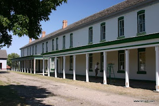
Today you can visit the interpretive center, take a walking tour of 16 original buildings, visit the Pioneer Daughter's Museum, take in a show at the Fort Totten Little Theatre during it's summer performances, and stay at the Totten Trail Historic Inn bed and breakfast, an officer's quarters carefully converted into an Inn.

We didn't stay at the Inn, but we did tour it... and the rest of the fort in close detail. It was an enjoyable way to spend the afternoon.

Time was getting late so we did a quick tour through the Sullys Hill National Game Preserve right down the road from the Fort. Originally designated a National Park by Theodore Roosevelt in 1904, it was changed to a National Game Preserve in 1931... only one of seven National Parks to have ever been demoted or disbanded. During our quick exploration, we did see some of the bison herd, caught a glimpse of some of the elk herd, and looked squarely into the eyes of some prairie dogs and deer.

On Sunday we're moving again. The objective is the International Peace Garden hard on the border with Canada.

More to follow later in the day...
T

The Devil's Lake?

As I wrote in my last post, Devils Lake is in a basin. Water flows in but not out. It's a big tub that catches and holds everything that flows in... rain, snow-melt, minerals, pollution, fertilizer and agricultural runoff... everything. The only process removing water from the lake is evaporation. Because of this situation, during extended dry periods, the level of the lake falls. In fact, during the extended dry period from about 1900 to 1950 when the level of the lake fell by almost 25 feet, there were proposals and projects started to "stabilize" the level of Devils Lake by bringing in water from the Missouri River, about 100 miles to the west. None of these projects were ever completed.

Inundated and abandoned farm buildings.
 During extended wet periods, the level of the lake rises. From the low in 1950 until 1993, an apparently wetter period, the lake recovered from it's low-water condition, gaining back the 25 feet lost during the dry spell, to about where it was in 1900 when regular measurements began.

Hard NOT to see the high water on road. Tough to see road!
 But since 1993 the climate has been even wetter and precipitation has increased substantially. Between 1993 and now, the summer of 2010, the lake has risen by more than another 25 feet -- well above anything observed in recorded history.

Must find another way.
In 1993, the lake covered 45,000 acres. By the summer of 2010 it covered 177,000 acres, almost quadrupling in size. The rising waters in just those 17 years claimed 280 square miles of previously dry land. This 280 square miles included farm land, woods, parks, roads, subdivisions, and homes.


So what's to be done? Well, they continue to raise the levees, and roads, and dams. The roads are full of large trucks -- thousands of them -- hauling levee-building materials around the clock. The State of North Dakota is trying to pump some water from the lake into the nearby Sheyenne River and thence the northward flowing Red River, sparking lawsuits from the State of Minnesota and the Government of Canada, neither of which want the saline and polluted water from the lake. And, I'm sure, there's a lot of praying taking place.


 In the end, it will be dependent on the ebb and flow of nature, the climate, and the amount of precipitation that falls during the next few years. If the water keeps rising the City of Devils Lake will become a submerged island behind a series of levees and dams. Once the water rises another 7 or 8 feet from today's levels, it will find a natural outlet into the Sheyenne River and below, despite all political and scientific objections.

I find it interesting that the last two places we've stayed have been so impacted by high water. While we had all heard about the great Grand Forks flooding of 1997, I knew nothing about the Devils Lake problem until the last week or so. I hadn't expected that North Dakota, which I've always understood to be rather dry prairie, would have this situation to deal with. It's really quite an interesting story of the long-term power of nature and short-term vision of humans... of battling nature rather than living in harmony with it.

As always, see our Online Photo Gallery for additional photos of our explorations.

Looking for higher ground...
T

A Sinking Feeling

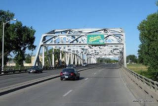
US-2 bridge over the Red River in Grand Forks.
Yesterday, Thursday, we moved from East Grand Forks to Devils Lake, ND. It's a drive of just over 100 miles and a bright sunny day made it enjoyable. I hadn't realized it when planning for our westward trek this fall, but US-2 through North Dakota is almost all 4 lane roadway... all but the last 10 miles at the border with Montana. Because it's not Interstate Highway, it's less busy and much more enjoyable. I believe most people just default to the I-roads when traveling long distance, and don't take the time to consider "lesser roads", which is OK with me. I'll continue to enjoy the uncongested and better taken care of "lesser roads" while everyone else battles the Interstates.


As we neared the community of Devils Lake, the lake started showing itself here, there, and then everywhere. We've learned that the area has been battling with rising water for over the past 17 years. You see, the lake sits in a basin with no outlet. Water flows into the lake but doesn't flow out. Since records have been kept, starting about 1900, the lake went through an extended dry period when the lake levels were receding, then a period of rising and, arguably, more stable levels. But in 1993 the lake started rising and hasn't stopped to this day. See the graph (click for larger size)...

Today, the lake covers an area almost 4 times larger than it was in 1993. It's risen over 25 feet, inundating farmland, homes, businesses, and recreation areas. The lake is ringed with dead trees poking out of the water. There are continual efforts to raise the levels of dikes, levees, and roads. The state has developed a project to pump water from the lake and into a nearby river that flows away from the lake. In my next post, I'll delve into this rising lake subject in more detail... after we've had a chance to explore and learn more.

Causeway to Grahams Island.
The first choice for a camp near Devils Lake was Grahams Island State Park. Yes, it's on an island but connected to the mainland via a causeway. But due to rising waters, the island is getting smaller and the causeway is nearly in the lake.

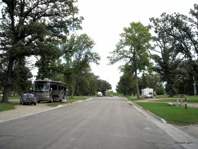
We found the Park and Campground to be to our liking and set up camp. On Friday we'll explore the area in greater detail.

Looking for my life vest...
T

Westward Ho!

By the time you read this Thursday morning we'll probably be moving west again. The route is US Hwy 2 and the destination is the Devils Lake area, about 100 miles up the road. And if you thought we might be through with high-water and flooding stories... you might be wrong. But you'll have to tune in during the next few days to see. How's that for a hook?

The laundry is done, tanks are ready for travel, and we're antsy to continue the journey. We did get the bikes out this afternoon for a 12 mile ride on the awesome Greenway trail system along the Red River. During our stop here we've walked and biked all the way from Minnesota to North Dakota a number of times. How's that for another bucket list item... now checked off. It's been a good stop... really became attached to the Grand Forks area.

More later...
T

The Flood... Before and After

We've been enjoying our stay in East Grand Forks, especially the nearby greenway along the river and the nice collection of restaurants... all within walking distance. The car hasn't moved since we've been here.

As I mentioned in my last post, the Sherlock Campground in the Red River State Recreation Area was a residential neighborhood prior to the big flood of 1997. When the water receded and plans for higher levees were drawn up it was determined that this part of town was just too low to be adequately protected from future flooding. The owners of these properties were bought out, the homes, which had been severely damaged by the record flood, were removed, and the land became part of the new State Recreation Area.


The streets through the campground are the very same ones that carried traffic through the neighborhood. In many areas, the sidewalks also remain. Between our camp and the downtown commercial/entertainment district, only two or three blocks away, is a new levee that now protects East Grand Forks. I climbed to the top of that levee and pointed the camera down 2nd Street toward downtown (the dry side of the levee), to the southeast. The second picture is from the exact same spot but toward the old neighborhood in the opposite direction.
2nd Street looking southeast into downtown from levee
2nd Street, looking northwest into campground from levee
It was April 1997. The Red River, which has a long history of flooding, started to rise as warm weather melted an unusually heavy snow pack. The National Weather Service, which is charged with making accurate flooding projections, predicted the flood would crest at 49 feet -- a serious but probably manageable level for the towns. But the river kept rising, topping flood walls and breaking through levees, until it finally crested at 54 feet... a full 5 feet above the projections of an embarrassed Weather Service. Water was everywhere. The downtown areas of both Grand Forks and East Grand Forks were covered in 6 and 8 feet of water. A fire broke out in downtown Grand Forks but the record water depth prevented any fire fighting efforts and the fire consumed building after building until 9 large downtown buildings were destroyed and several more damaged. Most people were evacuated from both towns as the waters rose and there was no loss of life directly attributed to the flood. But normal life stopped as the waters slowly receded. It was a full month before many people were able to get back to their homes and businesses... and begin to rebuild their lives.

Bridge between Grand Forks and East Grand Forks during flood.

Downtown Grand Forks during flood of 1997
In the following few years the towns did rebuild. Learning from experience, a new system of levees and flood walls were constructed that top out at 60 feet... six feet above that record flood level. Large areas on both sides of the river were designated as a greenway where no development is permitted. Our campground is part of that greenway. Miles of heavily used trails run up and down both sides of the river along it -- perfect for that early morning long walk or weekend bike ride.

It's been estimated that about 3% of Grand Forks' population relocated away from the area in the months and years after the flood. But in East Grand Forks it was more like 17%.


Dar and I, during our limited time here, have found the area vibrant and refreshing. It's rare indeed that we eat out two nights in a row, but that's exactly what we've done. Monday night it was the Blue Moose and last night it was Whitey's, an East Grand Forks institution since 1925. According to legend, Al Capone (yeah, that Al Capone from Chicago) was involved in the original ownership of Whitey's. I can't vouch for that, but can report we really enjoyed both places.


We're extending our stay here one more night in order to get laundry caught up. It may be some time before we have full hookups again and the supply of clean underwear was near critical level. On Thursday we'll head west again.

Getting the bikes ready for a long ride along the river...
T

Blown to East Grand Forks

Just a quick note to let you know we moved today. Both today and tomorrow looked "iffy" weather-wise (high winds mostly) but decided that today was probably the better of the two. Winds would be 25 to 30 mph from the southwest today (mostly a cross-wind for our northwest travel)... and 25 to 30 mph from the west tomorrow (the dreaded, but all too common, headwind).

We left Leech Lake COE a little before 9am. Despite the gusty winds we made good time and arrived at the Sherlock Park Campground which is part of the Red River State Recreation area in East Grand Forks, MN. a bit after Noon.  Even though we're still in Minnesota, we can see North Dakota from here... right over there... across the Red River. En route we took a break at a very nice rest area, made a little coffee, and had a late breakfast.

By the time we arrived in the Grand Forks area the predicted rain was only minutes away. We checked in, found our site, and set up before anyone got too wet.

We're planning to be here two nights. There's a big Cabelas store just a couple blocks away (danger... warning...) and a number of interesting eating establishments... all within walking distance. We'd also like to explore the area that was so hard hit by the devastating floods of 1997. If you remember, the Red River rose to record levels inundating much of the commercial district. To make matters worse, a fire broke out in one of the flooded downtown buildings and, because firefighters couldn't get to it, sparked a conflagration that destroyed 9 major buildings and heavily damaged many others as everyone stood by helplessly and watched.

Interestingly, the campground we're in was a residential neighborhood up to the time of the flood. Everyone who lived here was moved to higher ground, what was left of the homes demolished and carted away, and a campground was established along those same neighborhood streets. We'll get some pictures up in the next day or two.

OK, I'm getting hungry and Dar is tapping her feet -- can't wait to get to Cabelas.

Later...
T

Northwoods Humor

During the past few days we inadvertently collected a few photos that provide a little glimpse into life here in the North Country. I may be the only one that finds humor in these, but I thought I'd share them with you anyway.

Now do you think that maybe this guy has a destiny?  I mean, who else would you vote for but a guy named Scherf for sheriff.

There's not much science that goes into advertising up here. No sir, it's really basic. You gotta read this one out loud a few times, fast, to understand what it's advertising.

Rules are pretty basic up here too. Launching a boat at our campground isn't too difficult for most people. Only three simple rules.

Interestingly when we loaded Jim and Sue's boat the other day, I forgot rule number 3.

And business establishments in the North get creative with their names and advertising tag lines. Who can resist "The Home of the Big WinnieBurger and the Gosh Dam Breakfast"?? And who could drive past the Bigwinnie Bar and Cafe?

Finally, it appears word has gotten around in the Canada Goose community that I'm a trouble-maker. Yowwee, they're sending the big ones after me now.

Holding my hamstrings...
T

The Skeeters of Lost Forty

In 1882, a survey mistakenly designated this particular plot of the far north Minnesota forest as under water... part of a lake... too wet to log off. As a result, the little area was never included in logging tracts that were sold off to timber companies. Loggers worked through the forest, on all sides of the little tract, never touching it with axes or saws. Years later that tract became known as the "Lost Forty"... a reference to the number of acres thought to be included. In actuality, the size of the plot is more than 100 acres.

Today, contained within the Chippewa National Forest and managed by the Minnesota Department of Natural Resources, the Lost Forty is one of the last stands or virgin white and red pine in the Northland. It really is something to see. There's a walking trail loop that winds through the tall 300 and 400 year old trees. I'm told that a slow walk through the plot provides perspective, a good place for quiet contemplation, and a glimpse into what these native northern forests were like before they were all cut down. It can be a very spiritual experience.

The Lost Forty is about 50 miles north of our camp on Leech Lake. Through lake country, low land, and forest, it was a pleasant drive on a warm sunny day. The last few miles were on gravel and dirt roads -- no problem for our low-clearance off-road Ford Focus. We found a small parking area and prepared for the hike when we found ourselves swatting at a few bugs... mosquitoes.

We missed a clue or two, as we headed into the stand of virgin pine, of the problems that lie ahead. There was the running and wimpering young couple who ran by us on their way back to the parking lot, followed closely by a cloud of skeeters. As they flashed by, one of them said something like "Turn back... go back... before it's too late!" I assumed they were probably city people... not as familiar with the outdoors as we are. Dar thought perhaps we should maybe apply some Deepwoods Off as a precaution, but unfortunately we didn't have any with us. Hmmm.

But we pressed on, as all intrepid explorers do, figuring we could handle any problem encountered. I mean, how bad could it really be?


The Lost Forty is an amazing area full of towering giants. Imagine mile after mile -- the entire north country of Minnesota, Wisconsin, and Michigan -- covered by these ancient old guys... hundreds of years old, able to withstand storms, fires, and diseases. Here, time isn't measured in days or weeks, but in decades and centuries. They held steady and strong in the face of all adversity... except the saw and axe.

The skeeters? They were a hungry lot, manageable by swatting and flapping as long as we were moving fast. But if we stopped to take a picture, or read a poster, or scratch a bite, the swarm descended and almost carried us away. So we kept moving... jogging actually... and tried to soak in the experience while the skeeters were soaking in our blood. It wasn't a long jog and before long we were the young couple running back to the car, admonishing newly arrived explorers to "Turn back... go back... before it's too late!"

For a little more information on the Lost Forty, click on this link.

Laughin' and scratchin'...
T

Wading across the Mississippi River

Friday morning we helped our good friends Sue & Jim break camp and load up before they headed for home. We thoroughly enjoyed their visit. Campfires, food, good conversation -- it all made for a fun time. Most of Thursday was spent out exploring Leech Lake in their boat and they topped off the day by making an anniversary dinner for us... a scrumptious feast of walleye fillets with all the trimmings. Thanks Sue & Jim for a wonderful time.

Leech Lake is the third largest lake in Minnesota, about 112,000 acres of water. Back in the early 1800's some thought it was the source of the Mississippi River. But while it's waters do flow into the Mississippi, the actual source has since been determined to be Lake Itasca, some 45 miles or so to the west. Leech has been dammed by the US Army Corps of Engineers and is used as a reservoir today. We're camped near the dam.

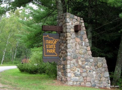
After Sue & Jim departed, we drove over to Itasca State Park to check out the headwaters of the Mississippi River. Having to drive around lakes and "almost lakes" (it's been said that Minnesota is the Land of 10,000 Lakes... and another 10,000 "almost lakes" -- large low marshy areas -- which, based on our experience, might be a true statement... at least in this part of the State), it was a 75 mile drive one way.


Lake Itasca, as I wrote above, is the source of the Mississippi River. We'd been to the source of the Missouri River near Three Forks, Montana [link] a couple years ago and thought we'd expand on that theme by adding the ol' Miss to the list. The State of Minnesota established Itasca State Park in 1891 -- the first Minnesota State Park, and only the second State Park in the Nation behind New York's Niagara Falls State Park. The objective was to preserve the pristine condition of the headwaters area for future generations. I think they've done a marvelous job.


We entered the Park through the East entrance and drove along the length of Lake Itasca to the headwaters pavilion at the north end of the lake. There we found a good set of educational exhibits that cover the early explorations for the source, the history of the native people, and graphical displays of the river from it's source to it's mouth near New Orleans. Just a short walk through the woods we found the headwaters... the spot where water flows from Lake Itasca and becomes the Mississippi River.


We both had to take off shoes and socks, roll up pant legs, and wade across the River... just to say we did it. I mean, how many people can say they walked across the Mississippi?


On our way home, following portions of The Great River Road (perhaps another theme for a future exploration??) we rounded a curve in a remote area between Cass Lake and Lake Winnie when I saw a flash of black as something had crossed the road and momentarily disappeared into the ditch. My first thought was "dog", but as I stopped the car we both saw a big ol' black bear come out of the ditch on the other side and run into the woods. Then, with car stopped dead on the road, as I tried to convince Dar to run in after it, it turned around and looked back at us. For a couple seconds he/she was watching us as closely as we were watching it. Dar snapped a picture but it wasn't usable. Nonetheless, a very cool experience.

Wondering what today will bring...
T

Short Update

Just a short (and I mean "short") update, as it's been 5 full days since my last. We've had a full day today and I'm tired and I'm going to bed and I'm going to get some good sleep in just a few moments.

We're currently at Federal Dam, MN. at a Corps of Engineers campground on Leech Lake. After leaving Camp Soldner on Tuesday,  and spending a quick overnight at the Bad River Casino in Odanah, WI., we rendezvoused with a couple of good friends and ex-neighbors from Burnsville, MN., Jim and Sue, on Wednesday, yesterday. While Jim and Sue are only here at the campground for two nights, Dar and I have decided to extend our stay at least through the weekend.

Everything is running fine and we're getting along fine. We have had spotty cell phone and internet service as we trudged our way across the northland, and a little rainy weather to deal with too. But I'll write more in the next day or two and get the Journal completely up-to-date.

Here's a photo of Sue, Jim, and Dar during a picnic lunch on Leech Lake today.

And thanks so much to those of you who sent good wishes for our anniversary today. How many years has it been???

Socks are off and I'm counting like crazy...
T

Slow Week

Well, it's been a slow week here at Camp Soldner, far out in the wilderness of the Upper Peninsula of Michigan. Early in the week we had the place to ourselves and enjoyed the solitude. Tuesday night Dar's Mom and  Dad came up to spend a few days and we enjoyed that too. Looks like the weekend will be even busier as Dennis and Laura have a small party planned.

I've been getting in daily sessions with the kayak. Warm days with very little wind have made for perfect paddling conditions. Even though this lake isn't very big, any brisk wind can make the middle of the lake a tough place to be for a light kayak. Fighting both the wind and rough water isn't fun... at least for me. So I've tried to take advantage of the ideal weather during the past few days.

The sauna has been getting a pretty good workout too. In this part of the world saunas are common. They come in handy during the winter as a device that can warm a body all the way to the core. But even during the summer they're good for soothing aching muscles ( especially useful for me these days), deep cleaning the pores, and to just hang out with sweaty friends. It's a very social environment.

My hamstrings are healing nicely... I'm probably back to something like 70% or more. I've been stretching and taking walks, and that all seems like it's doing the job. It could also be that time is the biggest factor in getting back to normal. Either way, I'm resolving to warm up a little before trying anything so crazy the next time.

The way it looks now, we'll be leaving Camp Soldner on Monday or Tuesday... depending on the weather. The planned route is US Highway 2... all the way to Everett, WA, where the highway ends. We're thinking it might be a month or perhaps a little longer for this leg as we'd like to take some time in Glacier National Park and other spots of note along the way.

Waiting for the promised rain...
Thom

Dam Busters

Yesterday, Monday, we enjoyed a quiet day at the Camp. We had the place to ourselves. The day started out foggy but quickly cleared to a sunny and warm one.

About noon Dar and I took the canoe out on the lake with a mission in mind. The lake we're on is fed through a small stream from another lake higher in the chain. At times in the past, small dams, the result of debris or beaver activity, would plug up the stream and the level of our lake would go down. In the past week or so, our neighbor Bill has noticed this very thing. He thought we might have a dam again. So we headed out on a mission to find the plug and, if we found one, to remove it.

And, just as predicted, we found one... a small debris dam in a shallow area of the stream. After 20 minutes of dam hard work the stream was flowing strong again. The residents of our lake will be happy when the water level creeps back up a couple inches in the next few days.

We kept canoeing into that next higher lake and along the shoreline to a small sandy landing spot on the other end where we could pull the canoe into the brush and walk over to the finest dining establishment in Three Lakes... Stumps Bar... where we enjoyed a burger and a beer for lunch.

Later in the afternoon I actually napped, something I almost never do. In my previous life I knew of someone who could nap at will. Sitting or laying almost anywhere, with almost anything going on around him, he could force a nap in just a couple minutes, sleep for 20 minutes or half an hour, and wake up refreshed and re-energized. My naps (the few I've had), on the other hand, were uncontrolled in comparison. It took me forever to get to a sleep state, and then I think my body thought it was night and didn't wake up... for hours. Then I wouldn't be tired that night and struggle a second time in the same day to get to sleep.

I always envied that fellow with the napping talent. And today I enjoyed my little nap. My sore muscles from that foolishness the other day are slowly improving too. They now only hurt when I do certain things... like walk, sit, stand, or lay down.

Lounging on the lake...
T

The Galloping Geezer Show

It wasn't supposed to happen this way; it certainly wasn't part of the plan. But there I was, laying on the ground, writhing in intense pain... wondering what happened. Am I loosing consciousness? Why can't I see clearly?... all I see are stars... and I can't seem to catch my breath. What's going on? Ahhh!

Maybe I should start at the beginning.

Here at Camp Soldner we're close to nature. Deer are regular visiters. Once in a while moose wander through. Beavers regularly plug up nearby rivers and streams. Our neighbor Bill reports that he found a black bear in his open garage one morning. Many have seen wolves, which were re-introduced to the UP some years ago. Then there are the birds... mostly waterfowl. Ducks, loons, cormorants, and, of course, the ubiquitous Canada goose.

I've had a long-standing grudge against the Canada goose (see previous blog entry on this filthy fowl) which, years ago, would migrate through the upper Midwest and impress us for a few weeks each Spring and Fall with their incredible numbers. But as the years wore on and the planet warmed (or "cooled" if you fall on the other side of the "global warming" controversy) the geese just stopped. They didn't stop coming... oh no, that would have been fine with me... they stopped going. They decided things were pretty darned good in these newly warmed (cooled) environs, and they just stopped migrating altogether. They just stayed... 12 months a year. They moved in like an indigent brother-in-law, hung around, laid on the couch, watched TV, ate everything in sight, and made a mess wherever they went. (calm down Thom!)

Dennis and Laura, the owners of Camp Soldner, have had an ongoing battle with these geese too. For whatever reason, the local gang of geese like the lawn here at the Camp... especially in the morning, when the rising sun warms the succulent grass they love to eat and provides a cozy place to warm up on cold mornings. Every remedy known to a Yooper has been implemented. They've tried it all... scarecrows (took care of the crows, but the geese weren't fazed), monofilament fishing line strung along the shoreline on short poles (stopped the amphibious landings... but they just started flying in), even sacrifices to the waterfowl gods... nothing worked.

So, since we've been here, the first chore when getting up is to see if the gang has showed up, and if so, go out and shoo them away -- another seemingly ineffective solution. You just can't be here every minute of every day.

In my mind, I formulated a plan with the assumption that geese, having very limited intelligence, might be "scared straight". If they were scared to the edge of life and death (in their minds), they might decide the grass is more succulent on someone else's lawn. Hmmm. With the right execution, this just might work.

Well, the other day I woke to a bright sunny morning. I shuffled my stiff body out to the kitchen of the bus-house, semi-blinded by the sun boring in through the big 4 acre east-facing windshield. I looked over the lake, absorbed the sights of nature and another glorious day, and... that danged gang of geese over on the other side of the Camp. Alright, this is the moment... this is the opportunity. This is the perfect chance to implement the plan I put together. If I could sneak out of the bus-house, work my way through a mine-field of goose poop without being seen... to the back side of the sauna building, and then jump out -- only a few feet from the offensive fowl -- running and screaming like a mad-man right at them... well, why would they ever take the chance of having that experience again?

I slipped on my favorite Keen sandals, quietly opened the bus-house door, and worked by way over to the sauna. OK... so far... so good. I don't think they saw me. I peeked around the corner... there were at least 15 of 'em. This is gonna be good! Now's the time...

My just-moments-before sleeping body was called into action by my scheming brain... I shot around the corner of the sauna and right for the middle of the pack of poopers like a 22 year old line backer trying to prove he's got the stuff to make the "A" team. After the first two powerful strides things started to go awry. Sirens and alarms started going off in my head. (Ah, Houston, we have a problem!) A sudden sharp pain tore through the back of my upper left leg... followed by the same pain in my upper right leg. My upper body was going faster than my legs... and I couldn't control much of anything... what's wrong?... this ain't right!.. why am I seeing stars... I'm going down and going down hard... uncontrolled... knees and elbows and geese flying everywhere... it must have been ugly. I hit the ground and rolled and tumbled and yelled and eventually stopped... I hurt everywhere... but especially the back-sides of my upper legs. I was losing consciousness.... seeing stars... narrowing vision... but was able to roll around and try to find a position where the pain would ease. Nothing helped. I concentrated on breathing deeply... must keep from passing out... Dar didn't see any of this and she's sleeping in the bus-house on the other side of the sauna... if I died here she wouldn't find me until she woke up at 10am... and I'd be as hard and cold as a washed up carp.

I did hear our neighbor Bill, who was a couple hundred feet away on his moored pontoon boat and apparently saw the whole thing...  wondering if I was OK... if I needed help. I waved and got out a pained "I'm OK... I'm OK"

After laying there for a few moments (If I actually passed out it could have been longer) I struggled over to a lawn swing... sat there for a few moments and remember still seeing mostly stars... very poor and unclear vision... struggling for air... a little nauseous too. This isn't getting any better. Must get to bus-house and to the nurse that resides within (AKA The Safety Director). It's my only chance.

I crawled, actually a combination of walking and crawling, over to the bus-house... leaned against the front end for support... worked my way around to the door... opened it and inquired as to whether the Nurse was available for a consultation. She came to the door, saw me, my lack of color, the pained expression on my face, my inability to maintain my balance, my eyes crossing and rolling back in their sockets...and she asked if I had a problem. OK, she might have asked "what did you do now?!"... I don't know... memories are choppy at this point.

She did help me into the bus-house and into a chair. She thought I might pass out again and wanted me on the couch... but I couldn't... not just then... not yet.  It took another 10 minutes or so to come around, to get past the worst of it, but the pain was still with me. She said I'd probably pulled a hamstring. I said, I think I pulled both of 'em. Whoa!

Since that time, things have improved. I'm feeling better but walking pretty slow. I'm using my hiking stick as a makeshift cane to steady myself as it all slowly heals.

The geese? They've been back almost every day, probably hoping to see another spectacle like that one the other day. I'm sure they've been talking with their geese buddies all over the U.P... telling them all about the Incredible Galloping Geezer Show... how funny it is... how it's a "must see".

Danged Geese!

Enjoying the medically necessary massages on my backside...
Thom

Michigan State Capitol Building

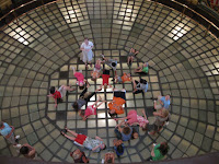
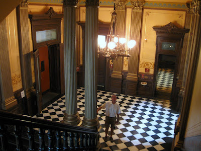
A couple weeks ago, on July 23rd, Dar and I made a visit to Lansing and the Michigan State Capitol Building. We've been making it a point to visit capitols when we're camped close by, and this visit will make Michigan our 15th. I reported this exploration in the Journal for that day, but said I'd do a more thorough post at a later date. This is that post.

Michigan was part of the Northwest Territory established by the US Congress in 1787 and was made it's own territory, the Michigan Territory, in 1805. Michigan began applying for statehood as early as 1832 but was rebuffed due to a dispute with Ohio (already a State) over a strip of land called the Toledo Strip, a sliver of land that ran just south of the current border and included the City of Toledo, an important shipping port on Lake Erie. By 1835 Michigan formed a State Government without authorization by Congress and included the Toledo Strip in it's jurisdiction. A bloodless conflict, called the Toledo War, erupted between Ohio and Michigan that same year. In dire financial straits due to the conflict and the resulting lack of statehood, Michigan finally "surrendered" the Toledo Strip to Ohio, and was granted statehood in 1837. As a consolation prize, Michigan was granted rights to the western 3/4 of the Upper Peninsula, which otherwise might have been given to Wisconsin.

Detroit was the first Capital of the new state but concerns about the defensibility of a Capitol building such a short distance from the Canadian border (Detroit was occupied by the British during the war of 1812) and with an interest in encouraging western development of the State, the nearly uninhabited Lansing Township was named the new Capital in 1847. That same year, a temporary wooden building was quickly erected to the the Capitol.

The Civil War caused any consideration of a new, more permanent, Capitol to be delayed until the 1870's. In 1872 Elijah E. Myers of Springfield IL was selected as architect and construction began in 1873. Taking 6 years to complete, the building was dedicated on January 1, 1879.

The building is laid out in a fashion similar to the United States Capitol, with a central dome and rotunda, and the branches of government occupying the wings. This style became a common one for many of the subsequent Capitol buildings that followed. Myers went on to also design the Capitols of Colorado and Texas, and the territorial Capitol of Idaho -- the most of any other single architect.

Like many other statehouses over the years, the building itself wasn't a high priority for the growing State and it fell into disrepair and neglect. But between 1989 and 1992 an extensive historical restoration project restored the building to it's original grandeur.

Our first impression was positive... this looks like a Capitol should look. And that positive impression held throughout our visit. The grounds are neat and clean, the building is nicely appointed, with about the right amount of symbolism communicated through art. Portraits of former governors and notable people from Michigan are present. The restoration project was clearly well done, and, based on descriptions from our tour guide, was clearly necessary. It is also fortunate the restoration was done when it was -- during a period of relative affluence for the State. If it had been delayed 10 years, and with all the economic hits the State has taken since 2001, there's little chance it would have been done at all.

Ranking right up there in the top third of Capitols we've visited, the Michigan State Capitol was a sensory pleasure and an intellectual delight.

See these and other photos from our day at the Capitol in our Online Photo Album.

Yooper Busy

We haven't just been busy. We've been Yooper Busy!

Unusual small mushroom in the grass at Camp Soldner

So, what's "Yooper Busy"?  This is the condition in which those of us in the U.P. ("Yoopers") are preoccupied with trying to pack as much warm-weather activity and fun as you can into a very short summer... struggling mightily to take advantage of every day without ice, snow, and sub-freezing temperatures. I've said it before... for many Yoopers the only good use they have for summer is to prepare for the next winter. They're a hearty bunch with one thing in common. They ALL love living up here.  They'll do almost anything to stay here.


Besides hanging out and enjoying the amenities of Camp Soldner, we've done a couple area explorations that I'd like to note. The first was with fellow explorers Bill and Nancy, our next door neighbors here at the camp. The four of us headed into the Keweenaw Peninsula (that big finger of land that juts into the middle of Lake Superior). Dar and I explored the Keweenaw back in 2007 but somehow, inexplicably, when I went to get the link to that post I found that I never did post anything about that day. Hmmm.

The Keeweenau was a hoppin' place during the later 1800's and early 1900's. Mining was the reason and copper was the primary metal being mined. And a booming timber and lumber industry added to the fury. People came in droves, towns boomed, affluence reigned. But even in the scale of U.S. history, the boom time here was little more than a deep breath. It grew fast, reached an apex, and died almost as fast. The mines played out, the rich ore gone, the timber was cut, labor strife, competition from huge new western mines. People left, seeking jobs, many of them to the Detroit area where the auto industry was beginning a new cycle of growth and affluence -- which now, at least for Michigan, has followed the same boom-bust pattern.

Then yesterday, Friday, we joined Dennis and Laura in an exploration of the highest point in Michigan, Mt. Arvon. The nearby Mt. Curwood had been considered the highest point until 1982 when more accurate instrumentation determined that Arvon was actually taller by a mere 11 inches. Of course that fact got me wondering whether geological bandits could lug a 12 inch rock to the top of Curwood to regain the title?

From L'anse MI., the 28 mile route followed progressively worsening roads. The last few miles were little more than a jeep trail... barely wide enough for Dennis' full-size van... through ruts, wash outs, pot holes. About a half mile from the peak we found a place to park the van and walk the rest of the way to the top. A good jeep could, and occasionally does, make it all the way.

A picnic table and signs mark the point. And of course, the official USDI Geological Survey marker. Just a short walk down a trail to the north we found a fantastic view of Lake Superior and the Huron Islands about 15 miles off, and the Keweenaw Peninsula on the horizon.

From the mountain we headed for the shoreline. Lake Superior is the largest fresh water lake in the world based on surface area, and the third largest based on volume. We drove, again down progressively worsening roads to a beach near the mouth of the Huron River -- which we learned was a sort of secret recreation area for locals and those "in the know". We found campers, beach'rs, picnic'rs... all enjoying the wide, sandy, and very pleasant beach. Don't tell anyone, but this was a real "find" for a couple explorers like us.

A Minimalist

A Minimalist A blog post I've recently been involved with helping to clear out the living spaces of someone who died. These are a few of...

Slightly Better than Most