May 12, 2016

Into Wisconsin and our Summer Home - Day 10

Thursday, May 12
Our last traveling day for this leg of our travels.  Usually looking for new routes we hadn't taken before, we took IA-3 from the Cedar Falls/Waterloo area to Dubuque. Now we're back to our original stomping grounds.

And first on the agenda, now that we're "home", is a stop for lunch in Potosi WI, at the famous Potosi Brewing Company. Enjoyable, as always. We learned that they have a penchant for hiring brewmasters named Steve. They're on their third one.

Learned that Dar's Mom and Dad, our hosts for the summer, were having visitors tonight. Bill and Nancy who spend the summers in the UP of Michigan would be stopping by and spending the night. On our way into town we stopped for a few dinner supplies, and arrived at our summer home about 4pm.

Recap:
This trip from Oregon to Wisconsin was 10 days (9 nights on the road).  It was 2,473 miles. The F350 used 199.8 gallons of gas ($436), got 12.4 mpg. We camped for 5 nights, motels for 4 nights. 9 nights averaged $44 per night.  Gas, camping, and motels totaled $830.


The Dark Nasty Cloud that followed us from Oregon. 

May 11, 2016

Into Iowa - Day 9

Wednesday, May 11
When a couple travelers (us for example) travel from west to east across the continental United States, one runs the risk of getting under a nasty dark cloud and then following it all the way to your destination. Weather generally moves from west to east too. It's just the way it is.

Much quieter morning after the fireworks last night. Continued on US-30 into Iowa, crossing the Missouri River between Blair NE and Missouri Valley IA. Mostly cloudy all day today... that dark cloud mentioned in the preceding paragraph.

Just east of Ames, picked up US-65 north to US-20 east. Not much to report about the drive today. It is Iowa after all. Oh... we did stop in Carroll IA for lunch at a Culvers.

We have some friends who live in Cedar Falls IA so we thought that'd be a good place to stop for the night. Weather was still "iffy" (that same cloud) so a motel seemed like the right choice once again. Attempts to reach our friends were eventually rewarded with a return call. They had just gotten off a cruise ship to some exotic destination and wouldn't be home for a few more days. I treated my sweetie to dinner at the truckstop next door to the motel, which had an incredible selection of pre-made sandwiches and roller dogs and even more. Then settled into our motel bed and fell fast asleep... by 8pm.  High living indeed.

May 10, 2016

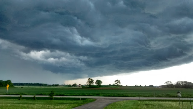
Through Nebraska, Stormy Night - Day 8

Tuesday, May 10
A nice quiet morning, partly sunny. No wind. A long day today as we follow US-30 east, through North Platte, Lexington, Kearney, and Grand Island. The temperature was climbing as the day wore on, and could only be described as "hot" when we stopped in Central City for an ice cream cone. A little further on, near Columbus, we checked out some possible camps, none of which was agreeable to us. Tired, hot, a dearth of camping possibilities, and increasingly threatening weather prompted us to "call an audible" and check into a Days Inn on the east side of Columbus.

Weather continued to deteriorate, heavy weather warnings were issued, and between watching out the window and keeping an eye on the weather radar we entertained ourselves until things settled down late in the evening. Nature provided entertainment is usually preferable to what's on the tube these days. Decided our decision to motel it tonight was the right choice.

May 9, 2016

Scottsbluff National Monument - Day 7

Monday, May 9
Woke in Scottsbluff at Riverside CG, a very nice city park along the North Platte. The sun was shining and it looked like a good day. We've noticed high water all along the North Platte as we've followed it east, the result of strong snow melt and some heavy rains higher in the hills. But here in Scottsbluff, the water is so high, and rising, that it's predicted to go into flood stage any day now. In all likelihood, Riverside CG will be closed in a day or two until the river subsides.

Just across the river to the south is Scotts Bluff National Monument. Serving as a landmark for thousands of years for early Americans, and then for emigrants as they walked to new lives in the West, this series of tall sandstone bluffs dominates the surrounding flat land. Mitchell Pass on the Old Oregon Trail runs directly between Scotts Bluff to the north and South Bluff to the south. A trail follows this historic route through the pass. It's possible for smaller vehicles to drive to the top of Scotts Bluff, which we certainly did, for hiking and great views of the surrounding prairie.

Another similar stop is a few miles to the east at the historic Chimney Rock... another emigrant landmark. We didn't hike out to the rock itself as it's on private property, but we did stop at the closest point to it for a quick picnic lunch. Another sandstone bluff of note in the area is Courthouse Rock.

Not far down the North Platte from Scottsbluff is Ogallala. Nearby McConaughy Lake, a reservoir just north of town, features a series of campgrounds that we found agreeable. We set up camp at Little Thunder Bay, site 27, for the night. Weather was still a tad threatening, but it looked like it'd hold for the night. Until a late day straggler came in toward evening, we were the only ones here.

May 8, 2016

Into Nebraska - Day 6

May 8 Sunday
After a quick nearly all carb breakfast, we were on the road again by 9:30. The Baymont motel in Casper was comfortable and preferable for us. Camping in near freezing conditions with the little camper takes some effort and at this point in my life, taking advantage of a motel once in a while is a viable option.

South (east) on I-25 for 90 miles to x92, for US-26. To Guernsey.  Checked out Oregon Trail Ruts Monument and Register Wall -- two places where real evidence remains from the passage of the emigrants. Quite impressive.

Continued down to Fort Laramie (the town) and stopped at Fort Laramie (the fort). During our visit there the sky darkened and a huge T-storm gathered to the south, eventually chased us out. As we drove east on US-26, I thought we'd outrun it, as radar indicated it was heading north. And we kept outrunning it until we got to Scottsbluff, checked the radar, and it looked like we were out of harms way. But don't get too comfortable, as it kept expanding and eventually made it to Scottsbluff.

Got campsite at Riverfront Park (nice camp hosts Richard and Darlene). Paid $10 for a no-hookup site, parked, took a little walk along the swelled river, and checked out the area facilities. By the time we'd gotten back to the camper the dang storm had found us. It was all I could do to get the chairs inside and get myself inside before the rain, and hail, hit. Rained the rest of the evening.

Checking the forecast, I'm tempted to high-tail it back to Wisconsin. Anywhere I look between here and there it's going to rain, T-storms, wind, and cold for the next few days.

May 7, 2016

South Pass Wyoming - Day 5

May 7 Saturday
The rain that messed with us yesterday wasn't falling as we left Jackson, but it looked like it could at any minute. We made the quick run down to Hoback Junction south of town, to regain our trail, then made the turn onto route 189/191 which carried us toward the east and south. Initially, the road follows the Hoback River through the spectacular Hoback Canyon. This is the land of the original mountain men. Men like Jim Bridger, Jedediah Smith, and Bill Sublette lived and worked in these mountains during the early 1800s. It was a unique time, sandwiched between discovery and the arrival of emigrants, that lasted about 30 years.

Off to the east and below the threatening clouds were the snow-covered Gros Ventre Mountains; to the west, the Snake River Mountains. Whether a day is clear or cloudy, the mountains are rewarding. I don't know why, but they just do something for me.

On our way south toward Farson there is an interim summit that made us ascend into the low cloud deck. For a few miles and until we descended again, we drove slowly through fog as visibility was very limited. Along through here we crossed the historic Lander Cutoff of the Emigrant Trail. Precipitation was on-again off-again, and with temperatures getting close to the freezing point, becoming various kinds of frozen water. Near Farson, where our path makes a hard left toward the east on WY-28, the sun made a brief appearance.

South Pass is the area where most of the emigrants in the middle 1800s crossed the Continental Divide. It was the easiest route close to available and, oh so necessary, water. The grade is gentle. The Divide is actually hard to discern. As we ascended, sleet and snow started building up on the road, eventually several inches of the stuff that was wet and slick. Several cars and a jack-knifed semi took the easy route into the ditch.

At the summit, there's a pull-off with a short trail, along which are interpretive signs about the pass. We pulled in... based on the lack of other tracks in the 5 inch deep snow, the only ones to recently do so. Since South Pass was my prime objective for this trip, there was simply no way I was going to short-change myself once we're actually here. Dar chose to stay in the truck while I ran around the circuit, stopping at every sign, wiping the thick layer of snow from the sign, snapping a photo of it, and jogging to the next. Jog, wipe, snap, repeat. By the time I was back at the truck, I was wet, hands frozen, shoes soggy, but I was happy I did it. I'm sure, at some point, we'll be back through here. And hopefully, the weather might be more tourist-friendly and we'll be able to spend a little more time.

From the Continental Divide, the road, counter-intuitively, goes UP. Eventually, reaching 8,400 feet before dropping back down toward the east. Driving became easier and we made Casper before deciding to drop anchor. Weather made the decision for us... it'll be another night in a motel.

May 6, 2016

Jackson Wyoming Overnight - Day 4

May 6
Rained during the night. Woke to an overcast sky and the promise of more precipitation. Broke camp during a lull and rolled out the gate at Craters of the Moon National Monument before 9am.

Uneventful drive to Idaho Falls, where we fueled and filled-in a few desired grocery items at an Albertsons store that was experiencing a widespread electrical and refrigeration problem. All freezers and coolers were wearing sheets of plastic and people were scurrying about trying to solve the problem.

Out of town on Hwy 26. Stopped at Palisades Dam on the Snake for a look see. As we sat there we were hit by a burst of very high wind and heavy driving rain. Waited out the heaviest. But slow going against the storm for a while. At Hoback Junction, due to weather, time of day, slim prospects for resources around South Pass, we decided to go the 20 miles into Jackson and call it a day. Room at Pony Express Motel at corner of WY22 and US26. Beer and lunner at Snake River Brewing. We'd spent some time here last year... really familiarized ourselves with Jackson. Knew our way around pretty good. Our spontaneous visit this year felt like coming home.

May 5, 2016

Craters of the Moon National Monument - Day 3

May 5
Dawn broke early over our camp at Silver Creek. Unfortunately, we slept through dawn and awoke at the break of, maybe, 8am. A fine morning. From camp, in most directions, there were no physical artifacts or evidence to suggest that anyone had ever been here before. I could see the snow capped Sawtooth Range dominating to the north. There was Silver Creek some 20 feet from the camper, riffling as it rushed by. There were miles of prairie between the two. But nary a structure or road or power line or anything that wasn't natural. From this point, this may have been the same scene I would have seen 100 or 200 years ago. Who knows?

Drove through Carey and made our way to Craters of the Moon NM. A brief stop at the Visitor Center was cut short by a swarm of kids from a local high school. Got campsite then went exploring. A series of short hikes... one to top of a cinder cone, another to a feature called tree molds - where hot lava inundates areas of standing and fallen trees, covers them with hot molten rock which then cools, leaving cavities that are essentially molds of the original trees. Observed lichen... all kinds, colors, and reflected on the similarity to life on this rock called Earth. Is life on earth analogous to lichen covered rocks?  Did a nature trail or two and had a picnic lunch at a trailhead. Overall, a grand day of exploration.


Into Idaho - Day 2

May 4
After a fine sleep at Clyde Holliday State Park, we were up and moving by a little after 9. It's beginning to look like the weather will push us to some degree as a system is forming that's going to turn the whole western USA into a shitstorm for a few days over the weekend. With our motivation thus heightened, moving becomes a higher priority.

We're aiming for the Craters of the Moon National Monument in Idaho. Neither of us have visited this place in the past and it's right along an east/west route segment we've likewise not taken before. So the decision was made to set course, without haste, for CRMO.

The route used US-26 from John Day to Ontario, I-84 through Boise to Mountain Home, then US-20 up and over to Carey ID. A bit bedraggled from the longish 300+ mile drive, we found an agreeable camp along a creek on BLM land about 8 miles south of Carey.

Tomorrow, which the weather gods have predicted will still be mostly sunny and nice, the plan is to explore Craters of the Moon NM. From our camp, it's only a short drive on US-26 between Carey and Arco.

The drive today was a mix of high forested mountains and low agricultural land. The section of US-20 in Idaho was through the high (5,000 feet or so) Camas Prairie, that was known to some emigrants in the mid-1800s as the Goodale Cutoff, an alternative to the Oregon Trail that made travel somewhat easier.

There aren't an overabundance of camping spots through the Camas Prairie. The few we checked out were suffering from one deficiency or another until we snagged this one along Silver Creek south of Carey.

May 3, 2016

On The Road Again - Day 1

May 3
I love traveling. But I don't love getting ready for travel. The past couple days have been brutal. Putting a camper in mothballs every couple months almost makes one consider just taking the big old beast along instead of parking it. Tempting, at least during times of work related stress. But I know that wouldn't last long either as we've come to like exploring in a smaller rig. OK... end of the negativity.

We made it out of the chute today. Began the trek back to Wisconsin... our homeland. Unfortunately we both have medical check-ups scheduled back there for the week of May15. That gives us barely two weeks to cover 2400 miles. Not a "balls to the walls" cannonball run, but also not the leisurely, month-long, trip of a couple years ago. It is what it is. We'll make it enjoyable.

For the record, we followed the McKenzie River on OR-126 up into the high Cascades, down the backside into Sisters, then over to Redmond and Prineville. Pressing eastward from there on US-26, passed through Mitchell, Dayville, and Mt. Vernon. We made camp for the night at Clyde Holliday State Park. The secret word for the evening is "mosquito".  And no negativity intended. I am positive there were a lot of mosquitoes at our first night's camp.

Enjoying history and geology, we try to stop at historical markers, overlooks, and natural wonders. Today, Good Pasture Covered Bridge is an example. I couldn't stop in time when it came into view, so I did an abrupt U turn and went back to investigate. What a wonder. What a work of art. The bridge clear-spans the wild McKenzie River at 165 feet, which makes it the second longest covered bridge span in Oregon. Built of local timber in the late 1930s, and refurbished somewhat in 1987 (mostly approaches and the intersection with OR-126), it's original massive wooden trusses continue to support anything up to and including logging trucks. This, and examples like it, are a testament to the abilities of people to do amazing things without the aid of computers and large mechanized equipment. This one wins my "man-made wonder of the day" award.

And the "natural wonder of the day" award goes to Sahalie Falls near the headwaters of the McKenzie. With an abundant precipitation Winter behind it, and a near normal snowpack in the high cascades, the stream was flowing strongly today. The 120' falls delighted with volume and drama what it lacks in vertical drop. I don't know... some people get jaded by waterfalls. Some people say "you seen one you seen 'em all". But we both get a real kick out of the majesty and power.

Check back... pictures to follow.

Beyond Branson; Pondering Future Travel

This past Tuesday, we moved from Branson to a very nice Corps of Engineer’s Park on Wappapello Lake.  We’re in the Redman Creek CG. This fac...