Dec 31, 2010

2010's In The Books

Before I get into my last post for 2010, a few housekeeping notes:

First, Dar has been working feverishly and, as of yesterday, achieved her goal of having all the photos from our 2010 explorations uploaded to our online photo collection. Due to our pace of travel the past few weeks we were often adding more pictures to the pile than could be processed into online albums. But, for the most part, they're up there now for your viewing pleasure. We arrange our photos in albums, each one focuses on a specific subject or exploration day. The albums are arranged in reverse chronological order -- the most recent right at the top.

Second, I fell behind a little too. Yesterday, I went back to December 23rd and added a long post about our travels to Terlingua and the Road to Presidio. This post is titled "Kosmic Kafes, Ghost Towns, and Mystery Lights". I hope you'll check it out.

And third, I've gone back to a number of posts from the past month or so and added photos... sometimes replacing public domain photos from the internet... and other times just to add color and spice to otherwise bland posts.

=============

Now for some thoughts about our past year. As of today, we've completed three and a half years of living this fulltiming lifestyle. The passage of time and the experience gained from actually doing it can produce unique or different perspectives on the subject. This is one that's been rolling around in my mind for a while.

We spend one night in some places... three months in others. This kind of flexibility is one of the great features of the lifestyle. I think I'd even go further... and say the variety in our length of stays really adds to the overall enjoyment of the lifestyle. I've often said this about the weather... that you must experience the extremes to really appreciate the mean. Unless you've sweltered in hot humid weather... and have frozen your cojones off in sub-zero arctic-like conditions... unless you've weathered the torrential downpours and snowstorms on the one hand... and have dealt with drought on the other... you really won't appreciate and enjoy the wonderful weather in the middle... the normal, the average, the mean.

Well, our travel is a lot like that. We love moving and exploring... but we also love staying in one place with family and friends. We love coming home... but we also love leaving home. I don't know that we'd enjoy exploring as much if we were doing it all the time. You may need those down times to absorb, to read, to plan, to be with people you love.

For our family, and for us, 2010 was a pretty good year. Other than a few more aches and pains here and there, we've gotten through the year in reasonably good health. Most of us are dealing with the sour economy and, so far, getting through it OK. I'm hopeful, and confident, that we're, all of us, flexible enough to survive any curve balls thrown our way in the future.

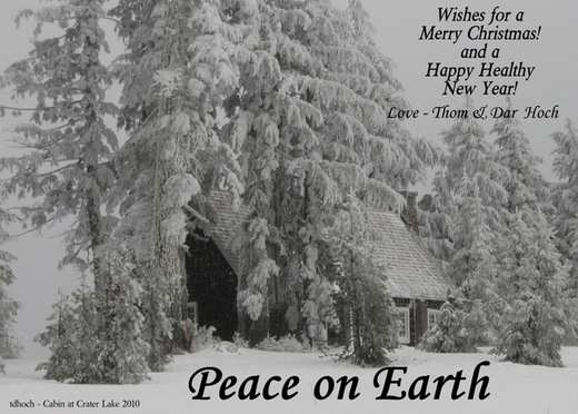
So, I guess that's a wrap. 2010 is in the books. This is the final post for the year. Dar and I wish everyone a healthy and happy 2011.

Dar and Thom

Dec 28, 2010

Pooped

Well, we did it. We turned a 6 mile hike into an 8+ mile hike, and our lazy bones (and muscles, joints, etc.) weren't as in-shape as we were hoping. As a result, we were both dragging by the time we got back to the bus-house this afternoon... but, we were in good spirits and glad we completed the Rio Grande Trail here at Seminole Canyon State Park.

After shedding some gear, popping a couple ibuprofen, and pouring a large beaker of electrolyte replacement therapy (beer), we sat outside, cool as it was, and tried to soak up some of the last heat rays from the sun. It was a great feeling.

Today's trail took us from the campground out to the point where Seminole Canyon meets the Rio Grande River... which, because of a dam, actually has real water in it at this point and is called Lake Amistad. Near that junction is the real attraction for making the hike... an open rock shelter/cave called Panther Cave, on the other side of the canyon. The Cave is only accessible by boat but is very visible from our side of the canyon. With binoculars you can see many pictographs, including a large panther, which were painted by native peoples 1500 or more years ago.

click to expand... then look carefully on the back wall, near the center of the picture for the panther.

But the pictographs are only the icing on the cake. The entire hike was a walk into history. Some of the trail follows the original Southern Pacific Transcontinental Railroad alignment and in many places cuts, fills, and grades remain. I could imagine steam engines passing this very point more than a hundred years ago... spewing steam and smoke while feeding the transportation needs of a headstrong growing nation. While this particular section of the original railroad grade was abandoned long ago for a more favorable nearby route, much of the original is still in use across the southern edge of the U.S.


A number of times today we stopped to rest... to sit on the edge of the canyon and dangle our feet over the side... to munch on energy-snacks and rehydrate with water... and just to enjoy the sounds. We watched as a Golden Eagle swooped up and down the canyon -- checking us out and giving us a little show. There was another black bird we can't identify, that made a sound we'd never heard before... reminiscent of a crow... but it wasn't a crow... flew down the canyon creating a racket that only it knew the reason for. And the ever-present sound of the waves lapping on rocks and shoreline provided a peaceful white-noise that enhanced the whole experience. There wasn't another human to be seen. We were alone with nature. It was one of those special times we'll always remember.


As my leg muscles rest tonight, my fingers are getting their chance to help me describe our day. Eventually, the whole body has to rest... and that time is close. Tomorrow, we're rolling down US-90 again, eastbound again, and hope to end up somewhere around Hondo, TX. for a few days. It should be an easy day.

More photos online... and good night all...
T

Dec 27, 2010

Seminole Canyon - The Sequel

Since leaving the Tucson area almost two weeks ago, we've been living around 4,000 and 5,000 feet of elevation as we moved through southeastern Arizona, southern New Mexico, and into West Texas. Alpine, which we said "adios" to this morning, is 4,500 feet. This is "high country" and during the winter, high country is often cold -- especially at night.

But we're rolling downhill now.. toward the warmer and more humid Gulf Coast. After a pleasant 166 mile run today, we decided to use our Texas State Parks pass and a "buy one - get one at half price" camping deal at Seminole Canyon State Park, near the confluence of the Pecos and  Rio Grande Rivers, and about 40 miles northwest of Del Rio, TX. I mean, how can we go wrong?.. the average for our two nights here will be about $12 per night which includes water at the site and a little electicity to help us stay warm. The elevation here is about 1,400 feet, but during the next week we'll loose almost all of that too, as our Winter Camp in Rockport is just a few feet above sea level.

We'll be at Seminole Canyon for two nights and tomorrow we'd like to hike the 6 mile Rio Grande River Trail. The last time we were here, in January of 2008, I came down with a virus or bug of some kind and spent my hiking day in bed. We have no Verizon cellphone service here, but the Park provides wifi and a good internet connection at no cost.

And I must remember to thank Len and Judi for a great dinner and stimulating conversation lubricated with adequate quantities of passable wine (some provided by us), during our last evening at Lost Alaskan in Alpine. We don't get many invitations to a sit-down-all-at-the-same-table dinner in this lifestyle, so we really enjoyed the event. Thanks you two for a wonderful time... and we hope you'll find I was wrong about El Paso.

Knocking the desert dust off my hiking boots...
T

Dec 26, 2010

Life at Lost Alaskan

The past few nights the low temps here in Alpine Texas have been in the low 20's, which feels more Alaskan than Texan... in my humble opinion. Sure, we're in West Texas and just a few miles from where, in January of 2008, we experienced our record low temp since starting the Sabbatical. But we've been fortunate with weather so far this fall and winter... maybe a little spoiled as a result.

Our Christmas was very nice. The RV Park sponsored a Mexican-themed Christmas pot-luck luncheon where we enjoyed chatting with other RVers in travel-mode during the holidays... and sampling the wide array and quantity of food. Later in the afternoon we made calls to family, including something new-to-us -- Skype video calls with our son and daughter-in-law, and our daughter, son-in-law, and the two grandkids. The advantage of an audio and video connection is priceless when grandkids are growing so fast.

Today we're vegging a little, listening to a couple football games, and getting ready for leaving Alpine tomorrow. Later, we're going to have dinner with Judi and Len, another fulltiming couple we me at the Christmas luncheon yesterday.

Tomorrow, our plan is to make it to the Seminole Canyon area, just a few miles northwest of Del Rio. We camped there back in 2008, but I came down with a bug and couldn't complete one of the hikes we were looking forward to. Perhaps this visit will take care of that.

It's downhill from here...
T

Dec 23, 2010

Kosmic Kafes, Ghost Towns, and Mystery Lights

The last time we were in the Big Bend area we didn't visit Terlingua or take the Road to Presidio. Well, that was remedied on the Thursday before Christmas... during our stay at Lost Alaskan in Alpine Texas. Terlingua, on the west side of Big Bend National Park, is a pretty good poke -- about 80 miles -- from Alpine, so we made an effort to get an early start. The first part of the drive was more twisty and hilly than I thought it'd be, testament to the mountainous region that Alpine is in. From our 4500 foot elevation at Alpine it's a mostly downhill run to the 2700 foot elevation of Terlingua. And due to this lower elevation, it's usually considerably warmer than Alpine too.

Had breakfast with some locals around this fire pit.
Our first stop was the famous Kathy's Kosmic Kowgirl Kafe'. This famous local eatery is really a collection of trailers sheds and other structures that house the facilities. Most of the food fixin' is done indoors... most of the eatin' is done outside, at tables under a roofed area or at chairs and benches around a smoldering campfire -- which is where we sat with our breakfast burritos and coffee. We just found a couple chairs among a group of locals and joined in the conversation which was wide-ranging and went nowhere really.  But that was the charm of the place. Relaxed, laid-back, we heard stories of one guys trip to Alaska; another's trip across country -- both of these on motorcycles. We talked about bees, highway speed limits, the quirky nature of the Terlingua area, how some people come to visit and never leave, how there aren't many rules or laws or people to enforce them anyway, how the Mexican Border violence is blown way out of proportion and is hurting business all along the border as tourists stay away, fearful they'll get caught up in it all. We stopped for a quick breakfast and ended up whiling away much of the morning at Kathy's.

Just a few miles down the road from Kathy's is the historic Terlingua Ghost Town. While it certainly is historic -- having been a 2000 person mining town in the early 20th century, there are more people here today than ghosts, I'd suspect. Looking like a place that didn't quite survive a war, there's actually a few going businesses hidden in the ruins. As we did the official walking tour, we ran into the owner of the Menagerie Press... a letterpress business. The woman who owns the place takes pride in the old printing presses she's scavenged from around the country... as well as her ancient International truck that's her daily driver. We had a nice time getting to know her.


 Next up was the Road to Presidio. It's only about 60 miles from start to finish, but expect it to take much of the afternoon if you'd really like the full experience. It's a winding, twisting road, with some steep grades (15% or more?) and tight curves that generally follows the Rio Grande River. Officially known as Farm Road-170, it's a road to be experienced, not traversed; a destination, not a "via" or "by way of..."; a place you go to, not through. We stopped many times... for photos, for a picnic, to look, to absorb, to appreciate. One of the guys we had breakfast with said it's the best road in the USA. I don't know about that, but it certainly is right up there on our list.


Picnic lunch along the Rio Grande.
From Presidio we returned to Alpine via US-67 through Marfa. And since the timing was right, we hung around Marfa to see the famous and mysterious Marfa Lights.  The what???
From Wikipedia:  The Marfa lights or the Marfa ghost lights are allegedly paranormal lights (known as "ghost lights") usually seen near U.S. Route 67 on Mitchell Flat east of Marfa, Texas, in the United States.
Marfa Lights Viewing Are
If you know me at all, you know I'm skeptical of claims like this. I mean, com'on, mysterious lights that no one has been able to explain for a hundred years? My mind naturally generates theories like... oh... that the members of the Marfa Chamber of Commerce take turns getting out into the hills around town with lanterns and big flashlights. Other theories talked about locally have to do with gasses escaping old mine shafts, or reflections of moving aircraft, or old Native spirits -- ghosts -- that haunt the hills, unable to rest for some unexplained reason.

In the hour after sunset, from the very nice Marfa Lights Observation Deck (modern and complete with paved parking, restrooms, and telescopes for your viewing convenience) about 8 miles east of Marfa, we stood, shivering, with a dozen others waiting for the show. The warmth from earlier in the day faded with the sun... that's the way it is in high country during the winter... warm days and cold nights.

A few observers who had been here before started pointing out a spot of light. It didn't appear to be moving; nor was it in the general direction we were directed to look for the mystery lights. Eventually, we wrote that one off as a cabin or ranch house. Then, one... two... eventually more moving lights appeared in the hills to the southwest. This was it!?? Were these the Marfa mystery lights?? Hmmm.

Now, please understand... I have no claim on truth or what's actually going on here. But my opinion is that we were just watching the headlights of cars up on US-67... the very same road we took just an hour or two before on our way from Presidio to Marfa. The lights were following a pattern, and with my binoculars, I thought I could even see the cars themselves as they wound their way around hills and curves on their way into Marfa.

We have seen the mystery lights... and, just maybe, they were us!

Reporting from the old Marfa Army Air Field near Marfa, TX...

T

Dec 22, 2010

Calm After the Flood

I was startled awake this morning... oh, about 6am... by a scream.

"Whaa... what?... where am I?... what time is it?... what's wrong?"

As my head cleared I learned we were victims of a flood. Dar had gotten up to... well, to do what we "fifty-ish and older" people do at 6am... to pee. It's still plenty dark here in West Texas at 6am, so to minimize the eye-pain from bright lights she decided to get the job done by the light of the silvery moon. Same old routine, you know... lid goes up... drawers go down... and sit... but in this case, on a full and over-flowing bowl of (thank God) fresh water... well, at least as fresh as water that's made it that far can be. And it's not just in the bowl, no sir. It's down the sides, on the floor, out the... err... powder room door, into the kitchen area... and, we learned later... down into one of the storage bays below. What the heck happened? Is this what they call a sitz bath?

Truth be known... we had a smaller version of this happen about a year and a half ago. Here's the scoop. The water control valve on the toilet lets water into the toilet bowl on command... like when it's time to flush. With it's job completed, it's supposed to shut off. However, now twice, something happens that prevents that valve from closing completely, and a slow trickle of water continues to flow into the bowl. At least with our RV toilet (Thetford Aqua Magic Style Plus) there apparently is no overflow that would carry excess water into the black-water tank... don't know if this is normal or not. At any rate, when the toilet overflows, it just overflows and the water goes down-hill from there.

The last time this happened, I removed the suspect valve, inspected it, back-flushed it, and, since I couldn't find a ready replacement, reinstalled it. And it's worked perfectly since... at least until this morning. And, since the incident this morning the valve, as you'd expect, has worked as it should all day today. Hmmm. My trust is waning.

Once we get to Rockport I was planning to rebuild the toilet anyway, so you know a new valve will be part of that job.  When you think about it, a functioning toilet is one of the few really mission-critical pieces of equipment on board the bus-house. And after almost 4 years of full-time service, I thought it prudent to replace seals and lube things up... so it's ready for the next four years. It's good to have a working toilet... you know? In the interim, we're living off our onboard fresh water tank and shutting the pump off at night, so we can sleep worry-free.

I don't want to leave anyone with the impression that this was a major flood. In the big scheme of things, it was really pretty minor... able to be sopped up with a few bath towels. But the potential of a larger "event" will keep us on our toes for a while.

Other than that, it was a slow day here in Alpine, TX. Dar went downtown, ran a few errands, and got a haircut. I finished my long-procrastinated project of getting my expense tracker spreadsheet updated. After that, I sat outside, and read the rest of the afternoon.

Washing and drying towels...
T

Dec 21, 2010

The El Paso Gauntlet

Our 270 mile jaunt yesterday was a mostly pleasurable and interesting drive, except for the terror of driving through El Paso. Due to the geography of the area, it's nearly impossible to avoid driving through this miserable dusty excuse for a town. All east-west traffic, highway or railroad, must squeeze through a mile-wide slot between mountains to the north and the Rio Grande river (the US - Mexico border) to the south -- so there's a lot going on through there. At the closest point, I-10 is less than 200 yards from the border.

El Paso has a population of 750,000. It's adjoining sister-city just across the Rio Grande, Juarez, has twice that... 1.5 million. Both times we've been through here in the past few years, a dense visible layer of dust, smoke, smog, exhaust, manure methane, and bad-breath, hangs over the area like a suffocating blanket. To be fair, there are probably some nice areas around town... I just haven't seen them.

Just to the northwest of the metro area is a string of the largest dairy farms, factories really, that I've ever seen. Depending on the direction of the wind, you'll smell them long before you'll see them. Coming from Wisconsin, where only a generation ago a large dairy herd consisted of less than 100 cows, we were stunned by the size of these operations... literally thousands and thousands of cows packed into pens as far as the eye could see. If these miserable creatures could think I'm sure they'd long for the day they'll become hamburger.

Many of the less-than-main-roads on the rural edges of the metro area are paved with native dirt, especially those on the Mexican side. Every old pickup truck moving down these trails leaves a rooster tail of dust that "enhances" the air quality. Add to that the observed plumes of smoke from what we can only guess is some kind of agricultural based field burning... well, you get the idea. This ain't one of our favorite spots in the good old U.S.A. We know we'll inevitably have to cut through this area again, but it's safe to say we will continue to "el pass-o" through... there won't be any "el-staying" any time soon.

Enough about that.

After a long and otherwise agreeable drive, we pulled into the Lost Alaskan RV Park in Alpine Texas. We think it'll be a nice spot to spend our Christmas week. While a couple of explorations are on the list during our week here, we'll mostly just enjoy the down-time.

Last night the alarm went off at 1:15am... A.M.!!! Dar wanted to see the lunar eclipse and had convinced me it was worth the effort. So there I was, standing outside in 40-ish degree weather, in my sleeping attire (which ain't much), peering through binoculars at another of nature's sky show attractions. Was it worth it? Sure was! But it also felt good to climb back into bed an hour and a half later.

Enjoying the clear air of Alpine Texas...
T

Dec 20, 2010

Movin' Monday

This morning we're leaving Las Cruces and resuming our eastward drive toward the Gulf Coast. Most people, with a car, would be there by nightfall tonight... I mean, it's only about 700 miles. But these intrepid explorers still have two weeks to cover those miles. Ahh... the luxury of time!

As a result, we think we'll spend a full week at our next stop... wherever that may be. Dar thinks it might be nice if we have a few days to enjoy Christmas. Check in later to see where we've established our Christmas Camp.

T

Dec 19, 2010

White Sands

Sand. White sand... as far as the eye can see. Huge, moving piles of the stuff... so white one would be forgiven for thinking it was the aftermath of a blizzard in Wisconsin. They plow it, just like snow. It drifts in the wind, just like snow. Kids and adults alike sled down steep hills of the stuff... just like snow. It's cool to the touch, even on the hottest days in summer. It's the largest gypsum dune field in the world at 275 square miles... the next largest is a mere 8 square miles. It's the White Sands National Monument.

The Tularosa Basin, down there, behind that old Nike missile.
Saturday we made the 50 mile trek northeast out of Las Cruces, through a gap, the St. Augustin Pass, between the San Andreas Mountains and the Organ Mountains in south central New Mexico. On the other side of the pass and almost 2000 feet below, is a broad flat valley called the Tularosa Basin -- 150 miles long and up to 60 miles wide. A large portion of the valley is used by the White Sands Missile Range, the largest military installation in the U.S. It's also the location of Trinity Site (hint: what happened on July 16, 1945?)

Because this large valley is a "basin", water that enters cannot escape. Any precipitation that falls on the basin or in the surrounding mountains flows to low-points where it pools until it mostly evaporates into the dry desert air. As it does so it leaves behind the dissolved solids -- the salts and, in this case, a lot of gypsum it absorbed while flowing down the surrounding mountains. The gypsum left behind when the water evaporates is in the form of selenite crystals, which are subsequently broken down by erosion into fine grains of gypsum sand. Persistent winds from the southwest pick up and carry this fine sand and it naturally accumulates in large sand dunes.


These sand dunes are "alive" too... in the sense that they're moving. Driven by prevailing winds, they can move as much as 30 feet per year. Plants and animals are also alive here... and have evolved interesting adaptations to enhance their chances for longer life. Some lizards and insects have developed white-ish colorations as camouflage. The soaptree yucca elongates it's stem to keep it's leaves above the sand of a building dune, growing as much as a foot per year. Chances are, when you see a yucca growing atop a 30 foot dune, it's really a 32 foot plant with it's roots in the desert floor beneath the dune. Often the dune will move and inundate a desert cottonwood tree, which has evolved to continue growing just fine, thank you, even when only the top-most branches of the tree are poking out the top of the dune.

There's also a plant called a skunkbush sumac that's able to establish itself and grow in dunes. It's a fast growing bush with a very deep and extensive root system. Interestingly, as the dune moves on... eventually completely away from the bush, these roots are able to hold onto the sand containing it's root system. The resulting "pedestal" or "plant stand" looks like a tall column of sand with a big bush growing on top. Check our online photo album for some good examples.


We lingered out in the dunes for most of the afternoon. About an hour before sunset, we joined a ranger-guided sunset nature hike to learn more about what we experienced. And then, as the crowd drifted away, we stood, alone, atop a dune, at sunset -- watching the light and colors illuminate the surrounding mountains, the sky and clouds, and the dunes themselves -- in a magnificent light show that we'll warmly remember for many years to come.

Still shaking white sand out of my Keens...
T

ps: the online photo album of this visit is worth a few minutes to browse.

Dec 18, 2010

Favorable Winds in New Mexico

Having thoroughly enjoyed our brief survey of Bisbee, we took advantage of the favorable weather to make our run into and across New Mexico. As most regular travelers through this area can relate, winter weather in New Mexico can be brutal at times... not so much precipitation, but high winds, and colder temps than unsuspecting travelers would anticipate. When through here in February of 2008 [link to journal entry] we had to deal with 50mph winds.

The 240 mile drive yesterday seemed easy. The miles melted away. We had a brisk tailwind for most of the journey, a luxury that doesn't happen often enough. Car drivers don't concern themselves with winds as the aerodynamic shapes of modern cars almost make winds a non-factor. But big old RV's have to punch a big 12 by 8-1/2 foot hole through the air when running down the road... that's a hundred square feet... and the laws of physics say that won't happen without horsepower and, of course, fuel. Comparing a 20 mph headwind to the same 20 mph tailwind, the speed of the air rushing over the vehicle when traveling at 60mph is an easy 40mph with the tailwind, but a whopping 80mph with the headwind. When the airspeed doubles, the energy needed quadruples. That's why fuel consumption suffers with headwinds.

But besides all that physics and fuel efficiency stuff, passenger (and driver) comfort in the bus-house is greatly effected by the wind as well. In the tailwind example above, which was close to what we experienced yesterday, we're moving along at 60mph but it only feels and sounds like 40mph. The atmosphere inside the bus-house is quiet and relaxed.... we can converse at normal volumes without strain. Traveling through the countryside becomes a real pleasure.

About half our drive yesterday was on AZ-80, a small two lane state highway with very little traffic. Roads like this have become our favorites. The other half was on the super-slab... I-10... where heavy truck traffic moving along at 70 or 80mph causes an increase in tension due to friction with our 65mph style. Besides the heavy traffic, we've found the smoothness of less traveled smaller roads to often be much better than the beat-up choppy Interstates. But with that said, I-10 through this part of New Mexico was in reasonably good shape.

Something else we noticed while east-bound on I-10 was the large number of people apparently moving themselves and their worldly possessions in that same direction. Cars packed with people and stuff, pickup trucks loaded and tarped, rented cargo trailers and trucks, and two or three vehicles packed up and traveling as a group... and many of them had California plates. It was literally a steady stream of them -- more than anything like it we've noticed before. We thought for a while that it was people traveling for the Holidays... but most were loaded with far more stuff than would be needed for a week long trip to visit Grandma. We can only speculate as to the reason for this phenomenon.

We pulled into a small RV Park in Las Cruces a little before 4pm. Our main motivation for spending a couple days here is our plan to visit the White Sands National Monument today, Saturday. We're leaving in a few minutes, so I better wrap this up.

T

Dec 16, 2010

From Tucson to Bisbee

Let's see... where was I? My last Journal entry was yesterday morning, Wednesday, just before we headed out to visit the Saguaro National Park. This National Park actually has two units -- one on the east side of Tucson and the other on the west side. Years ago, during a business thing, Dar and I visited the west-side unit. As a result, this time there was no choice in the matter... this time we were going to visit the east-side unit.

Only a short 15 minute drive from "the resort", we found the Park's visitor center and went inside to get the overview. Visitor centers at National Parks are usually well done, with plenty of opportunities to increase your knowledge, which means you'll increase your chances for a fulfilling and educational visit. The eastern unit, also known as the Rincon Mountain Unit, offers a lot of hiking and biking trails and an 8 mile long driving tour called the Cactus Forest Drive.


Of course, the focus of the park is the stately and grand Saguaro Cactus. These slow growing giants exist only in the Sonoran Desert, primarily in portions of Arizona, Northern Mexico, and a very small area of California. They grow very slowly, may live to 200 years, and stand as tall as 50 feet. A Saguaro doesn't get it's first arm until it may be 60 or 80 years old. The individuals we saw with more than a dozen arms are certainly well over 100 years of age, perhaps closer to 200 years. They've adapted to thrive in the dry desert environment, but they do require water, at least once in a while, to survive. Their exterior waxy skin is corrugated, and expands and contracts depending on the amount of moisture it's storing.

During our short visit we drove the Cactus Forest Drive and stopped at almost every pull-off and overlook to soak in the place... to marvel at the variety of life in the desert. In some ways it reminds me of some people I know... seemingly simple and uncomplicated, but really more complex, diverse, and so much more than what you expect.

===================

With time flying by quickly, we left "the resort" this morning and continued on our search for adventure in extreme southern Arizona, while still trying to make some eastward progress. The trip today was through Sonoita, Tombstone (maybe the subject of a future entry), and into the old mining community of Bisbee. We found an RV park within walking distance of the Old Bisbee section of town, and spent the afternoon exploring on foot. Old Bisbee's narrow streets and 100+ year old buildings and houses are located a mile high (5300 feet about) in the canyons, crooks, and notches between the peaks of the Mule Mountains in southeastern Arizona.


Bisbee was founded in the late 1800's and really thrived during the early 1900's. The mines produced copper, gold, and list of other minerals valuable to a growing industrial nation. At it's peak, Bisbee had about 14,000 residents, but by 1950 the boom times were over and the population was down to less than 6,000. Limited mining continued for a few more years but the biggest mines were all closed by the 1970's.

The history of the town may be mining but today it exudes an artsy-fartsy, quirky feel. It's clear to the casual observer that many residents and visitors are affluent... probably in search of something out-of-the-ordinary to spice up their lives. There's also the "flip-side"... the not-affluent artists, wannabe artists, wanderers, and hangers-on that are also attracted to art-based communities like this. We ran into one that was gingerly balancing on the fence of coherence while trying to talk with us... and I don't think she was the only one.


We strolled up and down the narrow streets, shot hundreds of photos (some of which will be showing up soon in an online photo album near you!), wandered into this place and that place, talked and had a beer or two while discussing the history of the area with longtime residents and interested visitors alike. A thoroughly enjoyable day.


Tomorrow, Friday, assuming the weather cooperates, we're planning to make another move... this one a longer drive deep into the State of New Mexico. We're thinking we'll make camp somewhere around Las Cruces.

Thanks for checking in on us...
T

ps: Bisbee is a very photogenic town. Check out our many more photos in our Bisbee Online Photo Album.

Dec 15, 2010

A Fancy-Schmancy Place

"So, you'd like to stay in our RV resort for a couple nights... What kind of RV do you have and how old is it?" The question was asked nicely enough but with an undertone of condescension. I thought I could sense that she wasn't sure we'd pass muster... half-ready to call security and have us escorted off the property.

But here we were... two people fresh off the desert floor with a little dust on our shoes, behind the ears, and an even dustier camper... standing at the registration desk of the Voyager RV Resort on the edge of Tucson. It felt like we were in one of those fancy-schmancy hotels where I used to stay in my business travel days... quiet, warm, lots of wood, no dust or dirt or mouse traps in the corners, there might have been Christmasy background music in the air... it was very nice.

I'd chosen this place for our short stay in Tucson because of the location... close to everything we're trying to pack into a day and a half. When we stay in bigger towns we have this travel philosophy that we'd rather pay a little more for convenience than to drive 10 or 20 miles out of our way, battling traffic (especially true in larger metro areas), burning extra diesel fuel, and fraying our nerves to find that "perfect" spot with the "it factor", whatever that is. No, we're here to stay, not camp.

"Well, we have that dusty brown camper, er, motorhome over there (pointing)... it's an '07... I know it's a little dirty right now... we've been out in the desert... but she really looks good when she's cleaned up... which I've been meaning to get to one of these days..."


In the end they accepted our story, and our money, in exchange for the right to stay here two nights. It's a large resort, with it's own hotel, restaurant, and all kinds of services. There are separate areas for RV's, for slightly more permanent park model mobile homes, and for regular houses that are bolted down to the ground. Lots of palm trees, security guards, club houses, courts and golf courses, pools, fences and gates. In two nights we'll have experienced the extremes of this lifestyle... from boondocking in the desert to parking in a high-dollar resort. Hows that for contrast?

Then last night we met with Norm, my cousin Deb's husband for dinner. He picked out a great little Mexican Restaurant not far from the resort, where we talked and ate and talked some more... got caught up on all the family news. Unfortunately, Deb is out of town for family reasons... once again our timing is off. But as I wrote in the last Journal entry... we'll be back to this part of the country on a regular basis in the future.

Today we're planning a stop at the Saguaro National Park (East) to explore a bit before stopping at a store or two for provisions for the next couple weeks of movin' fast toward Texas.
T

Dec 13, 2010

Picking Up the Pace

We're moving again tomorrow... Tuesday, and heading for the Tucson area where we're planning to have dinner one night with some members of our Tucson family. We'll only be in the area two days, so it'll be a quick visit to say the least.

We've decided to spend three months in Rockport Texas starting in early January. Dar is going to work at a local hospital during that time... both to keep her nursing skills current and to make a few bucks to offset the ever increasing price of her health insurance (up 25% for next year). And yes, it's the same hospital she worked at for a few weeks last winter. It'll be tough for intrepid explorers to plant themselves in one place for that long... but compromise is a big part of this lifestyle. We'll do fine.

For the next couple weeks we'll be moving every other day or so. We've been lingering in the desert a little longer than planned... not only due to a growing love for this part of the country, but also the better-than-normal weather (which normally is pretty darned good!) in recent weeks. We will be back to this little corner of the world next year... it's become a favorite.

Today we drove down and explored Organ Pipe Cactus National Monument, which was created by FDR in 1937 for the purpose of preserving this unique corner of the Sonoran Desert. Among the rich and varied plant life here is the Organ Pipe Cactus... a large columnar cactus that's common south of here in Mexico but rather rare here in the States. We drove the 21 mile long Ajo Mountain Trail... one of two driving tours that get the explorer out into the middle of the Monument's 516 square miles. It was a more primitive road than we probably should have been on with the Hochus Focus toad, but we made it and were rewarded with some stunning views along the way.


And tonight we burned up the last of the firewood we've been dragging along since Q., watched the sun set, and enjoyed the sky-show which was better than normal tonight. We watched military fighter jets, at least 6 of them, flying around and through the sky over our desert camp tonight. I'm only guessing it was some kind of night training??? But as we watched them dog-fight, maneuver, loop around, and chase each other, some of them actually dropped a series of flares -- which I'm guessing were defensive counter-measures against heat seeking air-to-air missiles. It was a show we'd never seen before... and you won't ever see in more populated areas.

Looking for my running suit...
T

Dec 12, 2010

Why Camping

"So, where are you camping tonight?"
"Why."
"No... not why... where?"
"Why."
"Well, I just want to know because I'm interested in following your explorations... seeing where you go and what adventures you run into... you know?"
"Oh, Ok. That's nice."
"Now that we've got that straightened out... where did you decide to stop for the night?
"Why."
"Didn't we just go over that? You're a hard guy to communicate with and you're getting on my nerves!"
"Why?"
"Well, every time I asked a simple question, you respond with another question."
"No I don't."
"Yes you do... allow me to demonstrate. Where did you decide to park the bus-house tonight?"
"Why"
"There you go... you answered a simple question with another question... you said why."
"Well, that's where we're camped."
"Where?"
"Why!"
"That does it... I'm not going to ask again... I'm outa' here!"
"Why?"
(fade to dark... sound of footsteps stomping off stage")
=======================


For those who have followed along this far, just let me explain that Why, Arizona is where we're actually camped tonight. That's right, just outside of the little community with the name of Why -- I think the only one in the entire country with that name. A couple miles south of town is a wonderful BLM 14 day boondocking area... where we can once again camp out in the undeveloped desert and enjoy a few more days of solitude and nearly total quiet. Tonight, we had a campfire, the weather was warm, we made calls back to family in the Midwest (which was hit with a snowstorm last night and is firmly in the grip of Winter now), and kept pinching ourselves to see if it was all a dream or if it was real. What a night!


Tomorrow we're hoping to see Organ Pipe National Monument... just a few miles to the south.

G'night all... from Why.
T

Dec 11, 2010

... and the Earth Moved

This morning, at 5:52am MST, the earth moved here in Yuma. 

Dar and I were both awake (don't ask why... OK?) and we felt the bus-house shake and shudder... as if it we were experiencing gusty winds... or a friendly neighbor was trying to get our attention by pushing and shoving on the side of the camper causing it to sway. But there was no wind and, while we like our neighbors a lot, we're not quite to that point where Fred and Lynne would be playing games with us before 6am. No, there was something else going on.

Later in the day we learned that we did, indeed, experience an earthquake. Here's the complete info on the temblor we felt (you may have to click on it to make it readable).


The quake was centered about 35 miles away... down in Mexico near a small town named Guadalupe Victoria. It was a 4.9 on the Richter Scale... certainly not a major shaker... but one of the largest ones in the region today. 

The earth continues to change -- right under our feet. I think that's all I'll say about that.

================

Sunday we're moving east. Our sights are on a BLM boondocking area a hundred or so miles east of here. There's the strong probability that we won't have internet or cell phone coverage at this location, so if there's some delay in getting the Journal and website updated... well, I hope you'll understand. We'll update things and re-connect with you'all as soon as we can.

Looking for my Richter Scale gauge before climbing back into bed...
T

Prison, a River, and Sand

When we last left our intrepid explorers they had just returned from a day of international mystery and intrigue in Mexico. Taking a day to recuperate with afternoon siestas in the warm sun, long soaks in the park's hot-tub, and a regimen of adult beverages (necessary electrolyte replacement therapy), they were again ready to go on Friday... to survey the Yuma Crossing National Heritage Area.

Yuma is where it is because of the natural lay of the land and the natural river crossing created by a granite ridge that constricts the Colorado River... the only easy crossing point for a thousand miles. The crossing made the area popular with Native Americans for many years and early Spanish explorers were exploring through here in the 1500's -- long before the Pilgrims landed at Plymouth Rock. As the U.S. grew and settlers moved west, the river crossing was a focus of interest for California-bound prospectors and immigrants, the Army, and those developing coast-to-coast railroads and highways across the continent. It was, and is, an important and strategic spot.

... on the right side of the law.
 The National Heritage Area referred to above is a series of historic sites, including the Yuma Territorial Prison and the Yuma Quartermaster Depot State Parks, Old Downtown Yuma, and, over on the California side of the crossing, Fort Yuma. We visited and toured the remains of the Prison, walked through Old Yuma, stopped at the Quartermaster Depot,which was closed while the community was decorating it for Christmas and getting ready for a parade (can't take any more Christmas parades this year!), and generally absorbed the history of the place. History is a prime driver of our explorations and this was an important one to experience.

I-8 through the Algodones Dunes in California
 With a little more time left in the day, we drove about 20 miles west to check out a few more BLM boondocking areas in Southeast California and to see the Algodones Sand Dunes, the largest mass of sand dunes in California. Stretching more than 40 miles long and about 5 miles wide, these massive dunes are just awesome. The border with Mexico also runs through the dunes and the Border Patrol is high-profile. We found a small section of preserved wooden roadway, a board road, that was provided for auto travelers needing to traverse the dunes back in the 1920's. As it became clogged with sand they'd pull it out and set it back on top with a team of horses. The biggest challenge at that stop was dodging all the dune buggies and sand machines zipping around -- common and very popular toys for big and small kids alike in this part of the world.

The border fence through the Algodones Dunes
Saturday is our last day in Yuma this year. We've thoroughly enjoyed our first visit... and certainly can't complain about the balmy weather (this week: typical low of 50f or so, high of 75f, gentle breezes, clear sky). This is a town of about 90,000 year-round residents, with another 90,000 or 100,000 northerners (like us) who, for some reason, would rather spend winter here than in North Dakota or some such place. I can't find many statistics on how many RV parks are in the Yuma area... but you gotta think that with 2 people per RV, there's going to be about 40,000 or 50,000 spots to park... wouldn't you think? That's a lot of RV's!

Still, for me (and Dar's nodding in agreement too), give me a nice boondocking site out in the desert... or a National Forest campground.

T

Dec 9, 2010

Los Algodones Mexico

With one last check for the reassuring feel of my passport in my pocket, we stepped through the iron gate that guards the border and into the town of Los Algodones Mexico. Our early morning arrival meant the town was still  stretching and yawning... getting ready for another busy day of mining cash from the stream of visitors from the north.

About a 15 minute drive from downtown Yuma, Algodones is located in the corner formed by the States of California, Arizona, and Baja, Mexico. The Colorado River runs through town, but I'll bet there are more annual shoppers than acre-feet of water flowing into Mexico via this meager stream. We left our car on the U.S. side, in a huge asphalt parking lot owned by the Quechan Indians... which, especially after having experienced Algodones, is the right thing to do. Algodones is small and anything a visitor is looking for can be found within an easy stroll from the border.

The town itself claims a population of about 4,000 people and, on a map, appears to be no more than a mile square. The main commercial district hugs the border and, in our observation, is no larger than 10 or 12 small city blocks. But they pack a lot into those few blocks.

And what are all those visitors shopping for? Number one on the list appears to be dental work. One source I found said there are more than 350 dentists doing business here, and we saw nothing to suggest that's an exaggeration. Another source said it's the highest concentration of dentists anywhere in the world. Again, a believable probability. Wherever you look are little dental offices crammed into small spaces with nervous people sitting in cramped waiting rooms. It's simply amazing. I'm told that it's possible to save 70% compared to the price of dental work in the U.S. I can't vouch for the prices and comparisons... but something is keeping these dental offices busy.

If I had to guess, the second most sought item is prescription and non-prescription medication. Drug stores, too, are everywhere. Pretty much whatever you'd want is available without a prescription. We did hear that they're starting to tighten easy access to some things, but we had no problem buying amoxacillin, an antibiotic.

Besides dental work and medications, the other big items are eye glasses and booze, followed by more traditional Mexican crafts... leather goods, blankets, hats, clothing, jewelry, pottery, and such. In the little town square area were a few artists who will paint anything on anything, with spray paints and unusual techniques developed through the years.

While getting into Mexico is as easy as stumbling through a gate, getting back into the U.S. was another story. The lines are always long, I'm told, sometimes as long as two hours. We left mid-day, and waited 40 minutes to get to a U.S. Customs Officer... who scanned our passports, asked two or three questions, looked over what we had, and waved us through. There are restrictions of what you can bring back into the U.S., but our little purchases were well under the radar screen.

We finished the day of exploration with a stop at Lutes Casino in the Old Town area of Yuma -- one of the oldest bars and gambling halls in Arizona. Despite the name, there's no gambling going on here today. It's an eclectic restaurant that seems to be on everyone's "must-see" list. Our beer and a burger lunch hit the spot after a day of international travel and intrigue.

When I have some bandwidth, I'll add a quick video of our day. So check back if you get a chance.

T

Dec 6, 2010

Down Yonder in Yuma

With both our time and propane in short supply, we abandoned Tranquility Base on BLM land outside Quartzsite on Sunday. We'd been there for 5 great days and nights. So much of the experience of boondocking at Q depends on the weather... mostly the wind... and the string of light wind days we were lucky enough to hit upon made our stay one of the most agreeable camps in recent memory.

I mentioned in a previous post, and will do so again here, that we've found periods of solitude to be so important to our psychic balance. We've discussed this at length and found, happily, we both feel the same way. It's easy to get wrapped up in busy-ness, socializing, and doing things. But having a few days to do nothing... to ponder... to think on your own (instead of being told what to think by the talking heads on TV)... is a very good exercise for the mind and for your well-being.

We pointed the bus-house nose south for one last time this year... can't go much further south without going into Mexico, which won't happen any time soon... at least with the bus-house. Our 100 mile drive to the Yuma area was easy and quick. Neither of us had ever been to Yuma before and were surprised by the vast amount of agriculture going on here... all irrigated, of course, by the waters of the Colorado River... what little water is left by the time that poor overworked river get's here. Mile after mile of neatly lined fields of lettuce, cabbage, and who-knows-what else. It's clearly a huge part of the local economy.


We settled into the Escapees Coop Park... SKP Kofa Ko-op Retreat... got one of the last sites for the next week. It's a tight-knit community of people who mostly live here all winter long. Some have RVs that they use to travel to and from their home "up-north", but many others have more-or-less permanent installations of mobile homes or park model trailers, complete with patios, screen porches, and covered parking for the Buick and the golf cart (local transportation only... no golf course here at the park). Escapees Parks are always friendly and we were thrown right into the mix at the weekly Sunday night ice-cream social. A couple musicians from the park even provided live musical entertainment for the big group. What a hoot.


We're making today, Monday, a chore day... and I won't write more about that. But tomorrow we thought we'd run into Mexico, we'll, actually "walk" into Mexico, and see what our neighbors to the South are selling these days. (Might be able to find a cheap inexpensive Christmas gift for my sweetie.) Later in the week we'll explore Old Yuma and other historic sites in the area.

Oh, and in case anyone is wondering... it'll be in the mid-70's today after a low last night of 50f.

Looking for my passport...
T

Dec 5, 2010

Desert Decor

After my last Journal update, on Saturday, Dar and I did drive over to the town of  Bouse (rhymes with "house"). Located about 15 miles from our Q desert camp, this town of about 600 people has been around for about a hundred years. It originally supported a railroad, was the center of mining activity in the nearby hills, and, during WWII, there was an army base a few miles down the road. But over the years poor old Bouse never found a sustained purpose to support it's existence. Thus, it looks and feels like a candidate for yet another future Arizona ghost town.

The targets of our quest were a museum that Dar heard was in town, and secondarily, some early Indian art carved into the desert floor somewhere in the area. We found the museum, in the old "asay office", and had an enjoyable conversation with a gent that was manning the place. The artifacts and old photos in the collection centered around the the town's mining and military connections, and we had an enjoyable time going through them... learning what they could tell us about those struggling pioneers. This small museum's existence supports our belief that almost every small town... really, any past clustering of people... has a story to tell if you just take the time to seek it out.

Armed with a few more clues about the Indian art from our museum visit -- as well as yet another nearby historic artifact known as the Quartzsite Rock Alignmnet -- we headed back into the desert on the hunt.

The Indian art is known as the Bouse Fisherman Intaglio. It's the figure of a person holding a spear and standing over a stream that contains a couple fish. "Intaglio" is a process of creating an image on a flat surface -- in this case by removing the darker surface material thus exposing the much lighter materials below. They are also called "geoglyphs" by some. There are hundreds of these intaglios around the Southwest, if you know where to look, produced by early native people anywhere from 500 to 2000 years ago [link to another set over in Blythe, CA]. Some are huge... a couple hundred feet or more, but the Bouse Fisherman is smaller, perhaps 80 feet from top to bottom. The surface material color difference that creates the figure is subtle... and easily missed unless you're looking for it. Most of them were first noticed from low-flying aircraft in the 1930's.

Ariel view... upside down... outlined by path
around fenced in area.
As you might imagine, the work of preserving these intaglios from damage can be difficult in this age of ATVs and go-anywhere Jeeps. In our hunt for The Fisherman, it became apparent that the State of Arizona, or whoever has the charge of preserving these things, is employing stealth as a tool. Even the guy back at the museum had not been to this one. Based on sketchy information, we thought it was close to one of a few pull-offs between milepost 7 and 8 on Plomosa Road. But there are no signs or any other indication of it's precise location. We found it by guessing, walking a trail over a hill a couple hundred yards, and stumbling on a fenced-in area and brick marker. Even then we weren't quite there. Small signs on the fence indicated his was a protected area and no vehiclular traffic was permitted. To gain entry to the fenced area it was necessary to straddle barbed wire strung across a (previously open??) personal access gate. But barbed wire doesn't usually stop truly intrepid explorers... so straddle it we did, albeit very carefully.

Another hundred yards or so beyond the gate we found it... The Bouse Fisherman. If you're interested in finding it too, I can get you to the trailhead at the highway pull-off (N33.78796  W114.09328), but after that you're on your own.

The Quartzsite Rock Alignment

Just a mile or so down the road from The Fisherman Intaglio is the Quartzsite Rock Alignment, which is an alignment of desert stones forming letters on the desert floor, about 15 or 20 feet in scale, that spell out "QUARTZSITE", followed by an arrow and the number "11", which is the mileage to the town of the same name. There's also another arrow that points due North. The story goes that this was done for pilots being trained during WWII, although I'm a bit of a skeptic on this, as it's easy to actually see Q in this clear desert air (just look... it's right over there...) and just 11 miles away. Could it have been done by the Q chamber of commerce hoping to lure tourists to the area? We may never really know.


Then, Saturday night, we drove into Q to see the Big 8th Annual Christmas Light Parade. Arriving a few minutes before step-off at 7pm, we parked among hundreds of hulking pickup trucks lining the parade route, each loaded with a couple wintering northerners eager to see the parade without having to go to the trouble of moving from their warm and comfy truck-seat. The parade consisted of groups of lit-up pickups, trailers, ATVs, 4 wheelers, and a hot rod or two... some nicely done... separated by a series of long breaks. We agreed that it was a nice 15 minute parade squeezed into a half hour.

So Saturday was a big day for small explorations.

T

Dec 4, 2010

Desert Days

Reading and soaking up sun. (and yes,
I'm reading on my Kindle.)
We're still here at Tranquility Base... in the desert outside Quartzsite. And the attached photo pretty much sums up what we've been doing the past few days. It even seems we've taken a break from exploring (gasp!), although we may try to jump-start that aspect of our life this afternoon when we're planning to head toward the town of Bouse, about 20 miles to the northeast... to see what's up that'a way.

Clouds of stars fill the night sky out here. And what's that large glowing ball of light on the horizon to the east? Could it be the lights of the Phoenix metroplex... a full 100 miles away? Studying my Arizona map, I think it almost has to be.

I never grow tired of watching the night sky-show or campfires... and we're getting a good dose of both almost every night lately. We found a good source for firewood in Q to feed our need for evening atmosphere and warmth. The BLM says NO cutting, collecting, or burning ANY wood on public lands, including dead and down stuff... which makes sense, I suppose, with so many campers out here during the busy Winter season. Anything growing out here struggles enough to stay alive without having to also deal with chainsaw wielding campers.

Tonight, Saturday night, Dar's dragging me into town to see the 8th annual Q Christmas Parade. There's an open invitation for anyone with anything to join in which ought to make it interesting to say the least (remember, we're in Q!). And NO, we're not lighting up the camper and joining in the parade... although I'm sure there'll be plenty who do.

We're trending toward leaving here on Sunday, tomorrow... although that will remain only a probability until we have the wheels actually turning. Next stop will be somewhere in the Yuma area.

Have a good weekend everyone...
T

Dec 1, 2010

Tranquility Base

Today, Wednesday, there was no need to run into town for anything so we never moved from our desert campsite all day. This boondocking experience has been very agreeable for both of us, so far. Dar even commented that one of these years we should spend Christmas out here. Hmmm.

The portable propane catalytic heater is doing it's job very well. We left it on until sack-time last night and it kept us very warm while outside temps were dropping into the 30's. After that, the noisy, inefficient motorhome furnace took over for the rest of the night.

This morning I popped out of bed about 7am, checked the batteries (still had some poop left), fired up the generator, put the coffee on, and ran back to the warm bed before you could say "what's for breakfast".

Once the sun warmed things up to a tolerable level, we spent much of the day outside soaking up the sun and the solitude. I scouted our camp perimeter again, circling at about 500 yards this time... checking for wildlife and just lost in my thoughts. We have a group of about 5 campers at about the 500 yard distance, and another lone camper at about 300 yards. But other than that we're all by ourselves out here... and it's just great... something I think we needed right now. There are times when socializing and activities are great, but we've both come to really enjoy times of solitude as a balance.

We made a campfire tonight, watched the sun set and then the stars pop into view. The first "star" visible was very bright and right overhead. Thinking it might be a planet, I got out the spotting scope and, what do you know, we were looking at our old friend Jupiter and two of it's moons. Then a parade of stars, satellites, shooting stars, and constellations kept us busy until the chill sent us inside.

Just another day out in the desert.
T

Nov 30, 2010

Desert Boondocking at Q

This morning, Tuesday, we left Cattail Cove State Park in our rear view mirror and made the short 60 mile drive south to the Quartzsite area (just "The Q" to some). The day was cool and the wind was light... perfect for seeking out that "just-right" spot on the many acres of public land around here so we could practice our boondocking skills. Not sure how long we'll be here, but something on the order of 4 or 5 days feels right at this point.

I'm sure some are wondering how the bean soup turned out yesterday. Well, it was just about the best bean soup I've ever had. Dar loved it too. I love soup on cold winter days, and have gotten very creative in adding all sorts of things to even the most pedestrian canned soups in a pinch. But this "from scratch" soup was just excellent.

Oh, and my experiment to use food-oriented titles for blog posts was inconclusive. I think I'll just go back to using my normal naming conventions in the future. Let me just say that a number of readers were very upset with the "bait and switch" nature of those entries. I am sorry if you got all riled up over this.

Back to boondocking... We have 4 big lead-acid "house" batteries that, when new and running optimally, should provide us about 200 amp/hours of usable 12 volt power. But because they're almost 4 years old, have endured some abuse, and many charge/discharge cycles, we're lucky if we can get half that. In the next few months I'll probably find a set of replacements.

This battery power is critical for boondocking... and anytime we're NOT plugged into the grid. Our main draws on the power are for lighting, fridge controls, furnace controls and blowers, and, with the "inverter" turned on, any 120volt thing we'd like to run... TV, microwave, coffee pot (critical), and keeping our laptops charged and running. When it's cold outside (like it will be tonight), the blower on the furnace will need a big chunk of the 100 amp/hours we have available. So we pile extra blankets on the bed and keep the thermostat turned as low as we can.

We also have our new catalytic propane heater to try out. Since it uses NO battery power at all, it allows us to use our reduced battery power for other things. But because one needs to be cautious with any combustion heater, it won't be used overnight... while we're sleeping... but it should help take the chill off in the evening and warming the place up in the morning.

So, we'll see how it goes...
T

Nov 29, 2010

Meat Loaf, Green Beans, and Mashed Potatoes

First off, the title of this post has nothing to do with anything I'm going to write about today. It's only an experiment. For some reason yesterday's post (referencing food in the title -- "donuts and beans") caused the website "hit" counter to go crazy. So today, I'm experimenting to see if, maybe, the reference to food in the title was responsible. OK, enough about that.

Oh, actually I do have one thing about food to clear up. In yesterday's post I referenced "15 bean soup". After reading the directions a little more carefully, I realized I may have mis-lead some readers. "15 bean" soup means you use 15 different kinds of beans (I had no idea there were that many!)... not 15 beans (count 'em, 1, 2, etc.). So last night I dumped the whole dang bag of 15 different kinds of beans into a pot of water and let them soak overnight. This morning, I drained, added fresh water, added a pound of diced ham, and let that mixture simmer for a couple hours. That's where I am now. Later I'll add a bunch of diced onion, a can of spiced-up diced tomatoes, other spices to taste, and whatever else I can find in the fridge that hasn't turned green and fuzzy yet. I'll let that steep for another hour or two... and, waah-laahh... 15 bean soup. What fun.

It's looking like the decision to delay here at Cattail Cove for a couple more days will work out the way we hoped. The winds are predicted to subside later today, and will be only light and variable tomorrow... and for the rest of the week. We're looking forward to boondocking at Quartzsite.

Tearing-up over chopped onion...
T

Nov 28, 2010

Donuts and Beans

We decided to stay at Cattail Cove State Park for a couple more nights. Why? Our next stop will be near Quartzsite where we'll be camping out in the desert, no hookups at all... you know, stretching those boondocking muscles a little. The forecast includes gusty winds the next couple days. So, since we have the time flexibility and like this park... the way it's tucked into the folds of the hills and shoreline along Lake Havasu... we might as well wait for the much calmer weather that's supposed to arive on Tuesday. The issue isn't driving in the winds, it's sitting out in the middle off the desert and getting pelted by wind-blown sand. So we'll just wait for more agreeable conditions for our desert camping exercise.

The other day I was killing some time while looking at a map of all the camps we've had over the past three and a half years. Here's that map...


We know we've ignored the Northeast and New England during the Sabbatical so far... and have some good reasons for doing so. But what popped out at me was that big "donut hole" in the middle of the western half of the country... the donut hole called Colorado! How can two intrepid explorers miss something so big... so engaging... so gorgeous... a place begging to be explored? We're going to have to do something about this situation in the next year, don't you think?

This afternoon, we thought we'd finish exploring the 3 mile Whyte Trail along the lakeshore. And I think I'll get started on a batch of 15 bean soup... made from scratch. I don't know if it'll make enough for the both of us... I mean, how much soup could possibly come from just 15 little beans? I may have to double the recipe and use 30 beans to make sure there's enough for Dar too.

Enjoying a sunny Sunday...
T

Nov 27, 2010

An Afternoon in the Desert

Considering we were away from family and could only connect up with them by cell phone, we otherwise had a nice Thanksgiving break. The park's Thanksgiving Dinner turned out better than expected, as we had about 30 people, far more food than necessary,... and a singing ranger who entertained us for over an hour after the feast. Bright sun and enough warm clothes made us all forget about the cool breezy weather.


Our traditional Thanksgiving movie is "Planes, Trains, & Automobiles" (Steve Martin, John Candy, et.al.) and it was dusted off for it's annual viewing again this year Thursday night. It's a corny old film that still makes me laugh... with a little holiday-season heart to boot. Very enjoyable.

Friday, we fought the urge to rush out do battle with the hoards looking for the best deals (didn't take much for me to fight that urge!) and instead went for a drive in the desert. Much of this part of Arizona is public land managed by the Bureau of Land Management. While there are some rules about what you can do here and there, it's pretty much open to the public for anything you feel like doing... hiking, boondocking, 4-wheelin', rock-hounding, having a camp-fire, and whatever else you could come up with.

Section of the Old Trails Highway (1912)
Around our desert campfire... relaxin'
There are paths and roads and trails that snake all around these lands... and if you don't see a road, just start a new one. But most of these "roads" are really Jeep trails that require a high-clearance 4WD vehicle to engage them with any confidence. As you know, the low-clearance Hocus-Focus is definitely NOT any of those things... so we proceeded cautiously. We did manage to find a section of the Old Trails Highway -- a coast to coast roadway alignment designated by the Government in 1912 -- the precursor to Route 66. It was primitive then... and what remains hasn't changed much. Finding a nice flat spot on top a rise... with a 360 degree view of the surrounding lands... we parked and killed the afternoon looking for rocks and meteorites (on good authority, the area we were in was an impact area for a meteor that ran into Earth some years ago), hiked around, found a geo-cache, started a campfire, and just relaxed. With nary another soul around, it was one of the best afternoons we've spent in some time. Might have to trade in the Focus on a Jeep one of these days.

Returning to our campground about night-fall, the big surprise was we were just in time for the parade of golf carts from a neighboring RV Park just up the road a piece... all decorated in Christmas and holiday themes. There were more than 20 of them... and it was cool to see them parade around our State Park with all the campers hootin' and holerin'. Dar was in her glory. Here's a link to a video we took of the event so you can get a feel for what it was like.

At this point, Saturday afternoon, we're thinking we might extend here another day or two... letting the desert warm up a bit before we take our turn boondocking down around Quartzsite for a few days... our next stop. This morning we had 32f, and the next couple mornings could be colder yet. It's one thing when we're plugged into power... it can be another when you're relying on some old weakened batteries that don't have the poop they once did.  We'll make the decision tomorrow morning, Sunday, our current day of departure.

T

Beyond Branson; Pondering Future Travel

This past Tuesday, we moved from Branson to a very nice Corps of Engineer’s Park on Wappapello Lake.  We’re in the Redman Creek CG. This fac...