Nov 30, 2010

Desert Boondocking at Q

This morning, Tuesday, we left Cattail Cove State Park in our rear view mirror and made the short 60 mile drive south to the Quartzsite area (just "The Q" to some). The day was cool and the wind was light... perfect for seeking out that "just-right" spot on the many acres of public land around here so we could practice our boondocking skills. Not sure how long we'll be here, but something on the order of 4 or 5 days feels right at this point.

I'm sure some are wondering how the bean soup turned out yesterday. Well, it was just about the best bean soup I've ever had. Dar loved it too. I love soup on cold winter days, and have gotten very creative in adding all sorts of things to even the most pedestrian canned soups in a pinch. But this "from scratch" soup was just excellent.

Oh, and my experiment to use food-oriented titles for blog posts was inconclusive. I think I'll just go back to using my normal naming conventions in the future. Let me just say that a number of readers were very upset with the "bait and switch" nature of those entries. I am sorry if you got all riled up over this.

Back to boondocking... We have 4 big lead-acid "house" batteries that, when new and running optimally, should provide us about 200 amp/hours of usable 12 volt power. But because they're almost 4 years old, have endured some abuse, and many charge/discharge cycles, we're lucky if we can get half that. In the next few months I'll probably find a set of replacements.

This battery power is critical for boondocking... and anytime we're NOT plugged into the grid. Our main draws on the power are for lighting, fridge controls, furnace controls and blowers, and, with the "inverter" turned on, any 120volt thing we'd like to run... TV, microwave, coffee pot (critical), and keeping our laptops charged and running. When it's cold outside (like it will be tonight), the blower on the furnace will need a big chunk of the 100 amp/hours we have available. So we pile extra blankets on the bed and keep the thermostat turned as low as we can.

We also have our new catalytic propane heater to try out. Since it uses NO battery power at all, it allows us to use our reduced battery power for other things. But because one needs to be cautious with any combustion heater, it won't be used overnight... while we're sleeping... but it should help take the chill off in the evening and warming the place up in the morning.

So, we'll see how it goes...
T

Nov 29, 2010

Meat Loaf, Green Beans, and Mashed Potatoes

First off, the title of this post has nothing to do with anything I'm going to write about today. It's only an experiment. For some reason yesterday's post (referencing food in the title -- "donuts and beans") caused the website "hit" counter to go crazy. So today, I'm experimenting to see if, maybe, the reference to food in the title was responsible. OK, enough about that.

Oh, actually I do have one thing about food to clear up. In yesterday's post I referenced "15 bean soup". After reading the directions a little more carefully, I realized I may have mis-lead some readers. "15 bean" soup means you use 15 different kinds of beans (I had no idea there were that many!)... not 15 beans (count 'em, 1, 2, etc.). So last night I dumped the whole dang bag of 15 different kinds of beans into a pot of water and let them soak overnight. This morning, I drained, added fresh water, added a pound of diced ham, and let that mixture simmer for a couple hours. That's where I am now. Later I'll add a bunch of diced onion, a can of spiced-up diced tomatoes, other spices to taste, and whatever else I can find in the fridge that hasn't turned green and fuzzy yet. I'll let that steep for another hour or two... and, waah-laahh... 15 bean soup. What fun.

It's looking like the decision to delay here at Cattail Cove for a couple more days will work out the way we hoped. The winds are predicted to subside later today, and will be only light and variable tomorrow... and for the rest of the week. We're looking forward to boondocking at Quartzsite.

Tearing-up over chopped onion...
T

Nov 28, 2010

Donuts and Beans

We decided to stay at Cattail Cove State Park for a couple more nights. Why? Our next stop will be near Quartzsite where we'll be camping out in the desert, no hookups at all... you know, stretching those boondocking muscles a little. The forecast includes gusty winds the next couple days. So, since we have the time flexibility and like this park... the way it's tucked into the folds of the hills and shoreline along Lake Havasu... we might as well wait for the much calmer weather that's supposed to arive on Tuesday. The issue isn't driving in the winds, it's sitting out in the middle off the desert and getting pelted by wind-blown sand. So we'll just wait for more agreeable conditions for our desert camping exercise.

The other day I was killing some time while looking at a map of all the camps we've had over the past three and a half years. Here's that map...


We know we've ignored the Northeast and New England during the Sabbatical so far... and have some good reasons for doing so. But what popped out at me was that big "donut hole" in the middle of the western half of the country... the donut hole called Colorado! How can two intrepid explorers miss something so big... so engaging... so gorgeous... a place begging to be explored? We're going to have to do something about this situation in the next year, don't you think?

This afternoon, we thought we'd finish exploring the 3 mile Whyte Trail along the lakeshore. And I think I'll get started on a batch of 15 bean soup... made from scratch. I don't know if it'll make enough for the both of us... I mean, how much soup could possibly come from just 15 little beans? I may have to double the recipe and use 30 beans to make sure there's enough for Dar too.

Enjoying a sunny Sunday...
T

Nov 27, 2010

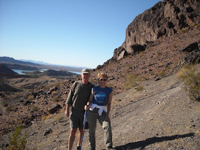
An Afternoon in the Desert

Considering we were away from family and could only connect up with them by cell phone, we otherwise had a nice Thanksgiving break. The park's Thanksgiving Dinner turned out better than expected, as we had about 30 people, far more food than necessary,... and a singing ranger who entertained us for over an hour after the feast. Bright sun and enough warm clothes made us all forget about the cool breezy weather.


Our traditional Thanksgiving movie is "Planes, Trains, & Automobiles" (Steve Martin, John Candy, et.al.) and it was dusted off for it's annual viewing again this year Thursday night. It's a corny old film that still makes me laugh... with a little holiday-season heart to boot. Very enjoyable.

Friday, we fought the urge to rush out do battle with the hoards looking for the best deals (didn't take much for me to fight that urge!) and instead went for a drive in the desert. Much of this part of Arizona is public land managed by the Bureau of Land Management. While there are some rules about what you can do here and there, it's pretty much open to the public for anything you feel like doing... hiking, boondocking, 4-wheelin', rock-hounding, having a camp-fire, and whatever else you could come up with.

Section of the Old Trails Highway (1912)
Around our desert campfire... relaxin'
There are paths and roads and trails that snake all around these lands... and if you don't see a road, just start a new one. But most of these "roads" are really Jeep trails that require a high-clearance 4WD vehicle to engage them with any confidence. As you know, the low-clearance Hocus-Focus is definitely NOT any of those things... so we proceeded cautiously. We did manage to find a section of the Old Trails Highway -- a coast to coast roadway alignment designated by the Government in 1912 -- the precursor to Route 66. It was primitive then... and what remains hasn't changed much. Finding a nice flat spot on top a rise... with a 360 degree view of the surrounding lands... we parked and killed the afternoon looking for rocks and meteorites (on good authority, the area we were in was an impact area for a meteor that ran into Earth some years ago), hiked around, found a geo-cache, started a campfire, and just relaxed. With nary another soul around, it was one of the best afternoons we've spent in some time. Might have to trade in the Focus on a Jeep one of these days.

Returning to our campground about night-fall, the big surprise was we were just in time for the parade of golf carts from a neighboring RV Park just up the road a piece... all decorated in Christmas and holiday themes. There were more than 20 of them... and it was cool to see them parade around our State Park with all the campers hootin' and holerin'. Dar was in her glory. Here's a link to a video we took of the event so you can get a feel for what it was like.

At this point, Saturday afternoon, we're thinking we might extend here another day or two... letting the desert warm up a bit before we take our turn boondocking down around Quartzsite for a few days... our next stop. This morning we had 32f, and the next couple mornings could be colder yet. It's one thing when we're plugged into power... it can be another when you're relying on some old weakened batteries that don't have the poop they once did.  We'll make the decision tomorrow morning, Sunday, our current day of departure.

T

Nov 25, 2010

Giving Thanks

We're planning a quiet Thanksgiving here at Cattail Cove State Park in Arizona. The park is sponsoring a Thanksgiving dinner at 1pm, complete with live music... and all we have to do is bring a side-dish to pass. I'm sure it'll be a good time.

I usually get a little pensive on holidays like this one, and I know my thoughts will wander around to all the things I'm thankful for. But at the top of the list is the family that we're lucky enough to have... Moms, Dads, Daughters, Sons, Brothers, Sisters, and Grand-sons. The very next thing on the list is our health... without which, nothing much else matters.

Happy Thanksgiving Everyone
T&D

Nov 23, 2010

Cracks and Chutes

In my last post I wrote, about Parker Dam, that it's the next lower dam on the Colorado River below Hoover Dam. That isn't the case. Rex and Mary over at Happy Camper caught the error and "reminded" me that the next dam below Hoover is the Davis Dam at Laughlin/Bullhead City which forms Lake Mojave. Parker Dam is the one below Davis. Thanks, you guys, for stopping by the journal... and for keeping me on my toes.

The last couple days we are clearly in R&R mode. Dar's been working on her online photo albums and doing more genealogy research. I've done a few small projects around the bus-house and have been reading "A Short History of Nearly Everything" by Bill Bryson (yes, on the Kindle and a very enjoyable read if you like science and history). Yesterday we ran into town for lunch at the Mudshark Brewing Company restaurant in Lake Havasu City (which was excellent... both the meal and the craft beer) and then took an interesting hike (known as "Crack in the Mountain") through some rocky terrain between AZ-95 and the river, just south of Lake Havasu City.


One of my projects that's gotten a lot of kudos from Dar has to do with our kitchen waste basket. I don't know about other RV's, but the bus-house had no built-in place for a trash can. At first we had an attractive covered thing with a step-on pedal that raised the lid so wastes could be deposited without the use of any hands whatsoever. Nice, but it used valuable floor space next to the cabinets in the kitchen, and was always getting in the way -- not a good thing when living in 300 sq. ft.. And when we traveled, we had to find a place to stow it lest it become a missle during quick stops.

The flip-out cabinet panel
What did come from the Newmar factory was a flip-out cabinet panel immediately below the kitchen sink, which provides access to a small storage space for kitchen sponges and brushes... anything small and wet... in a plastic tray attached to the inside of that panel. A flash of brilliance (her words, not mine) occurred one day when I realized that if I relocated that plastic tray a few inches to one side, and installed a home-made plastic chute-like affair next to it on the inside of that panel, most trash could be quickly, well, "trashed" by simply opening the panel and dropping it down the chute, and into the trash can securely situated inside the cabinet below and immediately under the chute.

The Chute with trash can below

Well, that worked well for the past few months, with one exception. Not wanting to drop large or sloppy or greasy trash down that chute, it was still necessary to open the lower cabinet where the trash can resides, and maneuver the object of your defection down and through the narrow space on top the receptacle.

A second flash of trash can brilliance occurred when I realized I could hang the trash can on the cabinet door with a couple simple hooks. The chute would still work fine... maybe even better since the trash can is now closer to the chute. And for those larger and sloppier hunks of trash, opening the trash can door now provides simple and easy "drop-in" disposal, without any contortions or maneuvering at all. And, best of all, it works whether we're moving or parked.

Detailed plans can be yours (remember, Christmas is just around the corner!) by sending a self-addressed stamped envelope to Merkel Press, along with a $24 contribution to defray expenses. Oh OK, just kidding... you really don't need plans anyway.

Can you tell I don't have much to write about?
T

Nov 21, 2010

On the Shores of Lake Havasu

Hi everyone. We've decided to take advantage of a deal here at Cattail Cove, an Arizona State Park right on the shores of Lake Havasu... pay for 5 nights and get 2 nights free.... and that means we'll be here until next weekend. This certainly fits in the budget and, since it's a holiday week, we're looking for a place to lay low for a few days anyway. The Park is even having a Thanksgiving Dinner to which we're invited, and since we won't be with family for the holiday, this could be the next best thing.


There are no complaints in the weather department from these two explorers. Despite a windy and cool day today, compared to Pahrump we're 20 degrees warmer. And with winter descending on all members of our family in the northern latitudes (daughter Andi called and has snow on the ground in the Portland area), there won't be any grumbling about chilly or breezy Arizona weather from us.

On Saturday we explored parts of the area around Lake Havasu. We especially liked seeing and learning about Parker Dam... the next lower dam on the Colorado River from Hoover Dam. It creates Lake Havasu, which is a major source of life-giving water to Phoenix and Tucson through the Central Arizona Project, as well as for the Metropolitan Water District of Southern California so they can keep their grass green. For the sake of all those people I hope the precipitation picks up markedly in the mountains of Colorado and Utah during the next few winters, and Lake Mead starts filling again. I really don't want to hear about crazy schemes to pipe water from the Great Lakes or Oregon, or to lasso ice bergs in the Arctic and drag them by tug boat to the Port of Long  Beach -- all real proposals at one point or another in the past. I mean... really? Where's the money for that going to come from considering the states of Arizona, Nevada, and California are all broke and technically bankrupt?

I wonder if the tea party can fix this?
T

Nov 19, 2010

Gettin' Out While the Gettin's Good

Last night, Thursday night, I checked the weather before climbing in the sack... and saw an already deteriorating forecast deteriorate further. Saturday and Sunday had already been tagged as "No Travel" days by the Safety Director, but now Monday was beginning to look "iffy" too. Much colder weather, snow in the pass between Pahrump and Las Vegas, and high winds... out of the south, of course (the dreaded but all too common headwind). Hmmm. We could hunker down for a few days in Parhump and let it all pass -- or we could just get out of town a little early, on Friday, today... sort of "gettin' out while the gettin's good".

So that's what we decided to do... move today. Dar stowed most of the interior stuff before bed. And this morning we were both up early, before daylight, to attack the pre-move checklist. Today's forecast still called for stiff southerly winds, building during the day... so the earlier we could get going the better. And, in a rare display of organization and motivation, we had all systems ready to go, the toad hooked up, and the wheels turning by 8am. Because we loose an hour when we cross from Nevada into Arizona (yes, back to the Mountain Time Zone again) the early start also gave us some breathing room on the other end, where we really didn't know for sure where we'd be staying.

225 miles later we find ourselves at Cattail Cove State Park, on the banks of Lake Havasu and just south of the booming town of Lake Havasu City in Arizona. We paid for two nights while we check out the area and see what else is around... would consider camping in the area for a week or more, if we found the right spot.

The weather here is a full magnitude better (on the Frobush Scale) compared to Pahrump... especially for the next few days. We're a couple thousand feet lower (500 feet vs. 2600 feet in Pahrump) and couple hundred miles further south... both of which make a big difference to those seeking sun and warmth.

Oh, and Yes, we did take the bus-house over the new bridge at Hoover Dam on our way south today. It was a total non-event, just as our explorations earlier this week predicted. There was a high-wind procedure in place today... where all trucks and high-profile vehicles are advised to use the left hand (innermost) lane when on the bridge. But we made it over without incident... or drama. Aw, Shucks!

More tomorrow...
T

Nov 18, 2010

Over the Dam Bridge

Until just the past few weeks, all traffic between Las Vegas and Kingman, AZ. on US-93 had no choice but to travel over the top of Hoover Dam. And getting over the dam can be a slow and tortuous process, with steep grades and narrow turns as the road descends canyon walls down to the dam and then back up the other side. The speed limit on the dam itself is 15mph due to the amount of tourist congestion (mostly people from Europe taking advantage of the cheap dollar to see the wonders of the United States). Better plan on a late arrival... wherever it was that you were going.

Well Bunkie, that's all changed now that the new O'Callaghan/Tillman Memorial Bridge (the Dam Bypass Bridge) is complete and open to traffic. Built just 1500 feet downstream from Hoover Dam, it's supposedly the first (thus the largest) concrete and steel composite arch bridge in the USA and includes the largest concrete arch in the western hemisphere. It is, no doubt, a big bridge. The roadway is about 900 feet above the Colorado River making it the second highest bridge in the nation -- 2nd only to the Royal Gorge Bridge in Colorado.


We'd heard from other RVers who saw the bridge while it was still under construction... that they didn't think they'd be able to cross the completed bridge without going into spasms, getting a serious case of the vapors, passing out altogether, or some combination of the three. To say the least, that had Dar concerned as we thought our route into Arizona with the bus-house was going to be down US-93 and over this bridge.

So, Wednesday, we loaded up the car and headed off to investigate. The main objective was the bridge, but it's been a few years since we've visited Hoover Dam so we thought we'd renew our memories of it too.

Arriving in the vicinity we decided to jump right in and drive across the new bridge first-thing. In addition to the bridge, new sweeping approaches were built on either side that provide the comforting feel of an Interstate Highway -- 4 wide lanes with broad paved shoulders. As we approached the bridge, curving around rocky outcroppings, we suddenly found ourselves on the bridge... at least what we thought was the bridge. But due to the wide bridge deck and shoulder-high solid concrete walls on both sides, we couldn't see anything... especially from the low-slung Hocus-Focus. OK... there's the sky... and there's a couple rocky outcroppings... but where's the river??? where's the dam???... before I could say "whiskey tango foxtrot" we were across. As for the bridge itself, remember ALL the structure is below the road deck... none of it is visible as one motors across. The experience can be summarized as feeling like driving an Interstate Highway through a mountainous area. Well, that was a let down! I was looking forward to Dar screaming and hyperventilating... maybe even passing out. But it wasn't to be. Honestly, it was a non-event.

Driving across the new bridge... or is it an Interstate Highway through the mountains?

On the other side, the Arizona side, we found the old road back to the dam was closed. Apparently, through traffic on the old road is no longer permitted... and access to the dam and visitors center is from the Nevada side only. That meant we had to turn around and drive back across the bridge. As we did so we noticed people -- quite a few of 'em -- walking on the new bridge in a separate pedestrian lane on the side closest the dam. "Wow... I'll bet the views from out there are stupendous!"

The bridge design includes pedestrian access out onto, and all the way across, the bridge. That's right, you can walk out there, dangle your camera over the side and get all kinds of interesting photos of the dam, the powerhouses, the river, Lake Mead, and the canyon walls that contain it all. It was so secure-feeling that even Dar, who looks for alternate routes around almost all bridges, had no problem with it. In fact, she walked all the way across and all the way back... stopping many times to lean over the edge to look and take pics... wasn't bothered a wit. This seems very strange, doesn't it? It certainly did to me.

At the edge of the bridge... and not a bit nervous.

But I have a hypothesis and it's this: due to the scale of everything in the vicinity... the shadowing mountains, the high canyon walls, the big old dam... it's all of such immense scale that it makes the bridge feel like "no big deal". Even right out in the middle... where Dar had me hold her by the ankles as she stretched-out over the railing... over the edge... to get that perfect straight-down (900 feet) (almost the height of the Hancock Building in Chicago) shot of the Colorado River and the bridges arch far below... well, it just didn't bother her at all. Strange to say the least. We both agreed it must have something to do with scale.

But despite how the experience impacted the two of us, we're really glad we did it. Explorers never know exactly what we'll find or how we'll feel about the experience. It was just one of those things we had to do.

With the dam bridge experience behind us, we drove down the old road to the dam, parked, and walked around. With traffic now shunted to the new bridge, it's a much more relaxing experience. We even found a rocky outcropping above the dam for a quick lunch.


Lake Mead, the lake created by Hoover Dam, is very low. In fact, it reached a historic low-point just this past Sunday, when it eclipsed a previous low set during the drought-stricken 1950's. Right now, there is less water in the Lake than at any time since it started filling back when the dam was completed in 1937. In the photos we took of Lake Mead, that white-ish coloring in the rocks just above the water graphically shows the high water level of the pool... some 150 feet above the current lake level. Everyone is nervously watching precipitation levels in the mountains above the lake, hoping for some wet years that can reverse the trend. But the demands for water from the Colorado continue to increase. Besides Las Vegas, Phoenix and Tucson are dependent on the Colorado for continued existence. Some believe the current level of population in the dry southwest is simply unsustainable in the long term. I don't know if that's true, but others have told me that as the water level drops, the number of buzzards circling above populated places increases. Hmmm.

So anyway, back to the bridge: if you're planning a trip through this part of the country, don't alter your plans due to any fear of heights or large bridges. Unless you're paying close attention you might cross the bridge and not even know it.

Bridge?  What bridge?
T

Nov 17, 2010

Dar's Back

Just a short post to bring the Journal up to date.

I retrieved Dar from the Las Vegas airport last night. Even though she had a great visit with family in Wisconsin, she was happy to be "home".  The flight back was unremarkable and arrived a good half-hour early. We stopped for a quick and light bite to eat on the way back to Pahrump, and got back to the bus-house by 8pm or so.

In a few minutes we're heading out on an exploration of the Hoover Dam and Lake Mead area. That means driving back to Vegas again, but intrepid explorers occasionally have to endure previously charted territory in order to reach the frontier. That's just the way it is in the exploring business.

Looking ahead, we're paid up here at the Escapees Park in Pahrump until Saturday. But wouldn't you know it... the weather is looking a bit "iffy" this weekend. So I think we'll look into tacking a day or two onto our stay, and wait for good traveling weather.

Now, where's that dam...
T

Nov 15, 2010

Mundane Monday Musings

I'll tell you what... it'll be good to have my travel partner back tomorrow evening. There are times when I look forward to a little solitude, a little time to myself.  But I've had my fill the past few days. In a recent post to this journal, just after Dar left last Thursday, I think I alluded to the many solo travelers and wanderers that are out there... seeing the country... and that I may be getting a glimpse into that lifestyle status. I can see why they find ways to connect with others on a regular basis. Whether they're caravaning in small groups, attending solo group rallys and get-togethers, or connecting up in the virtual world through blogs or other social networking tools... we all need to be in touch with others from time to time. I'd have to become much more extroverted if I ever needed to carry on by myself. Hurry back Dar!

Part of my weariness with the past few days is probably due to the tasks I've been putting off... and then decided I need to get done while I was alone. Among these was backing up about 2 years worth of photos and getting them off-site (out of the bus-house) for safe keeping. The recent tragedy of our friends in Rockport really sparked me into action on this one. I now have a backup routine that's not perfect... doesn't protect us 100%... but it minimizes what we could loose to, at most, a few weeks of photos. Of the other important computer files the most we could loose is a few days of updates. I don't want to bore you dear readers with the specifics. But if you'd like to know what I do, I'll be happy to reply to e-mail inquiries on the subject. And maybe I can learn something from you.

We have three laptop PCs on board and I used some of my "solitude" to clean them up, perform updates, etc. Windows PCs are always in need of updates for one thing or another... it's a never ending task. Others tell me I should move to an Apple Mac. Besides the $$$, I'm a little concerned about the learning curve and jumping through hoops to get everything working on a different platform. One program I use almost every day is a text editor that I've used for just shy of 100 years... and there's NOT a Mac version. Hmmm. No, I think we'll be Windows-Wanderers for a while yet.

For a break, I took a couple drives to explore the edges of the Pahrump Valley over the weekend. Most of the roads I found, up high... close to the mountains... had me pining for a Jeep or a half-track. Apparently asphalt is in short supply around here...or it could be there's no money to pay for a little asphalt??. Either way, the roads kept me from going too far with our low-clearance Hocus-Focus.

Tomorrow there's a bunch of domestic chores on the agenda and the place will be gleaming by the time Dar walks in tomorrow night. Who knows, I may even make the bed.!?

T

Nov 14, 2010

Pondering a Parable

From time to time I ponder the topic of "purpose"... the purpose of our travels, of our nomadic lifestyle, of this blog... indeed, of our very lives. The subject was re-awakened in me this morning by a good and wise friend, who sent me this verse. Thanks Pat.

If you're inclined to pondering at times, it might provide some fodder for you, too, on this quiet November Sunday.

Parable
First divesting ourselves of worldly goods, as St. Francis teaches,
in order that our souls not be distracted
by gain and loss, and in order also
that our bodies be free to move
easily at the mountain passes, we had then to discuss
whither or where we might travel, with the second question being
should we have a purpose, against which
many of us argued fiercely that such purpose
corresponded to worldly goods, meaning a limitation or constriction,
whereas others said it was by this word we were consecrated
pilgrims rather than wanderers: in our minds, the word translated as
a dream, a something-sought, so that by concentrating we might see it
glimmering among the stones, and not
pass blindly by; each
further issue we debated equally fully, the arguments going back and forth,
so that we grew, some said, less flexible and more resigned,
like soldiers in a useless war. And snow fell upon us, and wind blew,
which in time abated — where the snow had been, many flowers appeared,
and where the stars had shone, the sun rose over the tree line
so that we had shadows again; many times this happened.
Also rain, also flooding sometimes, also avalanches, in which
some of us were lost, and periodically we would seem
to have achieved an agreement; our canteens
hoisted upon our shoulders, but always that moment passed, so
(after many years) we were still at that first stage, still
preparing to begin a journey, but we were changed nevertheless;
we could see this in one another; we had changed although
we never moved, and one said, ah, behold how we have aged, traveling
from day to night only, neither forward nor sideward, and this seemed
in a strange way miraculous. And those who believed we should have a purpose
believed this was the purpose, and those who felt we must remain free
in order to encounter truth, felt it had been revealed.
— LOUISE GLÃœCK, winner of the Pulitzer Prize and
    author, most recently, of “A Village Life”

From the New York Times Opinion Pages; "Falling Back"; November 6, 2010 

Nov 12, 2010

Pahrump... Harrumph

At the risk of offending all our readers in Pahrump (wink), I've got to report that we've been generally disappointed with what we've found here. There's no doubt that it's a unique place with a unique history, but aspects of it just leave us shaking our heads. Before I start in, I want to make it clear that I'm writing about the overall town in this article... not the Escapees RV Park where we're staying -- which is well maintained and controlled by the owner/residents. We always find Escapees Parks to be desirable places to spend a few weeks. The following is in reference to the town of Pahrump.

First, a brief history lesson, copied from Wikipedia...
Pahrump was originally inhabited by the Shoshone. It was discovered and slowly inhabited by American settlers in the late 19th century. They reportedly chose the name for the valley which Pahrump is named after the original indigenous name Pah-Rimpi, or "Water Rock," so named because of the abundant artesian wells in the valley. Because of these artesian wells, the new inhabitants of Pahrump Valley began a number of large ranch-style holdings, mostly over 1000 acres (4 km²) in size. On these ranches, alfalfa, cotton, and livestock were raised. Until the 1960s, Pahrump had no telephone service and there were no paved roads in or out of the Pahrump Valley. However, as Las Vegas grew, real estate speculation became more popular in the area, which led to increased interest in Pahrump. This led to the introduction of telephone service and the construction of a paved highway, from Las Vegas to Pahrump, during the late 1960s.

The population of the valley grew almost exponentially from about 2,000 residents in 1980, to almost 25,000 as reported by the 2000 census (just 20 years). An estimate in 2007 pegged population at about 40,000 (wow, another 15,000 in just 7 years!!) -- but I'm guessing the '08 economic crisis and the resulting collapse of the housing market has lowered that number somewhat.

Pahrump is an unincorporated town and, supposedly, the largest such unincorporated settlement in the USA. There's some talk about the idea of incorporating... but I don't know what the issues are or where it stands at this point. It's a large, spread-out place... extending about 16 miles in a north/south direction, and about 9 miles east/west.

Now to our impressions: The place is much larger and more spread out than we imagined. As we first drove through the length of town on NV-160, we found mile after mile of what I'd describe as dispersed rural living... single level homes, many of them manufactured housing (double-wides), on small acreages or large lots. The more heavily traveled roads are paved, but many are not. Because it's very much a desert environment, most places keep the original desert landscape as their yard... grass requires huge quantities of water and expense. The core of town, if there is one, seems to be the intersection of NV-160 and NV-372, where there are a few casinos, a Super Walmart, a couple strip malls, grocery stores, and a Home Depot.

We explored a couple residential areas near the center of town and found a very mixed bag. One of these looked, on the map, like a planned neighborhood -- with parallel curved streets and what appeared to be parks or common areas. But what we found were unpaved streets and almost no houses... just curved gravel roads through the desert floor... certainly someone's big project that failed in some way.

The next one we explored was a golf course neighborhood... houses built around the fairways of an 18 hole championship golf course. Ah, maybe we've found the desired neighborhood... the place where up and comers in Pahrump aspire to be? Hmmm. There were many homes that surrounded the course... only a few empty lots, and the streets were indeed paved. There was more grass and greenery around the homes -- what you'd expect in a golf course community.

But closer inspection of the golf course revealed it was abandoned and left to die (the desert isn't kind to large expanses of grass if it isn't continually watered). It was almost eerie. Large deciduous trees that had apparently been brought in to line the course were also all dead... couldn't survive without irrigation. Scrub vegetation with cart paths winding throughout. We found the very nice looking club house, which was now rented out to a congregation of some sort for religious services. Later research found that the place had failed two years ago and was just recently sold at auction. Supposedly, the new owner intends to get the course started again, but other legal issues remain. It seems the original owners had contracted with a local private sewer and water utility to use a large quantity of waste "gray" water for irrigation of the grass. After the course went bankrupt, somehow (and no one's owning up to it) raw sewage has found it's way into the holding ponds around the course... creating a big stink in more ways than one. Hey, sounds like a place I'd like to have a house!

Driving around the edges of town we did find a few areas of newer homes and well maintained yards... clearly in the minority. But even there it was common to have a trashy, rubbish-strewn yard right across the street. The average place, the standard apparently, seems to be a double-wide mobile home surrounded by trash... old cars, the flotsam and jetsam of too much material accumulation combined with too little space in the double-wide... yesterdays treasures jettisoned to make room for today's bargains. Place after place, in parts of town, are like this. And because the desert environment can be dusty and dirty when the dry winds blow (and they can blow pretty good here), there's a layer of desert on anything that hasn't been moved or recently washed.

Add it all up, the lack of grass and greenery, the common trashy environment, the uncertainty of government status, poor infrastructure, the scent of financial failure, and a questionable future... it's easy to report that Pahrump is NOT on our list of possible future home bases... not what a couple kids from Wisconsin can deal with. I'm sure there are some REAL bargains out there, but someone else will have to gamble on them... we're out of the game.

I also ponder if this is what results from low taxes and small government? Maybe this exercise provided a glimpse into our future?

Sorry Pahrump... I really wanted to like you.
T

Nov 11, 2010

Come Fly With Me...

This morning Dar caught a Southwest flight to Wisconsin. She's joining her sister and her Mom for a "girls weekend" and making some preparations for the upcoming holidays.

And that leaves me here in Nevada, alone. Anticipating these solitary periods is better than actually experiencing them. I have plans, a bunch of work to do... but today, after I got back from the airport, I pretty much just veg'd. Maybe a glimpse into the world of the solo explorer?? In any case, having someone to share experiences with is what I've come to enjoy.

The Las Vegas airport was a zoo this morning. They say fewer people are coming to Vegas.. but you'd be hard-pressed to verify that in the "departure" lanes at the terminal. Traffic just crept... stop and go and very slow... the result of cabs and hotel vans just stopping to drop off passengers in any lane they happen to be in. Here, in Vegas, apparently there's no need for courtesy or concern about other travelers. Why should they move over to the curb lane... or even the lane next to the curb lane? They regularly use ANY of the 5 or 6 lanes... simply stopping, opening doors, dropping passengers, passing bags, tipping, and on and on. In any lane.

Have I mentioned lately how much I like big towns... crowds... congestion?

Well, Dar's safely in Wisconsin now... and I think I'll hit the sack.

Thom

Nov 10, 2010

A New Low

Tuesday, we went over to Death Valley National Park, about an hour drive west from Pahrump. With less daylight for exploring this time of year we made an effort to get started early -- and surprised ourselves when we were actually moving by 9am. The weather was perfect for exploring Death Valley... cool and very sunny. Let me tell you Bunkie... there aren't many cool days in Death Valley.

Death Valley was the name applied to the area by prospectors and miners during the California Gold Rush days during the 1850's. Aligned north-south between two mountain ranges near the California/Nevada border, it's about 70 miles long and 10 to 15 miles wide. The unique geography of the area makes it the lowest, driest, and hottest spot in North America. The average daily high temperature never gets below 65ºf (usually in December) but climbs to 115ºf during the long summer... and long periods of temps over 120ºf are regularly recorded. The hottest day on record is 134ºf which occurred back in 1913. The average annual rainfall is just 1.5 inches and there are a few years on the record with no rainfall at all.

Most of these extreme conditions are due to the valley's geography... a low valley (the entire valley floor is well below sea level) surrounded by high mountains. There are four mountain ranges between the Pacific Ocean and Death Valley which wring almost all moisture from the westerly breezes long before arriving here. The resulting lack of moisture makes for extreme desert conditions -- almost no plants or foliage of any kind -- which means the sun heats the surface of the valley floor quickly and efficiently. The thus heated air rises but is trapped by the surrounding mountains and persistent high pressure (that results from it's extreme low elevation)... and sinks again for another round of heating. This solar heating cycle has been described as a huge natural convection oven.


We stopped at Zabriskie Point on our way down into the Park, where we got our first view from a relatively high vantage point. A little further down the road, right at sea level, we stopped to explore the Furnace Creek Inn, a luxury hotel built by the Pacific Borax Company during the roaring 20's. The hotel caters to guests who have 3 or 4 "Franklins" to surrender for each nights stay --  a group we're not part of. A desk clerk (from Wisconsin, no less) told us to look around and then leave by the basement exit... in order to see the Inn's marvelous gardens... a real oasis in the desert.


After a stop at the National Park Visitor Center in Furnace Creek... to see the overview film about the Park and to stamp our National Park Passport, we drove a short distance north to the ruins of the Harmony Borax Works. Despite some small finds of gold, silver, and other minerals in the valley during the middle 1800s, the material that produced the most wealth was Borax. Borax is a mineral that is used in a variety of products and processes... from metal-working to cleaning agent to food additive and many more. After it's discovery on the valley floor in 1880, an industry developed that collected and processed the raw mineral into a more concentrated form, and, for 6 short years, was carted out of the Valley to a rail-head in Mojave, CA. by 20 mule team wagon trains. Who of our vintage doesn't remember Ronald Reagan (one of many hosts over the years) and the Death Valley Days radio and TV program sponsored by the 20 Mule Team Brand?

Before actually being here, our mental image of the place did not include the quantity or nearness of the mountains that border the narrow valley. I'm sure those faulty images were formed by the 20 Mule Team Borax advertisements that were set in the desert... what I thought was a nearly endless desert in all directions. But TV isn't reality... despite the urge to make it so.

Death Valley National Park is a big place and there's a lot more to do and see than can be done in one day. So we decided, with only a few hours of daylight left, to explore the area south of Furnace Creek and toward Badwater Basin. We did the two mile hike of Golden Canyon, stopped at Badwater Basin to do the touristy thing at the lowest spot in North America, and did the Artist Palette drive.


About Badwater... during our stop there we walked about a half mile out onto the salt-flats to get a feel for the size of the basin. The well-trodden path out there is all salt, which later we were scraping off our soles so we wouldn't be tracking it into the car. Interestingly, this lowest point in North America is just 85 miles from the highest point in the lower 48 contiguous United States... a difference of almost 15,000 feet in just 85 miles.

We both found Death Valley to be a fascinating place, one that we'll visit again... maybe even next week after Dar returns from her weekend in Wisconsin. There's a lot more to see and this is the best time of year to be there.

And Dar is trying to process the hundreds of images we shot during the day. I think she'll have them online before she leaves tomorrow morning.

Looking up the difference between a mule and an ass...
T

Nov 9, 2010

RV Blunders

A few days ago, during our stay in Fernley, we were entertained one morning by two separate neighbors as they pulled out of the RV Park. All RV'ers make mistakes from time to time... I know we've made a few. But the two we witnessed that day are of the type that really shouldn't happen if even a modicum of care is taken during departure.

Blunder One: a motorhome parked immediately to our right. After unhooking all the utilities, hooking up his car (he tows a Jeep Liberty, with a tow-bar, all four wheels on the ground), and warming his engine for a few minutes, he started driving off, but turned the wrong way, away from the angle of the parking pad and the natural flow of traffic... apparently trying to short-cut his way out of the park. Well, big motorhomes don't turn very short... and due to turning the wrong direction, he wasn't quite able to make the turn without backing up and taking another stab at it. The problem is that when you're towing a car, four wheels down, you NEVER, EVER back-up. You see, the front wheels of the car naturally "caster" correctly when going forward, that is, they naturally steer themselves in the direction of travel. But in reverse, they do the opposite of what you'd want them to do... and do so quickly. So, as our friend backed up, Dar and I watched as the front wheels of his car abruptly turned all the way to the left and his reverse motion was pushing the front end of the car sideways. Doing this can destroy a tow-bar, damage the car's steering and alignment, or both. But despite the awkward position of the towed car, it's front tires screaming in protest as they were dragged sideways, and this guy continued backing until he though he could make the turn. I wondered, as he pulled out of sight, if he knew or cared what he'd done... and if he'd damaged anything. Preventing this blunder is easy... don't ever back up when towing. If you get caught in a tight situation and can't continue without backing up, always disconnect the car from the tow-bar and re-connect when you can continue forward again.

Blunder Two: not 20 minutes after Blunder One, another fellow with a motorhome drove through the same site in a similar effort to short-cut his departure from the park. The good news is that he was able to make the turn without using reverse. The bad news is that he was dragging about 25 feet of his big 50 amp power cord... the one that plugs into the power receptacle at the site. Yeowzer! These things don't come out, un-plug, of the power pedestal easily... especially when pulled from the side with a motorhome providing the power... and almost always they damage the power ped at the site. He too wasn't aware of what happened and drove merrily on his way. Don't have any idea how far he got before someone alerted him to his dragging, and by that time, frayed power cord. Preventing this blunder is also easy... make it a point, prior to moving the RV, to get out and do a complete walk-around checking for things like this, or that the jacks have been retracted, and steps and awnings are stowed.

I don't know if other RV'ers do this, but watching arriving or departing neighbors is big sport with some of us... watching for mistakes or trying to learn something.

Now, where's that hose...
T

Nov 8, 2010

Paltry Post from Pahrump

I've got more to report than what's in this short journal entry, but I'm tired and just don't have the motivation after that Sunday night tight nail-biter football game that drained nearly all my energy. Of course, I'm talking about the Green Bay - Dallas game. I know... I know... the final score (45 -7; Green Bay) doesn't sound very close... in fact, it sounds like a bigger blow-out than this past summer's BP Macondo Well disaster in the Gulf of Mexico. But, for Packer fans, there's no margin that's a comfortable margin... and we suffer through each and every play until it's over. At the end, though, we were ahead... so it was a good day. But I'm still exhausted.

Monday, we're thinking we might run over to Hoover Dam and check out the goings-on at the old dam place. I understand there's a new bridge over there too. And then Tuesday, if the weather holds, we think we may run over to Death Valley National Park.

So check back for more posts from Pahrump.
T

Nov 6, 2010

Glowing Tonight

Between 1951 and 1962, the U.S. Government saw fit to detonate about 100 atomic and nuclear warheads here in Nevada. All of these detonations were above-ground tests... but many more subsequent tests were below ground... almost 1,000 more. These blasts took place at the Nevada Test Site, a 1400 square mile area of desert and mountains that starts about 10 miles from Beatty, NV... our camp tonight. Can you imagine the spectacle as the residents of Beatty gathered their friends, families, and children around and watched A-Bombs and H-Bombs being tested within a few dozen miles of their homes? Did they grab a beer and wait in lawn chairs for the blasts? "Hey Marge... come on out here and get a load of these fireworks... Boom!" ... It must have been a different world.

Yesterday morning, Friday, we finally got underway from Desert Rose RV Park in Fernley. It was a perfect day for traveling and seeing the expanse of Western Nevada as we traveled down US-95 toward Las Vegas. The miles melted away as we passed by Walker Lake, and the stunning views of high mountains to the west kept our heads spinning for much of the trip.


Once we arrived in Tonopah, our original goal of the day, it was just after noon... still early. So we decided to press on southward and ended up just outside of Beatty, about 100 miles to the northwest of Las Vegas. We're here only for an overnight... Saturday we're off to the Pahrump area where we hope to establish a camp for the next couple of weeks.

By the way, our coolant leak repair appears to be holding. At every stop I checked, but never noticed so much as a drop of wayward coolant.

What's that green glow off to the east?...
T

Nov 5, 2010

Cat In the Trash

The other night, oh, probably about 10pm or so, Dar asked if I'd take the trash out to the dumpster... you know... didn't want to wake to a smelly trash can the next morning and all that.

"Sure", I said, don't mind a short walk at all... a chance to stretch my legs a bit before bed. So off I went, into the dark, on the trail to the local dumpster a couple hundred yards away.

The RV park is dimly lit... millions of stars overhead but no moon... and it's quiet... very quiet. I know, having been here other nights for the same purpose, where the dumpster is located... off in a dark, out-of-the-way corner of the park.

As I drew close I could make out that one of the two big plastic dumpster covers was open... making the job of depositing my bag O' trash a simple matter of flinging it skyward, in a big lobbing arc, into the deepest recesses of the big receptacle.

And, as I did so, with great accuracy I might add, there was an unexpected, loud, and very ear-shattering YEEOWWW... and as quickly as the trash bag arced in and found it's target, a cat... no, a big black cat... an immensely huge feline... probably a bob cat or a mountain lion... let out this blood-curdling scream and leaped out on a similar and immediate reverse arcing path... completing a trash/cat round-trip in less than a second. Bag in... Cat out... that fast.

I am happy to report my sphincter muscles still have the same quickness and zip they had in my youth. Although startled... a bit shocked... heart skipped a few beats while it decided whether this was the end or not... and very wide-eyed, I did survive this attack by a viscous, rabid, jaguar!

But I'll tell you this... it'll be a while before I'm so eager to take the trash for another late night walk.

T

Nov 4, 2010

Flow Keeps us in Fernley Another Day

Just a short post to say that we're still in Fernley tonight. Plans changed.

As we were getting underway this morning, I noticed a puddle of what turned out to be engine coolant on the pavement under the rear end of the bus-house. Just like the human body, most of the bus-house's vital fluids are supposed to be sealed and contained within the systems they're designed for... and not spilling out willy-nilly on the ground. A check with the Safety Director confirmed this. OK, we've got a problem and we're not going anywhere until this is resolved.

After a few phone calls, inquiries, and conversations with RV park staff, we found a mobile diesel mechanic who could be over in two hours (ain't small towns great!). The nice thing about talking with locals is that they can provide the inside scoop on people or businesses like this... relay the experiences others have had... thumbs-up or thumbs-down. And this guy came with the highest recommendations.

At the appointed hour, George showed up as promised in his well equipped mobile service truck. He wasted no time crawling under the bus-house and looking over the situation. He found a bundle of heater hoses, tees, and clamps in what appeared to be the problem area. Closer inspection revealed that the clamps that held the hoses to the tees were loose... some of them very loose. I can't explain why, but they were loose... and I can't explain why they decided that today was the day to start leaking big time. Regardless, George cleaned up the area, opened the bundle (which had been zip-tied together), and tightened each of the six clamps. We then ran the diesel until it was hot so he could examine the area again and declare the problem solved. We really won't know for sure until we start up again in the morning... but there's high confidence that we've licked this one.

Considering the "flow" of the day (pun very much intended), we decided to just extend our stay here by one night and attempt launching again tomorrow, Friday, morning. These things happen once in a while... why even the Space Shuttle is regularily delayed by a leaking this or a faulty that.

In case anyone has need of a diesel mechanic in the Fernley area, call George Dickerson of Dickerson's Mobile Truck Repair (775.575.7277). A hard worker and great mechanic at a fair price.

T minus 14 hours and counting -- launch sequence has been re-started...
T

Nov 3, 2010

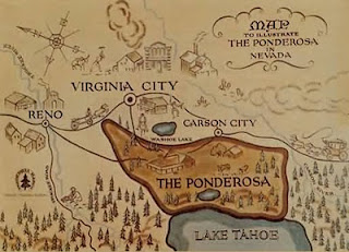
Virginia City Bonanza

There it was -- Virginia City. Right there on the map, just a little way from Lake Tahoe and Carson City. As a kid in the 60's, I saw Virginia City on TV every week... it was the nearest town to the Ponderosa Ranch, and where Ben, Hoss, Adam, and Little Joe had to go for supplies and story-lines for the famous TV show Bonanza. And there it was!

Well, the mostly flat and fictional Virginia City of the TV show (actually a backlot set at Paramount), was a tad different than the real one. The real Virginia City was a  mining boom-town, it's entire reason for existing at all was that it was sitting on top of one of the richest silver strikes of all time... the mother of all lodes... the Comstock Lode. Perched on the side of Mt. Davidson, a peak in the Virginia Range here in Northwest Nevada, the town exploded with growth after the first silver strike in 1859, eventually growing to more than 10,000 residents by 1880. But by that time, after 20 years of intense mining activity, the slow decline had already begun and it was generally considered that the Comstock lode was almost played-out. By 1900, the town had shrunk to 2,500 as people wandered away looking for work and new opportunities elsewhere.

Our first glimpse of the town was during our early morning drive west toward Carson City and Lake Tahoe. Near the town of Stagecoach we could see the buildings of the old mining town clustered ahead of us on an elevated slope well above the surrounding landscape. Despite being many miles away, the morning sun reflected off random 140 year-old windows... making the whole town shine like a pile of polished silver.

Later in the afternoon, after our Lake Tahoe and Nevada Capitol explorations, when we made the  steep (15% in spots) 7 mile climb up the mountain from US-50, we found a town that exists today primarily as a tourist destination. Only about 1,000 people claim Virginia City as their town, a good share of them probably working "down the hill" in Carson City. "C" street, the 6 or 8 block long main drag, is lined with old commercial buildings turned into tourist traps... bars, gift shops, candy stores, etc.

The very steep mountain-side on which Virginia City is built can make walking, or driving, a challenge. The longer main streets in town run along the side of the hill and, thus, are relatively level. But the shorter streets that run perpendicular to the main streets are at a significant steep angle. The roofs of buildings just one block down the hill are below the level of the next higher street.

Scattered about, both in and outside of town, are large piles of mined material "dumps" -- the stuff that's left after the silver has been extracted. Evidence of mining activity is all around, but in most cases, these are abandoned operations from years ago. There is some limited mining of the lower grade ores left behind by the old mining methods as newer processes can successfully extract more silver and gold than was possible before.

With the rich ores of the Comstock lode gone, mining for tourist dollars is probably the only thing keeping Virginia City from becoming a ghost town.

T

Nov 2, 2010

Nevada's State Capitol

I'm still not sure what to think about the Nevada State Capitol. Built in 1870, it's a small structure that's called the "State Capitol", but few of the functions of State Government are still contained within it's walls. It's just too small to be viable in this complicated world we live in. We did see that the Governor maintains an office here along with a few others. But the Supreme Court moved out and to it's own building in 1937. The Legislature, both the Senate and the House, moved out and to it's own building in 1971 -- making Nevada one of only three states in which the legislature is separate from the Capitol. And many other government offices are sprinkled around the Capitol grounds in their own buildings. While it's not uncommon for governments to out-grow their Capitol and expand to other nearby buildings, Nevada has taken this vacating of the Capitol to a level we hadn't seen before.

On top of that, by 1957 the Capitol building had deteriorated to the point that the State Public Works Board declared the building hazardous and recommended demolition. But the legislature saved it and a massive rehabilitation took place in the early 1970's. The only part of the building, as it stands today, that's original, are the exterior stone walls, the wooden staircases and some other interior appointments. Everything else was gutted and rebuilt -- making a structurally sound building but a building that feels, to me anyway, a bit like a reproduction... a little like looking at a print of a famous painting instead of the original. But, in the big scheme of things, I do think it's better to have saved it as they did than to let it fall to the wrecking ball.


So, while it's still the official State Capitol, it seems more symbolic than functional. Regardless, we did visit, we did add Nevada to the list of State Capitols that we've seen... and we did learn a lot of Nevada history along the way.

Personal impressions of the place: it's well hidden behind hundreds of trees planted on the Capitol grounds over the years for symbolic and ceremonial reasons... maybe by some who didn't realize how many trees there actually were or just how big they were going to get... so much so that it's impossible to get a complete photograph of the building. Because it was built so early in the State's history, it's very small in comparison with other Capitols we've seen. While you could call it "nicely done", and "well cared for", there's little grandeur or magesty to the place. It's very spartan, down-to-business, and utilitarian, which I believe was the intention when it was built. I loved the creaking wooden staircases (which are original), and the glimpse into what I imagined other early frontier capitols may have felt like.


Even though I shouldn't expect things like this to fit a common form or meet some standard created by others, I'd have to rank this Capitol somewhere lower on our list of those we've visited. It was interesting, not stunning. But we do enjoy the range of diversity among those we've visited... the stories of their origins... and the reflection of the people who built these Monuments.

As always... more pics from our day can be seen in an online album.

T

Lake Tahoe

This past Monday we crammed 3 explorations of Northwest Nevada into one day. This post will cover Lake Tahoe... and I'll follow it with separate posts for the other two -- the Nevada State Capitol and Virginia City.

An early start (for us) got us out the door and heading down US-50 toward Carson City and the Lake Tahoe area before 9am. The weather was typical for this part of Nevada during late fall... sunny and cool.

Neither of us had ever seen Lake Tahoe before so, being this close, we had to take the time to see it. From Carson City, the Lake is only about 10 miles away... but the climb to the rim adds about 2,500 feet of elevation.

Lake Tahoe is 22 miles long, 12 miles wide, and 1600 feet deep (the second deepest lake in the U.S. after Crater Lake). It's a bowl surrounded by mountains, straddling the border of Nevada and California high in the Sierra Nevada Range. The surface of the lake is 6200 feet above sea level, and it's the largest alpine lake in North America.

The drive up the hill from Carson City on US-50 is an excellent 4 lane road that, once it reaches the lake, bends south on a rim high above the western shoreline. There are pull-offs where we spent some time soaking in the view at our own pace, and trying to capture what we were seeing in pictures. And what a view it is! I can see why people gravitate here. In the summer, due to it's elevation and the tree lined slopes, it's cooler than the surrounding lower elevations and vacationers flock here in droves. In winter,  again, due to it's elevation, snow accumulates... and when you combine slopes with snow... you get ski resorts, and more droves of people. But summer or winter, the scenery is alway spectacular.


As we drove toward the town of South Lake Tahoe, on the south end of the lake, we rounded a bend and there, before us, were high-rise hotels and casinos.  For me, I wasn't expecting that and it was a little shocking. I guess I've heard that there are casino-hotels up here, but I just wasn't thinking about them before they suddenly came into view. The natural beauty of the area seems somehow adulterated by the looming glass high-rise towers... seem out of harmony with the natural order of things... in my humble opinion.


If we had more time, we could have circumnavigated the lake -- a drive of about 70 miles, and investigated the numerous State Parks along the way. But that would have taken the rest of the day and will have to wait until next time.

Reversing course, we made it back to Carson City in time for lunch, which we found at a cafe inside the old Carson Brewing Company building just a few blocks from the Nevada State Capitol. Unfortunately, there's no brewing going on here anymore... just an art gallery and a cafe'. What's this world coming to?

Ready to see the Nevada Capitol...
T

Nov 1, 2010

Visitors From the North

We had an agreeable weekend here around Fernley. The weather has certainly cooperated... crisp and cool, but mostly sunny.

Saturday we were surprised when a couple we know... from our short stay at an RV Park in Banderra, TX. last November... showed up here, in Fernley and parked right next to us. Phil and Rose are a neat energetic couple from B.C. (that'd be Canada, ahy?) and we were delighted to see them. The rest of the story is that they're readers of this journal, saw where we were parked, and it just worked out that they could connect up with us at Desert Rose RV Park for a few days as they work their way south for the winter. How neat is that? Needless to say, we've had a couple longer than usual happy hours since they've arrived, and have thoroughly enjoyed their company.

Today, Monday, we're heading out early in explorer mode. The target destination is Carson City and the surrounding area. Besides the Nevada State Capitol and Lake Tahoe, there's at least one micro-brewery that needs some explorin'.

Might be late getting back...
T

Beyond Branson; Pondering Future Travel

This past Tuesday, we moved from Branson to a very nice Corps of Engineer’s Park on Wappapello Lake.  We’re in the Redman Creek CG. This fac...