Skip to main content
Search
Search This Blog
The Sabbatical Journal
Posts
Showing posts from October, 2009
Show all
Posted by
Thom Hoch
October 31, 2009
An Easy Day at Zion
Posted by
Thom Hoch
October 30, 2009
Zion Daze
Posted by
Thom Hoch
October 29, 2009
Bighorn Sheep
Posted by
Thom Hoch
October 28, 2009
Cooling It In Zion
Posted by
Thom Hoch
October 27, 2009
Zion Shuffle
Posted by
Thom Hoch
October 26, 2009
Camped In Zion National Park
Posted by
Thom Hoch
October 25, 2009
Great Basin National Park
Posted by
Thom Hoch
October 25, 2009
Rubber-Necking Our Way Across Nevada
Posted by
Thom Hoch
October 24, 2009
Bus-House Makes it to Baker
Posted by
Thom Hoch
October 24, 2009
Being Chased by Weather
Posted by
Thom Hoch
October 23, 2009
First Time in Nevada
Posted by
Thom Hoch
October 22, 2009
A Hot (Springs) Stop
Posted by
Thom Hoch
October 22, 2009
Continuing South
Posted by
Thom Hoch
October 21, 2009
More about the Fossil Beds
Posted by
Thom Hoch
October 21, 2009
Taking a Break
Posted by
Thom Hoch
October 20, 2009
The John Day Fossil Beds
Posted by
Thom Hoch
October 19, 2009
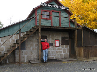
Golden Flower of Prosperity
Posted by
Thom Hoch
October 19, 2009
A Day to John Day
Posted by
Thom Hoch
October 18, 2009
Cooling It on the Columbia
Posted by
Thom Hoch
October 17, 2009
Easy Day to Arlington
Posted by
Thom Hoch
October 16, 2009
Saying Good-Bye
Posted by
Thom Hoch
October 15, 2009
Website/Journal Change
Posted by
Thom Hoch
October 08, 2009
Spewers of Hot Air
Posted by
Thom Hoch
October 06, 2009
Mission Accomplished
Newer Posts
Older Posts
Home